

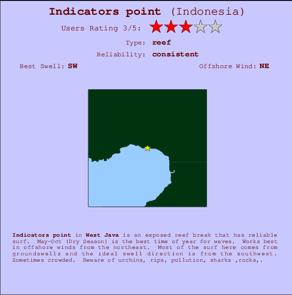
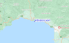
Indicators point Surf Guide
Indicators point in West Java is an exposed reef break that has reliable surf. May-Oct (Dry Season) is the best time of year for waves. Works best in offshore winds from the northeast. Tends to receive distant groundswells and the optimum swell angle is from the southwest. A reef breaks right. Sometimes crowded. Take care of urchins, rips, pollution, sharks ,rocks,.
Indicators point Spot Info
| Type: | Rating: | Reliability: | Todays Sea Temp*: |
|---|---|---|---|
| consistent | 27.7°C*ocean temperature recorded from satellite |
Surfing Indicators point:
The best conditions reported for surf at Indicators point occur when a Southwest swell combines with an offshore wind direction from the Northeast.

Énergie de Vague (puissance): 12h


Indicators point Surf:
Friday, 17 July 2026, 17:55 Local time| Vendredi 17 | Sam | |||
| 4PM | 7PM | 10PM | 1AM | |
| Wave (m) | ||||
| Période (s) | 15 | 15 | 15 | 15 |
| Vent (km/h) | ||||
| Etat du vent | cross- on |
cross- off |
cross- off |
glass |
- /breaks/Indicatorspoint/forecasts/latest
Indicators point Surf Guide
Indicators point in West Java is an exposed reef break that has reliable surf. May-Oct (Dry Season) is the best time of year for waves. Works best in offshore winds from the northeast. Tends to receive distant groundswells and the optimum swell angle is from the southwest. A reef breaks right. Sometimes crowded. Take care of urchins, rips, pollution, sharks ,rocks,.
Indicators point Spot Info
Type: Rating: Reliability: Todays Sea Temp*:  Reef
Reef 3
3consistent 27.7°C*ocean temperature recorded from satelliteSurfing Indicators point:
The best conditions reported for surf at Indicators point occur when a Southwest swell combines with an offshore wind direction from the Northeast.
Énergie de Vague (puissance): 12h
Utilisez les onglets ci-dessus pour voir la température de la mer à Indicators point, photos pour Indicators point, prévisions de houle détaillées pour Indicators point, prévisions de vent et météo, webcams pour Indicators point, conditions de vents en temps réel à partir des données de la station météo de Java - West et prévisions des marées pour Indicators point. Les cartes de houle pour Indonesia afficheront une image agrandie de Indonesia et des ses mers environnantes. Ces cartes de houles peuvent êtres animées pour montrer les différents composantes de houle, la hauteur, la période et l'énergie des vagues avec les prévisions météo et prévisions de vent. Des observations en temps réel du temps et de l'état de la mer sont fournies grâce aux bouées marines de Indonesia, des navires de passages, et des stations météo côtières. Toutes les pages de prévisions pour ce spot de surf ont un Vagu-o-Mètre Local et Global pour facilement trouver les meilleurs spot de surf à proximité de Indicators point.
Indicators point Surf:
Friday, 17 July 2026, 17:55 Local timeVendredi 17 Sam 4PM 7PM 10PM 1AM Wave (m) Période (s) 15 15 15 15 Vent (km/h) Etat du vent cross-
oncross-
offcross-
offglass - /breaks/Indicatorspoint/forecasts/latest
- /breaks/Indicatorspoint/forecasts/latest/six_day
Indicators point Surf Guide
Indicators point in West Java is an exposed reef break that has reliable surf. May-Oct (Dry Season) is the best time of year for waves. Works best in offshore winds from the northeast. Tends to receive distant groundswells and the optimum swell angle is from the southwest. A reef breaks right. Sometimes crowded. Take care of urchins, rips, pollution, sharks ,rocks,.
Indicators point Spot Info
Type: Rating: Reliability: Todays Sea Temp*: Reef3consistent 27.7°C*ocean temperature recorded from satelliteSurfing Indicators point:
The best conditions reported for surf at Indicators point occur when a Southwest swell combines with an offshore wind direction from the Northeast.
Énergie de Vague (puissance): 12h
Utilisez les onglets ci-dessus pour voir la température de la mer à Indicators point, photos pour Indicators point, prévisions de houle détaillées pour Indicators point, prévisions de vent et météo, webcams pour Indicators point, conditions de vents en temps réel à partir des données de la station météo de Java - West et prévisions des marées pour Indicators point. Les cartes de houle pour Indonesia afficheront une image agrandie de Indonesia et des ses mers environnantes. Ces cartes de houles peuvent êtres animées pour montrer les différents composantes de houle, la hauteur, la période et l'énergie des vagues avec les prévisions météo et prévisions de vent. Des observations en temps réel du temps et de l'état de la mer sont fournies grâce aux bouées marines de Indonesia, des navires de passages, et des stations météo côtières. Toutes les pages de prévisions pour ce spot de surf ont un Vagu-o-Mètre Local et Global pour facilement trouver les meilleurs spot de surf à proximité de Indicators point.
Indicators point Surf:
Friday, 17 July 2026, 17:55 Local timeVendredi 17 Sam 4PM 7PM 10PM 1AM Wave (m) Période (s) 15 15 15 15 Vent (km/h) Etat du vent cross-
oncross-
offcross-
offglass - /breaks/Indicatorspoint/forecasts/latest
Indicators point Surf Guide
Indicators point in West Java is an exposed reef break that has reliable surf. May-Oct (Dry Season) is the best time of year for waves. Works best in offshore winds from the northeast. Tends to receive distant groundswells and the optimum swell angle is from the southwest. A reef breaks right. Sometimes crowded. Take care of urchins, rips, pollution, sharks ,rocks,.
Indicators point Spot Info
Type: Rating: Reliability: Todays Sea Temp*: Reef3consistent 27.7°C*ocean temperature recorded from satelliteSurfing Indicators point:
The best conditions reported for surf at Indicators point occur when a Southwest swell combines with an offshore wind direction from the Northeast.
Énergie de Vague (puissance): 12h
Utilisez les onglets ci-dessus pour voir la température de la mer à Indicators point, photos pour Indicators point, prévisions de houle détaillées pour Indicators point, prévisions de vent et météo, webcams pour Indicators point, conditions de vents en temps réel à partir des données de la station météo de Java - West et prévisions des marées pour Indicators point. Les cartes de houle pour Indonesia afficheront une image agrandie de Indonesia et des ses mers environnantes. Ces cartes de houles peuvent êtres animées pour montrer les différents composantes de houle, la hauteur, la période et l'énergie des vagues avec les prévisions météo et prévisions de vent. Des observations en temps réel du temps et de l'état de la mer sont fournies grâce aux bouées marines de Indonesia, des navires de passages, et des stations météo côtières. Toutes les pages de prévisions pour ce spot de surf ont un Vagu-o-Mètre Local et Global pour facilement trouver les meilleurs spot de surf à proximité de Indicators point.
Indicators point Surf:
Friday, 17 July 2026, 17:55 Local timeVendredi 17 Sam 4PM 7PM 10PM 1AM Wave (m) Période (s) 15 15 15 15 Vent (km/h) Etat du vent cross-
oncross-
offcross-
offglass Tide Times:
Pour Karang Haji - Ocean Queen Hotel, %{dist} %{km} de %{location}.
PROCHAIN EST A (heure locale) il reste marée haute marée basse Indicators point Tide Times and Tide Chart
Live Weather:
At Genteng wx, 50 km from Indicators point.
calm
(km/h)Air temperature
35°COverall Indicators point Surf Consistency and Wind Distribution in Juillet
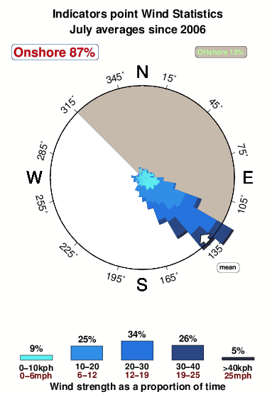


Wind stats for Indicators point: see the variation in direction and stength by month.
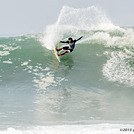
Photos de Surf
de la galerieContours: Routes et Rivières: Sélectionnez un spot de surf du menu 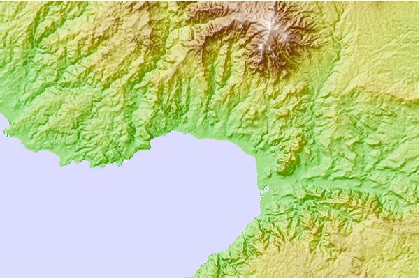
Utilisez cette carte en relief pour naviguer vers les spots de surf de Java - West, et les stations de marées aux alentours de Indicators point
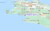
Spots de Surf les plus proches de Indicators point:
(Cliquez sur le nom du spot pour plus de détails)- Closest spot1 mi
- Second closest spot2 mi
- Third closest spot4 mi
- Fourth closest spot6 mi
- Fifth closest spot17 mi
Bouées marines les plus proches de Indicators point:
- Closest Bouées marines2428 mi
- Second closest Bouées marines2470 mi
- Third closest Bouées marines2536 mi
- Fourth closest Bouées marines2700 mi
- Fifth closest Bouées marines2711 mi
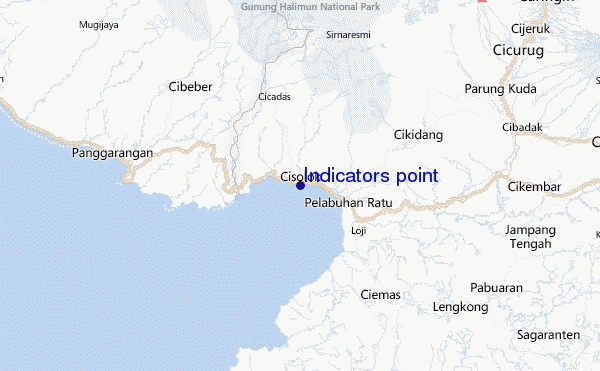
Stations de marée les plus proches de Indicators point:
- Closest station de maréePelabuhanratu5 mi
- Second closest station de maréeJakarta60 mi
- Third closest station de maréeLabuhan61 mi
- Fourth closest station de maréeTanjung Priok65 mi
- Fifth closest station de maréeBandar Lampung132 mi
Airports
- The closest passenger airport to Indicators point is Pondok Cabe (Jakarta) Airport (PCB) in Indonesia, 76 km (47 miles) away (directly).
- The second nearest airport to Indicators point is Halim Perdanakusuma International (Jakarta) Airport (HLP), also in Indonesia, 90 km (56 miles) away.
- Third is Soekarno Hatta International (Jakarta) Airport (CGK) in Indonesia, 95 km (59 miles) away.
- Husein Sastranegara (Bandung) Airport (BDO) in Indonesia is 121 km (75 miles) away.
- Penggung (Cirebon) Airport (CBN), also in Indonesia is the fifth nearest airport to Indicators point and is 228 km (142 miles) away.
- /breaks/Indicatorspoint/forecasts/latest


 Nearest