

Botany Bay Surf Guide
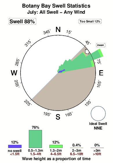
Botany Bay in Saint Thomas is a fairly exposed point break that has reasonably consistent surf. The best wind direction is from the southeast. The ideal swell direction from the north northeast. A right hand reef break. The quality of the surf isn't affected by the tide. Even when there are waves, it's not likley to be crowded. Hazards include - Urchins - Rips / undertow - Private beach - Localism - Sharks.
Botany Bay Spot Info
| Type: | Rating: | Reliability: | Todays Sea Temp*: |
|---|---|---|---|
| fairly consistent | 28.4°C*ocean temperature recorded from satellite |
Surfing Botany Bay:
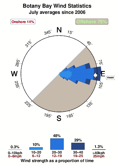
The best conditions reported for surf at Botany Bay occur when a North-northeast swell combines with an offshore wind direction from the Southeast.

Énergie de Vague (puissance): 12h


Botany Bay Surf:
Monday, 13 July 2026, 01:51 Local time| Dim | Lundi 13 | |||
| 11PM | 2AM | 5AM | 8AM | |
| Wave (m) | ||||
| Période (s) | 8 | 8 | 8 | 8 |
| Vent (km/h) | ||||
| Etat du vent | cross- off |
cross- off |
cross- off |
cross- off |
- /breaks/Botany-Bay/forecasts/latest
Botany Bay Surf Guide
Botany Bay in Saint Thomas is a fairly exposed point break that has reasonably consistent surf. The best wind direction is from the southeast. The ideal swell direction from the north northeast. A right hand reef break. The quality of the surf isn't affected by the tide. Even when there are waves, it's not likley to be crowded. Hazards include - Urchins - Rips / undertow - Private beach - Localism - Sharks.
Botany Bay Spot Info
Type: Rating: Reliability: Todays Sea Temp*:  Point
Point 3
3fairly consistent 28.4°C*ocean temperature recorded from satelliteSurfing Botany Bay:
The best conditions reported for surf at Botany Bay occur when a North-northeast swell combines with an offshore wind direction from the Southeast.
Énergie de Vague (puissance): 12h
Utilisez les onglets ci-dessus pour voir la température de la mer à Botany Bay, photos pour Botany Bay, prévisions de houle détaillées pour Botany Bay, prévisions de vent et météo, webcams pour Botany Bay, conditions de vents en temps réel à partir des données de la station météo de Saint Thomas et prévisions des marées pour Botany Bay. Les cartes de houle pour US Virgin Islands afficheront une image agrandie de US Virgin Islands et des ses mers environnantes. Ces cartes de houles peuvent êtres animées pour montrer les différents composantes de houle, la hauteur, la période et l'énergie des vagues avec les prévisions météo et prévisions de vent. Des observations en temps réel du temps et de l'état de la mer sont fournies grâce aux bouées marines de US Virgin Islands, des navires de passages, et des stations météo côtières. Toutes les pages de prévisions pour ce spot de surf ont un Vagu-o-Mètre Local et Global pour facilement trouver les meilleurs spot de surf à proximité de Botany Bay.
Botany Bay Surf:
Monday, 13 July 2026, 01:51 Local timeDim Lundi 13 11PM 2AM 5AM 8AM Wave (m) Période (s) 8 8 8 8 Vent (km/h) Etat du vent cross-
offcross-
offcross-
offcross-
off- /breaks/Botany-Bay/forecasts/latest
- /breaks/Botany-Bay/forecasts/latest/six_day
Botany Bay Surf Guide
Botany Bay in Saint Thomas is a fairly exposed point break that has reasonably consistent surf. The best wind direction is from the southeast. The ideal swell direction from the north northeast. A right hand reef break. The quality of the surf isn't affected by the tide. Even when there are waves, it's not likley to be crowded. Hazards include - Urchins - Rips / undertow - Private beach - Localism - Sharks.
Botany Bay Spot Info
Type: Rating: Reliability: Todays Sea Temp*: Point3fairly consistent 28.4°C*ocean temperature recorded from satelliteSurfing Botany Bay:
The best conditions reported for surf at Botany Bay occur when a North-northeast swell combines with an offshore wind direction from the Southeast.
Énergie de Vague (puissance): 12h
Utilisez les onglets ci-dessus pour voir la température de la mer à Botany Bay, photos pour Botany Bay, prévisions de houle détaillées pour Botany Bay, prévisions de vent et météo, webcams pour Botany Bay, conditions de vents en temps réel à partir des données de la station météo de Saint Thomas et prévisions des marées pour Botany Bay. Les cartes de houle pour US Virgin Islands afficheront une image agrandie de US Virgin Islands et des ses mers environnantes. Ces cartes de houles peuvent êtres animées pour montrer les différents composantes de houle, la hauteur, la période et l'énergie des vagues avec les prévisions météo et prévisions de vent. Des observations en temps réel du temps et de l'état de la mer sont fournies grâce aux bouées marines de US Virgin Islands, des navires de passages, et des stations météo côtières. Toutes les pages de prévisions pour ce spot de surf ont un Vagu-o-Mètre Local et Global pour facilement trouver les meilleurs spot de surf à proximité de Botany Bay.
Botany Bay Surf:
Monday, 13 July 2026, 01:51 Local timeDim Lundi 13 11PM 2AM 5AM 8AM Wave (m) Période (s) 8 8 8 8 Vent (km/h) Etat du vent cross-
offcross-
offcross-
offcross-
off- /breaks/Botany-Bay/forecasts/latest
Botany Bay Surf Guide
Botany Bay in Saint Thomas is a fairly exposed point break that has reasonably consistent surf. The best wind direction is from the southeast. The ideal swell direction from the north northeast. A right hand reef break. The quality of the surf isn't affected by the tide. Even when there are waves, it's not likley to be crowded. Hazards include - Urchins - Rips / undertow - Private beach - Localism - Sharks.
Botany Bay Spot Info
Type: Rating: Reliability: Todays Sea Temp*: Point3fairly consistent 28.4°C*ocean temperature recorded from satelliteSurfing Botany Bay:
The best conditions reported for surf at Botany Bay occur when a North-northeast swell combines with an offshore wind direction from the Southeast.
Énergie de Vague (puissance): 12h
Utilisez les onglets ci-dessus pour voir la température de la mer à Botany Bay, photos pour Botany Bay, prévisions de houle détaillées pour Botany Bay, prévisions de vent et météo, webcams pour Botany Bay, conditions de vents en temps réel à partir des données de la station météo de Saint Thomas et prévisions des marées pour Botany Bay. Les cartes de houle pour US Virgin Islands afficheront une image agrandie de US Virgin Islands et des ses mers environnantes. Ces cartes de houles peuvent êtres animées pour montrer les différents composantes de houle, la hauteur, la période et l'énergie des vagues avec les prévisions météo et prévisions de vent. Des observations en temps réel du temps et de l'état de la mer sont fournies grâce aux bouées marines de US Virgin Islands, des navires de passages, et des stations météo côtières. Toutes les pages de prévisions pour ce spot de surf ont un Vagu-o-Mètre Local et Global pour facilement trouver les meilleurs spot de surf à proximité de Botany Bay.
Botany Bay Surf:
Monday, 13 July 2026, 01:51 Local timeDim Lundi 13 11PM 2AM 5AM 8AM Wave (m) Période (s) 8 8 8 8 Vent (km/h) Etat du vent cross-
offcross-
offcross-
offcross-
offTide Times:
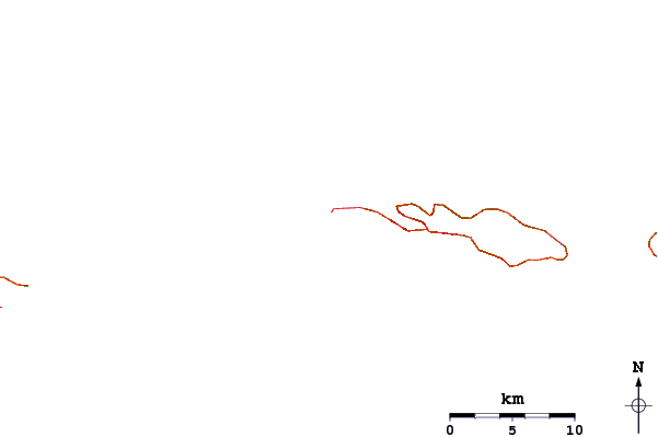
À Botany Bay (0 km).
PROCHAIN EST A (heure locale) il reste marée haute marée basse Botany Bay Tide Times and Tide Chart
Live Weather:
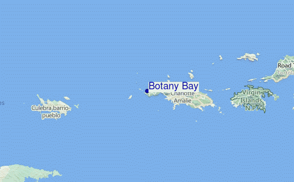
At Saint Thomas/Cyril E. King Airport, 6 km from Botany Bay.
light winds from the ENE
(km/h)
ClearAir temperature
28°COverall Botany Bay Surf Consistency and Wind Distribution in Juillet
Photos de Surf
de la galerieContours: Routes et Rivières: Sélectionnez un spot de surf du menu 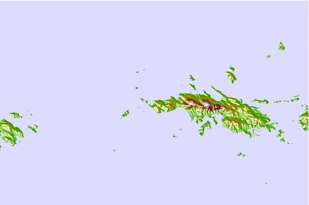
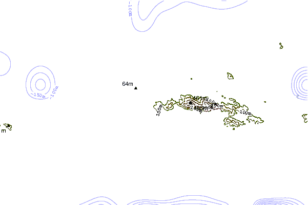
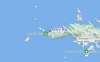
Utilisez cette carte en relief pour naviguer vers les spots de surf de Saint Thomas, et les stations de marées aux alentours de Botany Bay
Spots de Surf les plus proches de Botany Bay:
(Cliquez sur le nom du spot pour plus de détails)- Closest spot3 mi
- Second closest spot5 mi
- Third closest spot6 mi
- Fourth closest spot19 mi
- Fifth closest spot22 mi
Bouées marines les plus proches de Botany Bay:
- Closest Bouées marines19 mi
- Second closest Bouées marines29 mi
- Third closest Bouées marines70 mi
- Fourth closest Bouées marines104 mi
- Fifth closest Bouées marines147 mi
Stations de marée les plus proches de Botany Bay:
- Closest station de maréeSaint Thomas, Saint Thomas7 mi
- Second closest station de maréeCharlotte Amalie, Saint Thomas7 mi
- Third closest station de maréeMagens Bay, Saint Thomas Island7 mi
- Fourth closest station de maréeBenner Bay, Saint Thomas11 mi
- Fifth closest station de maréeRedhook Bay, Saint Thomas Island12 mi
Airports
- The closest passenger airport to Botany Bay is Cyril E King (St. Thomas) Airport (STT) in Virgin Isl., 7 km (4 miles) away (directly).
- The second nearest airport to Botany Bay is Terrance B Lettsome International (Roadtown/beef Island) Airport (EIS), also in Virgin Isl., 53 km (33 miles) away.
- Third is Roosevelt Roads Ns Airport (NRR) in Puerto Rico, 66 km (41 miles) away.
- Diego Jimenez Torres (Fajardo) Airport (FAJ) in Puerto Rico is 67 km (42 miles) away.
- Henry E Rohlsen (St. Criox Island) Airport (STX) in Virgin Isl. is the fifth nearest airport to Botany Bay and is 77 km (48 miles) away.

- /breaks/Botany-Bay/forecasts/latest


 Nearest