
Sandy Cay Surf Guide
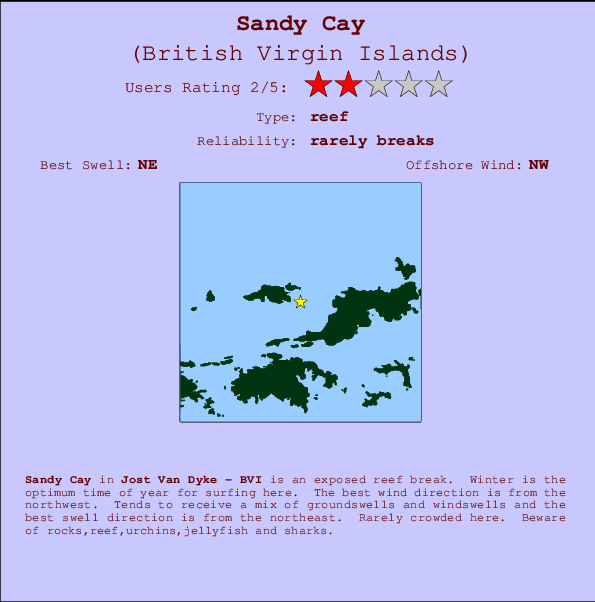
Sandy Cay in Jost Van Dyke is an exposed reef break. Winter is the best time of year for surfing here. The best wind direction is from the northwest. Tends to receive a mix of groundswells and windswells and the ideal swell direction is from the northeast. There is a right hand reef break. Rarely crowded here. Watch out for rocks,reef,urchins,jellyfish and sharks.
Sandy Cay Spot Info
| Type: | Rating: | Reliability: | Todays Sea Temp*: |
|---|---|---|---|
| rarely breaks | 29.0°C*ocean temperature recorded from satellite |
Surfing Sandy Cay:
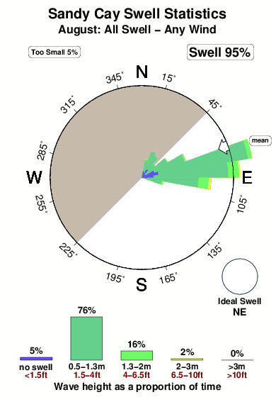
The best conditions reported for surf at Sandy Cay occur when a Northeast swell combines with an offshore wind direction from the Northwest.

Énergie de Vague (puissance): 12h


Sandy Cay Surf:
Sunday, 2 August 2026, 08:04 Local time| Dimanche 02 | ||||
| 5AM | 8AM | 11AM | 2PM | |
| Wave (m) | ||||
| Période (s) | 5 | 6 | 5 | 6 |
| Vent (km/h) | ||||
| Etat du vent | cross- on |
cross- on |
cross- on |
cross- on |
- /breaks/Sandy-Cay/forecasts/latest
Sandy Cay Surf Guide
Sandy Cay in Jost Van Dyke is an exposed reef break. Winter is the best time of year for surfing here. The best wind direction is from the northwest. Tends to receive a mix of groundswells and windswells and the ideal swell direction is from the northeast. There is a right hand reef break. Rarely crowded here. Watch out for rocks,reef,urchins,jellyfish and sharks.
Sandy Cay Spot Info
Type: Rating: Reliability: Todays Sea Temp*:  Reef
Reef 2
2rarely breaks 29.0°C*ocean temperature recorded from satelliteSurfing Sandy Cay:
The best conditions reported for surf at Sandy Cay occur when a Northeast swell combines with an offshore wind direction from the Northwest.
Énergie de Vague (puissance): 12h
Utilisez les onglets ci-dessus pour voir la température de la mer à Sandy Cay, photos pour Sandy Cay, prévisions de houle détaillées pour Sandy Cay, prévisions de vent et météo, webcams pour Sandy Cay, conditions de vents en temps réel à partir des données de la station météo de Jost Van Dyke et prévisions des marées pour Sandy Cay. Les cartes de houle pour British Virgin Islands afficheront une image agrandie de British Virgin Islands et des ses mers environnantes. Ces cartes de houles peuvent êtres animées pour montrer les différents composantes de houle, la hauteur, la période et l'énergie des vagues avec les prévisions météo et prévisions de vent. Des observations en temps réel du temps et de l'état de la mer sont fournies grâce aux bouées marines de British Virgin Islands, des navires de passages, et des stations météo côtières. Toutes les pages de prévisions pour ce spot de surf ont un Vagu-o-Mètre Local et Global pour facilement trouver les meilleurs spot de surf à proximité de Sandy Cay.
Sandy Cay Surf:
Sunday, 2 August 2026, 08:04 Local timeDimanche 02 5AM 8AM 11AM 2PM Wave (m) Période (s) 5 6 5 6 Vent (km/h) Etat du vent cross-
oncross-
oncross-
oncross-
on- /breaks/Sandy-Cay/forecasts/latest
- /breaks/Sandy-Cay/forecasts/latest/six_day
Sandy Cay Surf Guide
Sandy Cay in Jost Van Dyke is an exposed reef break. Winter is the best time of year for surfing here. The best wind direction is from the northwest. Tends to receive a mix of groundswells and windswells and the ideal swell direction is from the northeast. There is a right hand reef break. Rarely crowded here. Watch out for rocks,reef,urchins,jellyfish and sharks.
Sandy Cay Spot Info
Type: Rating: Reliability: Todays Sea Temp*: Reef2rarely breaks 29.0°C*ocean temperature recorded from satelliteSurfing Sandy Cay:
The best conditions reported for surf at Sandy Cay occur when a Northeast swell combines with an offshore wind direction from the Northwest.
Énergie de Vague (puissance): 12h
Utilisez les onglets ci-dessus pour voir la température de la mer à Sandy Cay, photos pour Sandy Cay, prévisions de houle détaillées pour Sandy Cay, prévisions de vent et météo, webcams pour Sandy Cay, conditions de vents en temps réel à partir des données de la station météo de Jost Van Dyke et prévisions des marées pour Sandy Cay. Les cartes de houle pour British Virgin Islands afficheront une image agrandie de British Virgin Islands et des ses mers environnantes. Ces cartes de houles peuvent êtres animées pour montrer les différents composantes de houle, la hauteur, la période et l'énergie des vagues avec les prévisions météo et prévisions de vent. Des observations en temps réel du temps et de l'état de la mer sont fournies grâce aux bouées marines de British Virgin Islands, des navires de passages, et des stations météo côtières. Toutes les pages de prévisions pour ce spot de surf ont un Vagu-o-Mètre Local et Global pour facilement trouver les meilleurs spot de surf à proximité de Sandy Cay.
Sandy Cay Surf:
Sunday, 2 August 2026, 08:04 Local timeDimanche 02 5AM 8AM 11AM 2PM Wave (m) Période (s) 5 6 5 6 Vent (km/h) Etat du vent cross-
oncross-
oncross-
oncross-
on- /breaks/Sandy-Cay/forecasts/latest
Sandy Cay Surf Guide
Sandy Cay in Jost Van Dyke is an exposed reef break. Winter is the best time of year for surfing here. The best wind direction is from the northwest. Tends to receive a mix of groundswells and windswells and the ideal swell direction is from the northeast. There is a right hand reef break. Rarely crowded here. Watch out for rocks,reef,urchins,jellyfish and sharks.
Sandy Cay Spot Info
Type: Rating: Reliability: Todays Sea Temp*: Reef2rarely breaks 29.0°C*ocean temperature recorded from satelliteSurfing Sandy Cay:
The best conditions reported for surf at Sandy Cay occur when a Northeast swell combines with an offshore wind direction from the Northwest.
Énergie de Vague (puissance): 12h
Utilisez les onglets ci-dessus pour voir la température de la mer à Sandy Cay, photos pour Sandy Cay, prévisions de houle détaillées pour Sandy Cay, prévisions de vent et météo, webcams pour Sandy Cay, conditions de vents en temps réel à partir des données de la station météo de Jost Van Dyke et prévisions des marées pour Sandy Cay. Les cartes de houle pour British Virgin Islands afficheront une image agrandie de British Virgin Islands et des ses mers environnantes. Ces cartes de houles peuvent êtres animées pour montrer les différents composantes de houle, la hauteur, la période et l'énergie des vagues avec les prévisions météo et prévisions de vent. Des observations en temps réel du temps et de l'état de la mer sont fournies grâce aux bouées marines de British Virgin Islands, des navires de passages, et des stations météo côtières. Toutes les pages de prévisions pour ce spot de surf ont un Vagu-o-Mètre Local et Global pour facilement trouver les meilleurs spot de surf à proximité de Sandy Cay.
Sandy Cay Surf:
Sunday, 2 August 2026, 08:04 Local timeDimanche 02 5AM 8AM 11AM 2PM Wave (m) Période (s) 5 6 5 6 Vent (km/h) Etat du vent cross-
oncross-
oncross-
oncross-
onTide Times:
Pour Road Town, %{dist} %{km} de %{location}.
PROCHAIN EST A (heure locale) il reste marée haute marée basse Sandy Cay Tide Times and Tide Chart
Live Weather:
At BUOY-LAMV3, 13 km from Sandy Cay.
- Air temperature
28.5°COverall Sandy Cay Surf Consistency and Wind Distribution in Août
Photos de Surf
de la galerieContours: Routes et Rivières: Sélectionnez un spot de surf du menu 


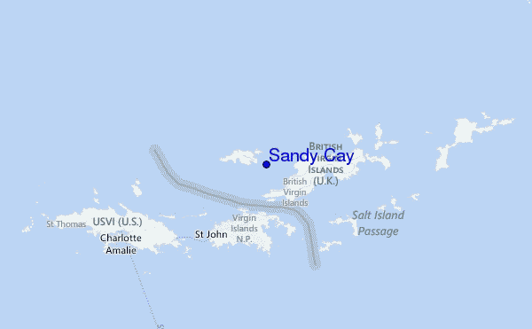
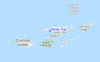
Utilisez cette carte en relief pour naviguer vers les spots de surf de Jost Van Dyke, et les stations de marées aux alentours de Sandy Cay
Spots de Surf les plus proches de Sandy Cay:
(Cliquez sur le nom du spot pour plus de détails)- Closest spot1 mi
- Second closest spot3 mi
- Third closest spot3 mi
- Fourth closest spot3 mi
- Fifth closest spot3 mi
Bouées marines les plus proches de Sandy Cay:
- Closest Bouées marines14 mi
- Second closest Bouées marines51 mi
- Third closest Bouées marines91 mi
- Fourth closest Bouées marines126 mi
- Fifth closest Bouées marines156 mi
Stations de marée les plus proches de Sandy Cay:
- Closest station de maréeRoad Town4 mi
- Second closest station de maréeCoral Harbor, Saint Johns Island6 mi
- Third closest station de maréeLameshur Bay, Saint Johns8 mi
- Fourth closest station de maréeRedhook Bay, Saint Thomas Island12 mi
- Fifth closest station de maréeBenner Bay, Saint Thomas13 mi
Airports
- The closest passenger airport to Sandy Cay is Terrance B Lettsome International (Roadtown/beef Island) Airport (EIS) in Virgin Isl., 17 km (11 miles) away (directly).
- The second nearest airport to Sandy Cay is Cyril E King (St. Thomas) Airport (STT), also in Virgin Isl., 30 km (19 miles) away.
- Third is Henry E Rohlsen (St. Criox Island) Airport (STX) in Virgin Isl., 82 km (51 miles) away.
- Roosevelt Roads Ns Airport (NRR) in Puerto Rico is 101 km (63 miles) away.
- Diego Jimenez Torres (Fajardo) Airport (FAJ), also in Puerto Rico is the fifth nearest airport to Sandy Cay and is 102 km (63 miles) away.
- /breaks/Sandy-Cay/forecasts/latest


 Nearest