

Tanjung A'an Surf Guide
Tanjung A'an in South Lombok is a fairly exposed reef break that has very consistent surf and works all around the year. Offshore winds are from the north. Most of the surf here comes from groundswells and the best swell direction is from the south southwest. A right hand reef. The quality of the surf isn't affected by the tide. Even when there are waves, it's not likley to be crowded. Hazards include rips and rocks.
Tanjung A'an Spot Info
| Type: | Rating: | Reliability: | Todays Sea Temp*: |
|---|---|---|---|
| very consistent | 26.4°C*ocean temperature recorded from satellite |
Surfing Tanjung A'an:
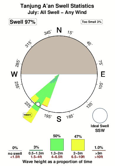
The best conditions reported for surf at Tanjung A'an occur when a South-southwest swell combines with an offshore wind direction from the North.

Énergie de Vague (puissance): 12h


Tanjung A'an Surf:
Friday, 31 July 2026, 14:44 Local time| Vendredi 31 | ||||
| 11AM | 2PM | 5PM | 8PM | |
| Wave (m) | ||||
| Période (s) | 17 | 17 | 17 | 17 |
| Vent (km/h) | ||||
| Etat du vent | cross- on |
cross- on |
cross- on |
cross- on |
- /breaks/Tanjung-Aan/forecasts/latest
Tanjung A'an Surf Guide
Tanjung A'an in South Lombok is a fairly exposed reef break that has very consistent surf and works all around the year. Offshore winds are from the north. Most of the surf here comes from groundswells and the best swell direction is from the south southwest. A right hand reef. The quality of the surf isn't affected by the tide. Even when there are waves, it's not likley to be crowded. Hazards include rips and rocks.
Tanjung A'an Spot Info
Type: Rating: Reliability: Todays Sea Temp*:  Reef
Reef 3
3very consistent 26.4°C*ocean temperature recorded from satelliteSurfing Tanjung A'an:
The best conditions reported for surf at Tanjung A'an occur when a South-southwest swell combines with an offshore wind direction from the North.
Énergie de Vague (puissance): 12h
Utilisez les onglets ci-dessus pour voir la température de la mer à Tanjung A'an, photos pour Tanjung A'an, prévisions de houle détaillées pour Tanjung A'an, prévisions de vent et météo, webcams pour Tanjung A'an, conditions de vents en temps réel à partir des données de la station météo de Lombok - South et prévisions des marées pour Tanjung A'an. Les cartes de houle pour Indonesia afficheront une image agrandie de Indonesia et des ses mers environnantes. Ces cartes de houles peuvent êtres animées pour montrer les différents composantes de houle, la hauteur, la période et l'énergie des vagues avec les prévisions météo et prévisions de vent. Des observations en temps réel du temps et de l'état de la mer sont fournies grâce aux bouées marines de Indonesia, des navires de passages, et des stations météo côtières. Toutes les pages de prévisions pour ce spot de surf ont un Vagu-o-Mètre Local et Global pour facilement trouver les meilleurs spot de surf à proximité de Tanjung A'an.
Tanjung A'an Surf:
Friday, 31 July 2026, 14:44 Local timeVendredi 31 11AM 2PM 5PM 8PM Wave (m) Période (s) 17 17 17 17 Vent (km/h) Etat du vent cross-
oncross-
oncross-
oncross-
on- /breaks/Tanjung-Aan/forecasts/latest
- /breaks/Tanjung-Aan/forecasts/latest/six_day
Tanjung A'an Surf Guide
Tanjung A'an in South Lombok is a fairly exposed reef break that has very consistent surf and works all around the year. Offshore winds are from the north. Most of the surf here comes from groundswells and the best swell direction is from the south southwest. A right hand reef. The quality of the surf isn't affected by the tide. Even when there are waves, it's not likley to be crowded. Hazards include rips and rocks.
Tanjung A'an Spot Info
Type: Rating: Reliability: Todays Sea Temp*: Reef3very consistent 26.4°C*ocean temperature recorded from satelliteSurfing Tanjung A'an:
The best conditions reported for surf at Tanjung A'an occur when a South-southwest swell combines with an offshore wind direction from the North.
Énergie de Vague (puissance): 12h
Utilisez les onglets ci-dessus pour voir la température de la mer à Tanjung A'an, photos pour Tanjung A'an, prévisions de houle détaillées pour Tanjung A'an, prévisions de vent et météo, webcams pour Tanjung A'an, conditions de vents en temps réel à partir des données de la station météo de Lombok - South et prévisions des marées pour Tanjung A'an. Les cartes de houle pour Indonesia afficheront une image agrandie de Indonesia et des ses mers environnantes. Ces cartes de houles peuvent êtres animées pour montrer les différents composantes de houle, la hauteur, la période et l'énergie des vagues avec les prévisions météo et prévisions de vent. Des observations en temps réel du temps et de l'état de la mer sont fournies grâce aux bouées marines de Indonesia, des navires de passages, et des stations météo côtières. Toutes les pages de prévisions pour ce spot de surf ont un Vagu-o-Mètre Local et Global pour facilement trouver les meilleurs spot de surf à proximité de Tanjung A'an.
Tanjung A'an Surf:
Friday, 31 July 2026, 14:44 Local timeVendredi 31 11AM 2PM 5PM 8PM Wave (m) Période (s) 17 17 17 17 Vent (km/h) Etat du vent cross-
oncross-
oncross-
oncross-
on- /breaks/Tanjung-Aan/forecasts/latest
Tanjung A'an Surf Guide
Tanjung A'an in South Lombok is a fairly exposed reef break that has very consistent surf and works all around the year. Offshore winds are from the north. Most of the surf here comes from groundswells and the best swell direction is from the south southwest. A right hand reef. The quality of the surf isn't affected by the tide. Even when there are waves, it's not likley to be crowded. Hazards include rips and rocks.
Tanjung A'an Spot Info
Type: Rating: Reliability: Todays Sea Temp*: Reef3very consistent 26.4°C*ocean temperature recorded from satelliteSurfing Tanjung A'an:
The best conditions reported for surf at Tanjung A'an occur when a South-southwest swell combines with an offshore wind direction from the North.
Énergie de Vague (puissance): 12h
Utilisez les onglets ci-dessus pour voir la température de la mer à Tanjung A'an, photos pour Tanjung A'an, prévisions de houle détaillées pour Tanjung A'an, prévisions de vent et météo, webcams pour Tanjung A'an, conditions de vents en temps réel à partir des données de la station météo de Lombok - South et prévisions des marées pour Tanjung A'an. Les cartes de houle pour Indonesia afficheront une image agrandie de Indonesia et des ses mers environnantes. Ces cartes de houles peuvent êtres animées pour montrer les différents composantes de houle, la hauteur, la période et l'énergie des vagues avec les prévisions météo et prévisions de vent. Des observations en temps réel du temps et de l'état de la mer sont fournies grâce aux bouées marines de Indonesia, des navires de passages, et des stations météo côtières. Toutes les pages de prévisions pour ce spot de surf ont un Vagu-o-Mètre Local et Global pour facilement trouver les meilleurs spot de surf à proximité de Tanjung A'an.
Tanjung A'an Surf:
Friday, 31 July 2026, 14:44 Local timeVendredi 31 11AM 2PM 5PM 8PM Wave (m) Période (s) 17 17 17 17 Vent (km/h) Etat du vent cross-
oncross-
oncross-
oncross-
onTide Times:
Pour Aan, %{dist} %{km} de %{location}.
PROCHAIN EST A (heure locale) il reste marée haute marée basse Tanjung A'an Tide Times and Tide Chart
Live Weather:
At Bandara Airport, 20 km from Tanjung A'an.
light winds from the ESE.(Wind varies from 080 to 150 degs)
(km/h)
Dry and partly cloudyAir temperature
30°COverall Tanjung A'an Surf Consistency and Wind Distribution in Juillet
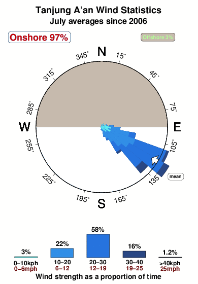


Wind stats for Tanjung A'an: see the variation in direction and stength by month.
Photos de Surf
de la galerieContours: Routes et Rivières: Sélectionnez un spot de surf du menu 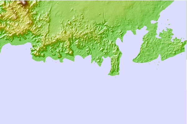
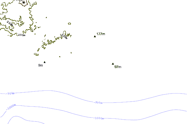
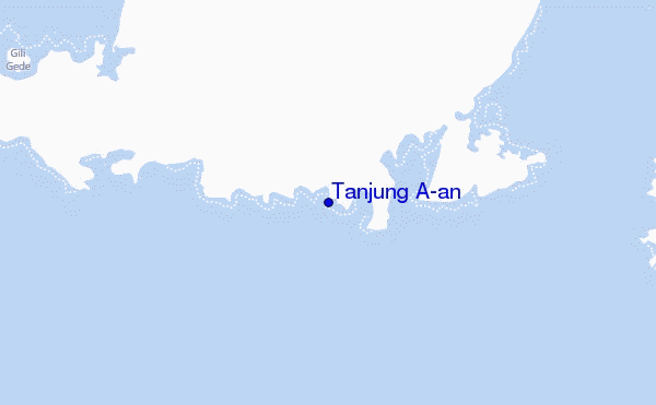
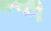
Utilisez cette carte en relief pour naviguer vers les spots de surf de Lombok - South, et les stations de marées aux alentours de Tanjung A'an
Spots de Surf les plus proches de Tanjung A'an:
(Cliquez sur le nom du spot pour plus de détails)- Closest spot2 mi
- Second closest spot2 mi
- Third closest spot2 mi
- Fourth closest spot2 mi
- Fifth closest spot3 mi
Bouées marines les plus proches de Tanjung A'an:
- Closest Bouées marines1740 mi
- Second closest Bouées marines2050 mi
- Third closest Bouées marines2175 mi
- Fourth closest Bouées marines2253 mi
- Fifth closest Bouées marines2270 mi
Stations de marée les plus proches de Tanjung A'an:
- Closest station de maréeMataram27 mi
- Second closest station de maréeDenpasar78 mi
- Third closest station de maréeSumbawa Besar81 mi
- Fourth closest station de maréeSingaraja101 mi
- Fifth closest station de maréeBanjar106 mi
Airports
- The closest passenger airport to Tanjung A'an is Selaparang (Mataram) Airport (AMI) in Indonesia, which is 48 km (30 miles) away (directly).
- The second nearest airport to Tanjung A'an is Bali International (Denpasar) Airport (DPS), also in Indonesia, 129 km (80 miles) away.
- The third closest airport is Sumbawa Besar Airport (SWG), also in Indonesia, 129 km (80 miles) away.

- /breaks/Tanjung-Aan/forecasts/latest
 Nearest