

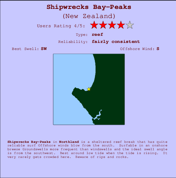
Shipwrecks Bay-Peaks Surf Guide
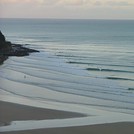
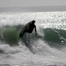
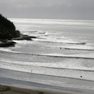
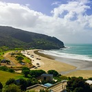
Shipwrecks Bay-Peaks in Northland is a sheltered reef break that has quite reliable surf The best wind direction is from the south. Surfable in an onshore breeze Tends to receive distant groundswells and the best swell direction is from the southwest. A left hand reef. Best around low tide when the tide is rising. Rarely crowded here. Beware of rips and rocks.
Shipwrecks Bay-Peaks Spot Info
| Type: | Rating: | Reliability: | Todays Sea Temp*: |
|---|---|---|---|
| fairly consistent | 15.2°C*ocean temperature recorded from satellite |
Surfing Shipwrecks Bay-Peaks:
The best conditions reported for surf at Shipwrecks Bay-Peaks occur when a Southwest swell combines with an offshore wind direction from the South.

Énergie de Vague (puissance): 12h


Shipwrecks Bay-Peaks Surf:
Wednesday, 29 July 2026, 22:33 Local time| Mer | Jeudi 30 | |||
| 9PM | 0AM | 3AM | 6AM | |
| Wave (m) | ||||
| Période (s) | 15 | 15 | 14 | 13 |
| Vent (km/h) | ||||
| Etat du vent | cross- on |
cross- on |
on | on |
- /breaks/Shipwrecks-Bay-Peaks/forecasts/latest
Shipwrecks Bay-Peaks Surf Guide
Shipwrecks Bay-Peaks in Northland is a sheltered reef break that has quite reliable surf The best wind direction is from the south. Surfable in an onshore breeze Tends to receive distant groundswells and the best swell direction is from the southwest. A left hand reef. Best around low tide when the tide is rising. Rarely crowded here. Beware of rips and rocks.
Shipwrecks Bay-Peaks Spot Info
Type: Rating: Reliability: Todays Sea Temp*:  Reef
Reef 4
4fairly consistent 15.2°C*ocean temperature recorded from satelliteSurfing Shipwrecks Bay-Peaks:
The best conditions reported for surf at Shipwrecks Bay-Peaks occur when a Southwest swell combines with an offshore wind direction from the South.
Énergie de Vague (puissance): 12h
Utilisez les onglets ci-dessus pour voir la température de la mer à Shipwrecks Bay-Peaks, photos pour Shipwrecks Bay-Peaks, prévisions de houle détaillées pour Shipwrecks Bay-Peaks, prévisions de vent et météo, webcams pour Shipwrecks Bay-Peaks, conditions de vents en temps réel à partir des données de la station météo de Northland et prévisions des marées pour Shipwrecks Bay-Peaks. Les cartes de houle pour New Zealand afficheront une image agrandie de New Zealand et des ses mers environnantes. Ces cartes de houles peuvent êtres animées pour montrer les différents composantes de houle, la hauteur, la période et l'énergie des vagues avec les prévisions météo et prévisions de vent. Des observations en temps réel du temps et de l'état de la mer sont fournies grâce aux bouées marines de New Zealand, des navires de passages, et des stations météo côtières. Toutes les pages de prévisions pour ce spot de surf ont un Vagu-o-Mètre Local et Global pour facilement trouver les meilleurs spot de surf à proximité de Shipwrecks Bay-Peaks.
Shipwrecks Bay-Peaks Surf:
Wednesday, 29 July 2026, 22:33 Local timeMer Jeudi 30 9PM 0AM 3AM 6AM Wave (m) Période (s) 15 15 14 13 Vent (km/h) Etat du vent cross-
oncross-
onon on - /breaks/Shipwrecks-Bay-Peaks/forecasts/latest
- /breaks/Shipwrecks-Bay-Peaks/forecasts/latest/six_day
Shipwrecks Bay-Peaks Surf Guide
Shipwrecks Bay-Peaks in Northland is a sheltered reef break that has quite reliable surf The best wind direction is from the south. Surfable in an onshore breeze Tends to receive distant groundswells and the best swell direction is from the southwest. A left hand reef. Best around low tide when the tide is rising. Rarely crowded here. Beware of rips and rocks.
Shipwrecks Bay-Peaks Spot Info
Type: Rating: Reliability: Todays Sea Temp*: Reef4fairly consistent 15.2°C*ocean temperature recorded from satelliteSurfing Shipwrecks Bay-Peaks:
The best conditions reported for surf at Shipwrecks Bay-Peaks occur when a Southwest swell combines with an offshore wind direction from the South.
Énergie de Vague (puissance): 12h
Utilisez les onglets ci-dessus pour voir la température de la mer à Shipwrecks Bay-Peaks, photos pour Shipwrecks Bay-Peaks, prévisions de houle détaillées pour Shipwrecks Bay-Peaks, prévisions de vent et météo, webcams pour Shipwrecks Bay-Peaks, conditions de vents en temps réel à partir des données de la station météo de Northland et prévisions des marées pour Shipwrecks Bay-Peaks. Les cartes de houle pour New Zealand afficheront une image agrandie de New Zealand et des ses mers environnantes. Ces cartes de houles peuvent êtres animées pour montrer les différents composantes de houle, la hauteur, la période et l'énergie des vagues avec les prévisions météo et prévisions de vent. Des observations en temps réel du temps et de l'état de la mer sont fournies grâce aux bouées marines de New Zealand, des navires de passages, et des stations météo côtières. Toutes les pages de prévisions pour ce spot de surf ont un Vagu-o-Mètre Local et Global pour facilement trouver les meilleurs spot de surf à proximité de Shipwrecks Bay-Peaks.
Shipwrecks Bay-Peaks Surf:
Wednesday, 29 July 2026, 22:33 Local timeMer Jeudi 30 9PM 0AM 3AM 6AM Wave (m) Période (s) 15 15 14 13 Vent (km/h) Etat du vent cross-
oncross-
onon on - /breaks/Shipwrecks-Bay-Peaks/forecasts/latest
Shipwrecks Bay-Peaks Surf Guide
Shipwrecks Bay-Peaks in Northland is a sheltered reef break that has quite reliable surf The best wind direction is from the south. Surfable in an onshore breeze Tends to receive distant groundswells and the best swell direction is from the southwest. A left hand reef. Best around low tide when the tide is rising. Rarely crowded here. Beware of rips and rocks.
Shipwrecks Bay-Peaks Spot Info
Type: Rating: Reliability: Todays Sea Temp*: Reef4fairly consistent 15.2°C*ocean temperature recorded from satelliteSurfing Shipwrecks Bay-Peaks:
The best conditions reported for surf at Shipwrecks Bay-Peaks occur when a Southwest swell combines with an offshore wind direction from the South.
Énergie de Vague (puissance): 12h
Utilisez les onglets ci-dessus pour voir la température de la mer à Shipwrecks Bay-Peaks, photos pour Shipwrecks Bay-Peaks, prévisions de houle détaillées pour Shipwrecks Bay-Peaks, prévisions de vent et météo, webcams pour Shipwrecks Bay-Peaks, conditions de vents en temps réel à partir des données de la station météo de Northland et prévisions des marées pour Shipwrecks Bay-Peaks. Les cartes de houle pour New Zealand afficheront une image agrandie de New Zealand et des ses mers environnantes. Ces cartes de houles peuvent êtres animées pour montrer les différents composantes de houle, la hauteur, la période et l'énergie des vagues avec les prévisions météo et prévisions de vent. Des observations en temps réel du temps et de l'état de la mer sont fournies grâce aux bouées marines de New Zealand, des navires de passages, et des stations météo côtières. Toutes les pages de prévisions pour ce spot de surf ont un Vagu-o-Mètre Local et Global pour facilement trouver les meilleurs spot de surf à proximité de Shipwrecks Bay-Peaks.
Shipwrecks Bay-Peaks Surf:
Wednesday, 29 July 2026, 22:33 Local timeMer Jeudi 30 9PM 0AM 3AM 6AM Wave (m) Période (s) 15 15 14 13 Vent (km/h) Etat du vent cross-
oncross-
onon on Tide Times:
Pour Ahipara Bay, New Zealand, %{dist} %{km} de %{location}.
PROCHAIN EST A (heure locale) il reste marée haute marée basse Shipwrecks Bay-Peaks Tide Times and Tide Chart
Live Weather:
At Kaitaia Airport, 18 km from Shipwrecks Bay-Peaks.
light winds from the ESE
(km/h)
no reportAir temperature
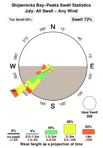
13.5°COverall Shipwrecks Bay-Peaks Surf Consistency and Wind Distribution in Juillet
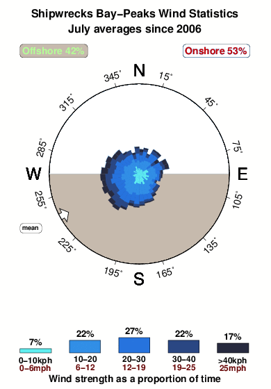


Wind stats for Shipwrecks Bay-Peaks: see the variation in direction and stength by month.
Photos de Surf
de la galerieContours: Routes et Rivières: Sélectionnez un spot de surf du menu 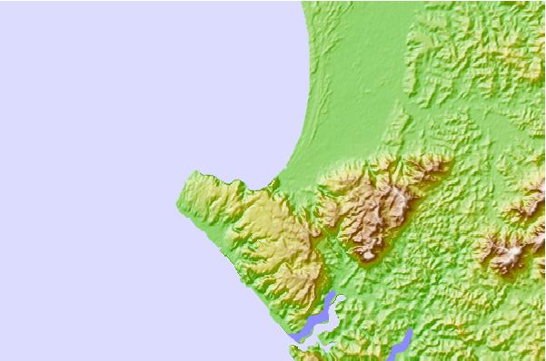
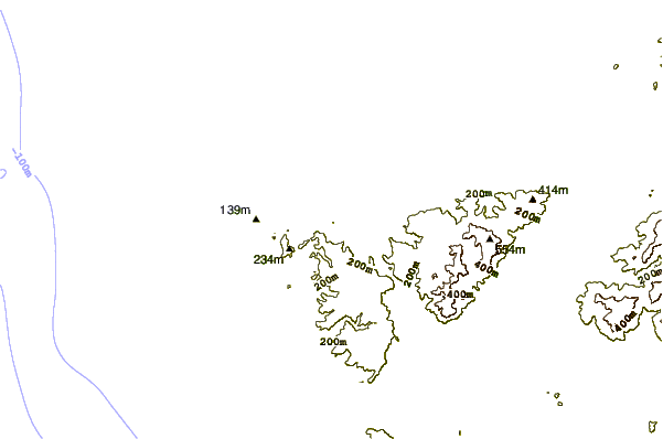
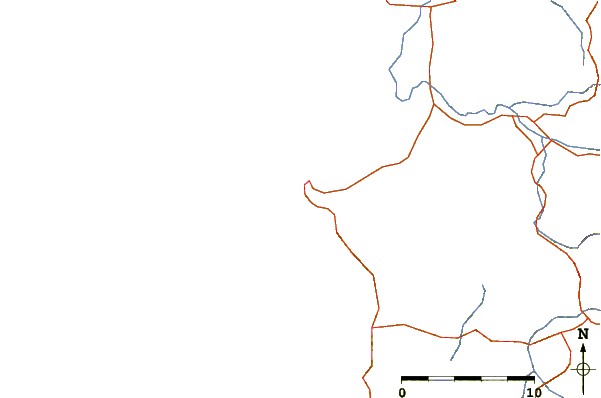
Utilisez cette carte en relief pour naviguer vers les spots de surf de Northland, et les stations de marées aux alentours de Shipwrecks Bay-Peaks
Spots de Surf les plus proches de Shipwrecks Bay-Peaks:
(Cliquez sur le nom du spot pour plus de détails)- Closest spot1 mi
- Second closest spot1 mi
- Third closest spot2 mi
- Fourth closest spot2 mi
- Fifth closest spot4 mi
Bouées marines les plus proches de Shipwrecks Bay-Peaks:
- Closest Bouées marines93 mi
- Second closest Bouées marines260 mi
- Third closest Bouées marines381 mi
- Fourth closest Bouées marines421 mi
- Fifth closest Bouées marines422 mi
Stations de marée les plus proches de Shipwrecks Bay-Peaks:
- Closest station de maréeAhipara Bay2 mi
- Second closest station de maréeDairy Factory Wharf11 mi
- Third closest station de maréeOmaia Island14 mi
- Fourth closest station de maréeSheigis Beacon21 mi
- Fifth closest station de maréeHouhora River Entrance24 mi
Airports
- The closest passenger airport to Shipwrecks Bay-Peaks is Kaitaia Airport (KAT) in New Zealand, which is 17 km (11 miles) away (directly).
- The second nearest airport to Shipwrecks Bay-Peaks is Kerikeri Airport (KKE), also in New Zealand, 71 km (44 miles) away.
- The third closest airport is Whangarei Airport (WRE), also in New Zealand, 129 km (80 miles) away.
- /breaks/Shipwrecks-Bay-Peaks/forecasts/latest

 Nearest