

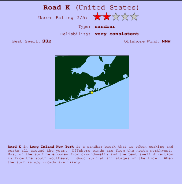
Road K Surf Guide
Road K in Long Island New York is an exposed sandbar break that has very consistent waves and works all around the year. The best wind direction is from the north northwest. Most of the surf here comes from groundswells and the ideal swell direction is from the south southeast. Good surf at all stages of the tide. A popular wave that can get growded.
Road K Spot Info
| Type: | Rating: | Reliability: | Todays Sea Temp*: |
|---|---|---|---|
| very consistent | 22.6°C*ocean temperature recorded from satellite |
Surfing Road K:
The best conditions reported for surf at Road K occur when a South-southeast swell combines with an offshore wind direction from the North-northwest.
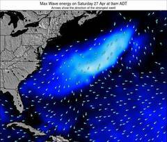
Énergie de Vague (puissance): 12h

Road K Surf:
Saturday, 18 July 2026, 15:22 Local time| Samedi 18 | ||||
| 11AM | 2PM | 5PM | 8PM | |
| Wave (m) | ||||
| Période (s) | 4 | 4 | 4 | 5 |
| Vent (km/h) | ||||
| Etat du vent | cross- on |
cross- on |
cross- on |
cross- on |
- /breaks/Road-K/forecasts/latest
Road K Surf Guide
Road K in Long Island New York is an exposed sandbar break that has very consistent waves and works all around the year. The best wind direction is from the north northwest. Most of the surf here comes from groundswells and the ideal swell direction is from the south southeast. Good surf at all stages of the tide. A popular wave that can get growded.
Road K Spot Info
Type: Rating: Reliability: Todays Sea Temp*:  Sandbar
 2
2very consistent 22.6°C*ocean temperature recorded from satelliteSurfing Road K:
The best conditions reported for surf at Road K occur when a South-southeast swell combines with an offshore wind direction from the North-northwest.
Énergie de Vague (puissance): 12h
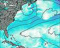
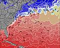
Utilisez les onglets ci-dessus pour voir la température de la mer à Road K, photos pour Road K, prévisions de houle détaillées pour Road K, prévisions de vent et météo, webcams pour Road K, conditions de vents en temps réel à partir des données de la station météo de Long Island NY et prévisions des marées pour Road K. Les cartes de houle pour United States afficheront une image agrandie de United States et des ses mers environnantes. Ces cartes de houles peuvent êtres animées pour montrer les différents composantes de houle, la hauteur, la période et l'énergie des vagues avec les prévisions météo et prévisions de vent. Des observations en temps réel du temps et de l'état de la mer sont fournies grâce aux bouées marines de United States, des navires de passages, et des stations météo côtières. Toutes les pages de prévisions pour ce spot de surf ont un Vagu-o-Mètre Local et Global pour facilement trouver les meilleurs spot de surf à proximité de Road K.
Road K Surf:
Saturday, 18 July 2026, 15:22 Local timeSamedi 18 11AM 2PM 5PM 8PM Wave (m) Période (s) 4 4 4 5 Vent (km/h) Etat du vent cross-
oncross-
oncross-
oncross-
on- /breaks/Road-K/forecasts/latest
- /breaks/Road-K/forecasts/latest/six_day
Road K Surf Guide
Road K in Long Island New York is an exposed sandbar break that has very consistent waves and works all around the year. The best wind direction is from the north northwest. Most of the surf here comes from groundswells and the ideal swell direction is from the south southeast. Good surf at all stages of the tide. A popular wave that can get growded.
Road K Spot Info
Type: Rating: Reliability: Todays Sea Temp*: Sandbar2very consistent 22.6°C*ocean temperature recorded from satelliteSurfing Road K:
The best conditions reported for surf at Road K occur when a South-southeast swell combines with an offshore wind direction from the North-northwest.
Énergie de Vague (puissance): 12h
Utilisez les onglets ci-dessus pour voir la température de la mer à Road K, photos pour Road K, prévisions de houle détaillées pour Road K, prévisions de vent et météo, webcams pour Road K, conditions de vents en temps réel à partir des données de la station météo de Long Island NY et prévisions des marées pour Road K. Les cartes de houle pour United States afficheront une image agrandie de United States et des ses mers environnantes. Ces cartes de houles peuvent êtres animées pour montrer les différents composantes de houle, la hauteur, la période et l'énergie des vagues avec les prévisions météo et prévisions de vent. Des observations en temps réel du temps et de l'état de la mer sont fournies grâce aux bouées marines de United States, des navires de passages, et des stations météo côtières. Toutes les pages de prévisions pour ce spot de surf ont un Vagu-o-Mètre Local et Global pour facilement trouver les meilleurs spot de surf à proximité de Road K.
Road K Surf:
Saturday, 18 July 2026, 15:22 Local timeSamedi 18 11AM 2PM 5PM 8PM Wave (m) Période (s) 4 4 4 5 Vent (km/h) Etat du vent cross-
oncross-
oncross-
oncross-
on- /breaks/Road-K/forecasts/latest
Road K Surf Guide
Road K in Long Island New York is an exposed sandbar break that has very consistent waves and works all around the year. The best wind direction is from the north northwest. Most of the surf here comes from groundswells and the ideal swell direction is from the south southeast. Good surf at all stages of the tide. A popular wave that can get growded.
Road K Spot Info
Type: Rating: Reliability: Todays Sea Temp*: Sandbar2very consistent 22.6°C*ocean temperature recorded from satelliteSurfing Road K:
The best conditions reported for surf at Road K occur when a South-southeast swell combines with an offshore wind direction from the North-northwest.
Énergie de Vague (puissance): 12h
Utilisez les onglets ci-dessus pour voir la température de la mer à Road K, photos pour Road K, prévisions de houle détaillées pour Road K, prévisions de vent et météo, webcams pour Road K, conditions de vents en temps réel à partir des données de la station météo de Long Island NY et prévisions des marées pour Road K. Les cartes de houle pour United States afficheront une image agrandie de United States et des ses mers environnantes. Ces cartes de houles peuvent êtres animées pour montrer les différents composantes de houle, la hauteur, la période et l'énergie des vagues avec les prévisions météo et prévisions de vent. Des observations en temps réel du temps et de l'état de la mer sont fournies grâce aux bouées marines de United States, des navires de passages, et des stations météo côtières. Toutes les pages de prévisions pour ce spot de surf ont un Vagu-o-Mètre Local et Global pour facilement trouver les meilleurs spot de surf à proximité de Road K.
Road K Surf:
Saturday, 18 July 2026, 15:22 Local timeSamedi 18 11AM 2PM 5PM 8PM Wave (m) Période (s) 4 4 4 5 Vent (km/h) Etat du vent cross-
oncross-
oncross-
oncross-
onTide Times:
Pour Shinnecock Inlet (ocean), Long Island, New York, %{dist} %{km} de %{location}.
PROCHAIN EST A (heure locale) il reste marée haute marée basse Road K Tide Times and Tide Chart
Live Weather:
At Westhampton Beach/Francis S. Gabreski Airport, 9 km from Road K.
light winds from the SW
(km/h)Air temperature
22.2°COverall Road K Surf Consistency and Wind Distribution in Juillet
Photos de Surf
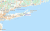
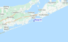
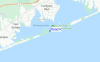
de la galerieContours: Routes et Rivières: Sélectionnez un spot de surf du menu 


Utilisez cette carte en relief pour naviguer vers les spots de surf de Long Island NY, et les stations de marées aux alentours de Road K
Spots de Surf les plus proches de Road K:
(Cliquez sur le nom du spot pour plus de détails)- Closest spot1 mi
- Second closest spot2 mi
- Third closest spot2 mi
- Fourth closest spot9 mi
- Fifth closest spot11 mi
Bouées marines les plus proches de Road K:
- Closest Bouées marines22 mi
- Second closest Bouées marines26 mi
- Third closest Bouées marines53 mi
- Fourth closest Bouées marines57 mi
- Fifth closest Bouées marines70 mi
Stations de marée les plus proches de Road K:
- Closest station de maréePonquogue Bridge1 mi
- Second closest station de maréePonquoque Point, Shinnecock Bay1 mi
- Third closest station de maréeShinnecock Inlet (ocean), Long Island2 mi
- Fourth closest station de maréeShinnecock Yacht Club, Penniman Creek, Shinnecock Bay2 mi
- Fifth closest station de maréeShinnecock Bay entrance, Shinnecock Bay3 mi
Airports
- The closest passenger airport to Road K is The Francis S Gabreski (West Hampton Beach) Airport (FOK) in USA, 10 km (6 miles) away (directly).
- The second nearest airport to Road K is Long Island Mac Arthur (Islip) Airport (ISP), also in USA, 50 km (31 miles) away.
- Third is Igor I Sikorsky Mem (Stratford) Airport (BDR) in USA, 63 km (39 miles) away.
- Hartford Brainard Airport (HFD) in USA is 101 km (63 miles) away.
- Westchester Co (White Plains) Airport (HPN), also in USA is the fifth nearest airport to Road K and is 104 km (65 miles) away.
- /breaks/Road-K/forecasts/latest


 Nearest