

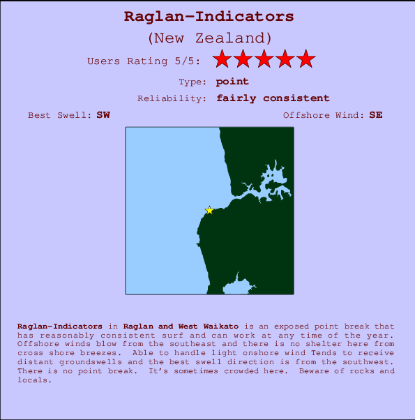
Raglan-Indicators Surf Guide
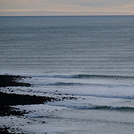
Raglan-Indicators in West Coast Auckland is an exposed point break that has reasonably consistent surf and can work at any time of the year. Offshore winds are from the southeast. Waves can be ok even in light onshore winds Waves just as likely from local windswells as from distant groundswells and the ideal swell direction is from the southwest.There is a left breaking point here. It's sometimes crowded here. Watch out for rocks and locals.
Raglan-Indicators Spot Info
| Type: | Rating: | Reliability: | Todays Sea Temp*: |
|---|---|---|---|
| fairly consistent | 14.6°C*ocean temperature recorded from satellite |
Surfing Raglan-Indicators:
The best conditions reported for surf at Raglan-Indicators occur when a Southwest swell combines with an offshore wind direction from the Southeast.

Énergie de Vague (puissance): 12h


Raglan-Indicators Surf:
Thursday, 16 July 2026, 22:10 Local time| Jeu | Vendredi 17 | |||
| 9PM | 0AM | 3AM | 6AM | |
| Wave (m) | ||||
| Période (s) | 15 | 15 | 15 | 15 |
| Vent (km/h) | ||||
| Etat du vent | cross | cross | cross | cross |
- /breaks/Raglan-Indicators/forecasts/latest
Raglan-Indicators Surf Guide
Raglan-Indicators in West Coast Auckland is an exposed point break that has reasonably consistent surf and can work at any time of the year. Offshore winds are from the southeast. Waves can be ok even in light onshore winds Waves just as likely from local windswells as from distant groundswells and the ideal swell direction is from the southwest.There is a left breaking point here. It's sometimes crowded here. Watch out for rocks and locals.
Raglan-Indicators Spot Info
Type: Rating: Reliability: Todays Sea Temp*:  Point
Point 5
5fairly consistent 14.6°C*ocean temperature recorded from satelliteSurfing Raglan-Indicators:
The best conditions reported for surf at Raglan-Indicators occur when a Southwest swell combines with an offshore wind direction from the Southeast.
Énergie de Vague (puissance): 12h
Utilisez les onglets ci-dessus pour voir la température de la mer à Raglan-Indicators, photos pour Raglan-Indicators, prévisions de houle détaillées pour Raglan-Indicators, prévisions de vent et météo, webcams pour Raglan-Indicators, conditions de vents en temps réel à partir des données de la station météo de Raglan and West Waikato et prévisions des marées pour Raglan-Indicators. Les cartes de houle pour New Zealand afficheront une image agrandie de New Zealand et des ses mers environnantes. Ces cartes de houles peuvent êtres animées pour montrer les différents composantes de houle, la hauteur, la période et l'énergie des vagues avec les prévisions météo et prévisions de vent. Des observations en temps réel du temps et de l'état de la mer sont fournies grâce aux bouées marines de New Zealand, des navires de passages, et des stations météo côtières. Toutes les pages de prévisions pour ce spot de surf ont un Vagu-o-Mètre Local et Global pour facilement trouver les meilleurs spot de surf à proximité de Raglan-Indicators.
Raglan-Indicators Surf:
Thursday, 16 July 2026, 22:10 Local timeJeu Vendredi 17 9PM 0AM 3AM 6AM Wave (m) Période (s) 15 15 15 15 Vent (km/h) Etat du vent cross cross cross cross - /breaks/Raglan-Indicators/forecasts/latest
- /breaks/Raglan-Indicators/forecasts/latest/six_day
Raglan-Indicators Surf Guide
Raglan-Indicators in West Coast Auckland is an exposed point break that has reasonably consistent surf and can work at any time of the year. Offshore winds are from the southeast. Waves can be ok even in light onshore winds Waves just as likely from local windswells as from distant groundswells and the ideal swell direction is from the southwest.There is a left breaking point here. It's sometimes crowded here. Watch out for rocks and locals.
Raglan-Indicators Spot Info
Type: Rating: Reliability: Todays Sea Temp*: Point5fairly consistent 14.6°C*ocean temperature recorded from satelliteSurfing Raglan-Indicators:
The best conditions reported for surf at Raglan-Indicators occur when a Southwest swell combines with an offshore wind direction from the Southeast.
Énergie de Vague (puissance): 12h
Utilisez les onglets ci-dessus pour voir la température de la mer à Raglan-Indicators, photos pour Raglan-Indicators, prévisions de houle détaillées pour Raglan-Indicators, prévisions de vent et météo, webcams pour Raglan-Indicators, conditions de vents en temps réel à partir des données de la station météo de Raglan and West Waikato et prévisions des marées pour Raglan-Indicators. Les cartes de houle pour New Zealand afficheront une image agrandie de New Zealand et des ses mers environnantes. Ces cartes de houles peuvent êtres animées pour montrer les différents composantes de houle, la hauteur, la période et l'énergie des vagues avec les prévisions météo et prévisions de vent. Des observations en temps réel du temps et de l'état de la mer sont fournies grâce aux bouées marines de New Zealand, des navires de passages, et des stations météo côtières. Toutes les pages de prévisions pour ce spot de surf ont un Vagu-o-Mètre Local et Global pour facilement trouver les meilleurs spot de surf à proximité de Raglan-Indicators.
Raglan-Indicators Surf:
Thursday, 16 July 2026, 22:10 Local timeJeu Vendredi 17 9PM 0AM 3AM 6AM Wave (m) Période (s) 15 15 15 15 Vent (km/h) Etat du vent cross cross cross cross - /breaks/Raglan-Indicators/forecasts/latest
Raglan-Indicators Surf Guide
Raglan-Indicators in West Coast Auckland is an exposed point break that has reasonably consistent surf and can work at any time of the year. Offshore winds are from the southeast. Waves can be ok even in light onshore winds Waves just as likely from local windswells as from distant groundswells and the ideal swell direction is from the southwest.There is a left breaking point here. It's sometimes crowded here. Watch out for rocks and locals.
Raglan-Indicators Spot Info
Type: Rating: Reliability: Todays Sea Temp*: Point5fairly consistent 14.6°C*ocean temperature recorded from satelliteSurfing Raglan-Indicators:
The best conditions reported for surf at Raglan-Indicators occur when a Southwest swell combines with an offshore wind direction from the Southeast.
Énergie de Vague (puissance): 12h
Utilisez les onglets ci-dessus pour voir la température de la mer à Raglan-Indicators, photos pour Raglan-Indicators, prévisions de houle détaillées pour Raglan-Indicators, prévisions de vent et météo, webcams pour Raglan-Indicators, conditions de vents en temps réel à partir des données de la station météo de Raglan and West Waikato et prévisions des marées pour Raglan-Indicators. Les cartes de houle pour New Zealand afficheront une image agrandie de New Zealand et des ses mers environnantes. Ces cartes de houles peuvent êtres animées pour montrer les différents composantes de houle, la hauteur, la période et l'énergie des vagues avec les prévisions météo et prévisions de vent. Des observations en temps réel du temps et de l'état de la mer sont fournies grâce aux bouées marines de New Zealand, des navires de passages, et des stations météo côtières. Toutes les pages de prévisions pour ce spot de surf ont un Vagu-o-Mètre Local et Global pour facilement trouver les meilleurs spot de surf à proximité de Raglan-Indicators.
Raglan-Indicators Surf:
Thursday, 16 July 2026, 22:10 Local timeJeu Vendredi 17 9PM 0AM 3AM 6AM Wave (m) Période (s) 15 15 15 15 Vent (km/h) Etat du vent cross cross cross cross Tide Times:
Pour Ruapuke, %{dist} %{km} de %{location}.
PROCHAIN EST A (heure locale) il reste marée haute marée basse Raglan-Indicators Tide Times and Tide Chart
Live Weather:
At Te Akau, 29 km from Raglan-Indicators.
light winds from the S
(km/h)
DryAir temperature
11°COverall Raglan-Indicators Surf Consistency and Wind Distribution in Juillet


Wind stats for Raglan-Indicators: see the variation in direction and stength by month.
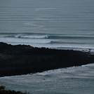
Photos de Surf
de la galerieContours: Routes et Rivières: Sélectionnez un spot de surf du menu 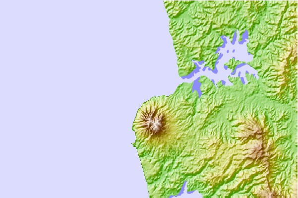
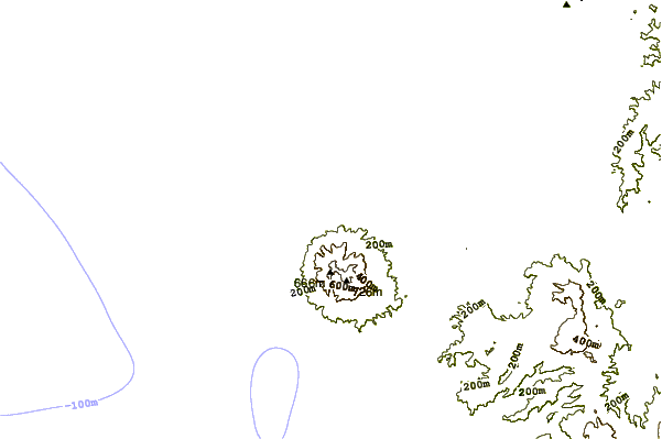
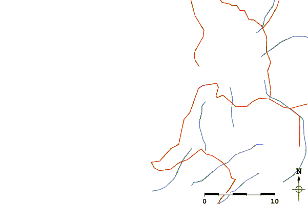
Utilisez cette carte en relief pour naviguer vers les spots de surf de Raglan and West Waikato, et les stations de marées aux alentours de Raglan-Indicators
Spots de Surf les plus proches de Raglan-Indicators:
(Cliquez sur le nom du spot pour plus de détails)- Closest spot1 mi
- Second closest spot2 mi
- Third closest spot2 mi
- Fourth closest spot4 mi
- Fifth closest spot30 mi
Bouées marines les plus proches de Raglan-Indicators:
- Closest Bouées marines100 mi
- Second closest Bouées marines135 mi
- Third closest Bouées marines221 mi
- Fourth closest Bouées marines236 mi
- Fifth closest Bouées marines251 mi
Stations de marée les plus proches de Raglan-Indicators:
- Closest station de maréeRaglan6 mi
- Second closest station de maréeAotea Harbour12 mi
- Third closest station de maréeKawhia17 mi
- Fourth closest station de maréeWaikato River Entrance30 mi
- Fifth closest station de maréeLPG Terminal55 mi
Airports
- The closest passenger airport to Raglan-Indicators is Hamilton Airport (HLZ) in New Zealand, 48 km (30 miles) away (directly).
- The second nearest airport to Raglan-Indicators is Auckland International Airport (AKL), also in New Zealand, 91 km (57 miles) away.
- Third is Tauranga Airport (TRG) in New Zealand, 125 km (78 miles) away.
- Rotorua Airport (ROT) in New Zealand is 138 km (86 miles) away.
- New Plymouth Airport (NPL), also in New Zealand is the fifth nearest airport to Raglan-Indicators and is 142 km (88 miles) away.
- /breaks/Raglan-Indicators/forecasts/latest


 Nearest