

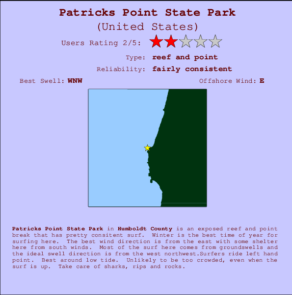
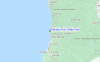
Patricks Point State Park Surf Guide
Patricks Point State Park in Humboldt is an exposed reef and point break that has pretty consitent surf. Winter is the best time of year for surfing here. The best wind direction is from the east with some shelter here from south winds. Tends to receive distant groundswells and the best swell direction is from the west northwest.The break here is a left hand point. Best around low tide. Rarely crowded here. Watch out for sharks, rips and rocks.
Patricks Point State Park Spot Info
| Type: | Rating: | Reliability: | Todays Sea Temp*: |
|---|---|---|---|
| fairly consistent | 12.7°C*ocean temperature recorded from satellite |
Surfing Patricks Point State Park:
The best conditions reported for surf at Patricks Point State Park occur when a West-northwest swell combines with an offshore wind direction from the East.

Énergie de Vague (puissance): 12h


Patricks Point State Park Surf:
Friday, 17 July 2026, 00:41 Local time| Jeu | Ven | |||
| 8PM | 11PM | 2AM | 5AM | |
| Wave (m) | ||||
| Période (s) | 18 | 18 | 17 | 17 |
| Vent (km/h) | ||||
| Etat du vent | cross | cross | cross- off |
glass |
- /breaks/Patricks-Point-State-Park/forecasts/latest
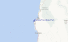
Patricks Point State Park Surf Guide
Patricks Point State Park in Humboldt is an exposed reef and point break that has pretty consitent surf. Winter is the best time of year for surfing here. The best wind direction is from the east with some shelter here from south winds. Tends to receive distant groundswells and the best swell direction is from the west northwest.The break here is a left hand point. Best around low tide. Rarely crowded here. Watch out for sharks, rips and rocks.
Patricks Point State Park Spot Info
Type: Rating: Reliability: Todays Sea Temp*:  Reef and point
 2
2fairly consistent 12.7°C*ocean temperature recorded from satelliteSurfing Patricks Point State Park:
The best conditions reported for surf at Patricks Point State Park occur when a West-northwest swell combines with an offshore wind direction from the East.
Énergie de Vague (puissance): 12h
Utilisez les onglets ci-dessus pour voir la température de la mer à Patricks Point State Park, photos pour Patricks Point State Park, prévisions de houle détaillées pour Patricks Point State Park, prévisions de vent et météo, webcams pour Patricks Point State Park, conditions de vents en temps réel à partir des données de la station météo de CAL - Humboldt et prévisions des marées pour Patricks Point State Park. Les cartes de houle pour United States afficheront une image agrandie de United States et des ses mers environnantes. Ces cartes de houles peuvent êtres animées pour montrer les différents composantes de houle, la hauteur, la période et l'énergie des vagues avec les prévisions météo et prévisions de vent. Des observations en temps réel du temps et de l'état de la mer sont fournies grâce aux bouées marines de United States, des navires de passages, et des stations météo côtières. Toutes les pages de prévisions pour ce spot de surf ont un Vagu-o-Mètre Local et Global pour facilement trouver les meilleurs spot de surf à proximité de Patricks Point State Park.
Patricks Point State Park Surf:
Friday, 17 July 2026, 00:41 Local timeJeu Ven 8PM 11PM 2AM 5AM Wave (m) Période (s) 18 18 17 17 Vent (km/h) Etat du vent cross cross cross-
offglass - /breaks/Patricks-Point-State-Park/forecasts/latest
- /breaks/Patricks-Point-State-Park/forecasts/latest/six_day
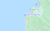
Patricks Point State Park Surf Guide
Patricks Point State Park in Humboldt is an exposed reef and point break that has pretty consitent surf. Winter is the best time of year for surfing here. The best wind direction is from the east with some shelter here from south winds. Tends to receive distant groundswells and the best swell direction is from the west northwest.The break here is a left hand point. Best around low tide. Rarely crowded here. Watch out for sharks, rips and rocks.
Patricks Point State Park Spot Info
Type: Rating: Reliability: Todays Sea Temp*: Reef and point2fairly consistent 12.7°C*ocean temperature recorded from satelliteSurfing Patricks Point State Park:
The best conditions reported for surf at Patricks Point State Park occur when a West-northwest swell combines with an offshore wind direction from the East.
Énergie de Vague (puissance): 12h
Utilisez les onglets ci-dessus pour voir la température de la mer à Patricks Point State Park, photos pour Patricks Point State Park, prévisions de houle détaillées pour Patricks Point State Park, prévisions de vent et météo, webcams pour Patricks Point State Park, conditions de vents en temps réel à partir des données de la station météo de CAL - Humboldt et prévisions des marées pour Patricks Point State Park. Les cartes de houle pour United States afficheront une image agrandie de United States et des ses mers environnantes. Ces cartes de houles peuvent êtres animées pour montrer les différents composantes de houle, la hauteur, la période et l'énergie des vagues avec les prévisions météo et prévisions de vent. Des observations en temps réel du temps et de l'état de la mer sont fournies grâce aux bouées marines de United States, des navires de passages, et des stations météo côtières. Toutes les pages de prévisions pour ce spot de surf ont un Vagu-o-Mètre Local et Global pour facilement trouver les meilleurs spot de surf à proximité de Patricks Point State Park.
Patricks Point State Park Surf:
Friday, 17 July 2026, 00:41 Local timeJeu Ven 8PM 11PM 2AM 5AM Wave (m) Période (s) 18 18 17 17 Vent (km/h) Etat du vent cross cross cross-
offglass - /breaks/Patricks-Point-State-Park/forecasts/latest
Patricks Point State Park Surf Guide
Patricks Point State Park in Humboldt is an exposed reef and point break that has pretty consitent surf. Winter is the best time of year for surfing here. The best wind direction is from the east with some shelter here from south winds. Tends to receive distant groundswells and the best swell direction is from the west northwest.The break here is a left hand point. Best around low tide. Rarely crowded here. Watch out for sharks, rips and rocks.
Patricks Point State Park Spot Info
Type: Rating: Reliability: Todays Sea Temp*: Reef and point2fairly consistent 12.7°C*ocean temperature recorded from satelliteSurfing Patricks Point State Park:
The best conditions reported for surf at Patricks Point State Park occur when a West-northwest swell combines with an offshore wind direction from the East.
Énergie de Vague (puissance): 12h
Utilisez les onglets ci-dessus pour voir la température de la mer à Patricks Point State Park, photos pour Patricks Point State Park, prévisions de houle détaillées pour Patricks Point State Park, prévisions de vent et météo, webcams pour Patricks Point State Park, conditions de vents en temps réel à partir des données de la station météo de CAL - Humboldt et prévisions des marées pour Patricks Point State Park. Les cartes de houle pour United States afficheront une image agrandie de United States et des ses mers environnantes. Ces cartes de houles peuvent êtres animées pour montrer les différents composantes de houle, la hauteur, la période et l'énergie des vagues avec les prévisions météo et prévisions de vent. Des observations en temps réel du temps et de l'état de la mer sont fournies grâce aux bouées marines de United States, des navires de passages, et des stations météo côtières. Toutes les pages de prévisions pour ce spot de surf ont un Vagu-o-Mètre Local et Global pour facilement trouver les meilleurs spot de surf à proximité de Patricks Point State Park.
Patricks Point State Park Surf:
Friday, 17 July 2026, 00:41 Local timeJeu Ven 8PM 11PM 2AM 5AM Wave (m) Période (s) 18 18 17 17 Vent (km/h) Etat du vent cross cross cross-
offglass Tide Times:
Pour Big Lagoon, %{dist} %{km} de %{location}.
PROCHAIN EST A (heure locale) il reste marée haute marée basse Patricks Point State Park Tide Times and Tide Chart
Live Weather:
At BUOY-TDPC1, 9 km from Patricks Point State Park.
- Air temperature
-°CCurrent weather near Patricks Point State Park
Buoy Data:
At Humboldt Bay, North Spit, CA, 19 miles from Patricks Point State Park.
7PM 8PM 9PM 10PM Age des données 4 hr 3 hr 2 hr 1 hr hauteur de la vague (m) 


Période Dominante (s) 15 15 8 8 Overall Patricks Point State Park Surf Consistency and Wind Distribution in Juillet


Wind stats for Patricks Point State Park: see the variation in direction and stength by month.
Photos de Surf
de la galerieContours: Routes et Rivières: Sélectionnez un spot de surf du menu 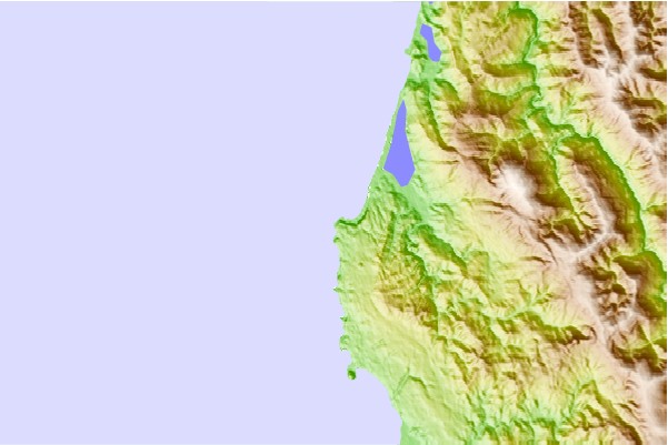
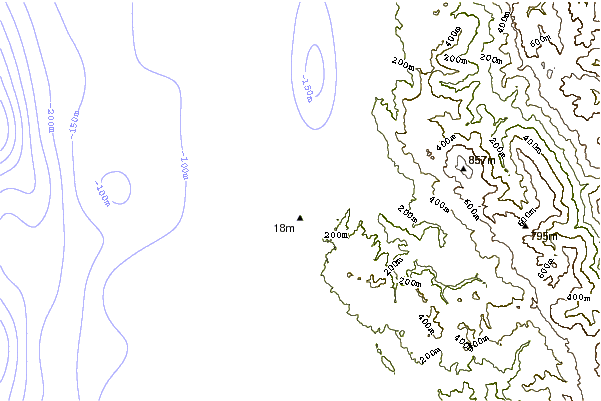
Utilisez cette carte en relief pour naviguer vers les spots de surf de CAL - Humboldt, et les stations de marées aux alentours de Patricks Point State Park
Spots de Surf les plus proches de Patricks Point State Park:
(Cliquez sur le nom du spot pour plus de détails)- Closest spot2 mi
- Second closest spot5 mi
- Third closest spot6 mi
- Fourth closest spot7 mi
- Fifth closest spot8 mi
Bouées marines les plus proches de Patricks Point State Park:
- Closest Bouées marines19 mi
- Second closest Bouées marines35 mi
- Third closest Bouées marines50 mi
- Fourth closest Bouées marines65 mi
- Fifth closest Bouées marines116 mi
Stations de marée les plus proches de Patricks Point State Park:
- Closest station de maréeTrinidad Harbor6 mi
- Second closest station de maréeMcKinleyville14 mi
- Third closest station de maréeMad River Slough, Arcata Bay, Humboldt Bay19 mi
- Fourth closest station de maréeArcata Wharf, Humboldt Bay21 mi
- Fifth closest station de maréeSamoa, Humboldt Bay22 mi
Airports
- The nearest passenger airport to Patricks Point State Park is Chico Muni Airport (CIC) in USA, which is 246 km (153 miles) away (directly).
- The second closest airport to Patricks Point State Park is Beale Afb (Marysville) Airport (BAB), also in USA, 322 km (200 miles) away.
- /breaks/Patricks-Point-State-Park/forecasts/latest


 Nearest