

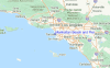
Manhattan Beach and Pier Surf Guide
Manhattan Beach and Pier in LA County is an exposed beach break that has consistent surf. Summer offers the favoured conditions for surfing. The best wind direction is from the east. Most of the surf here comes from groundswells and the ideal swell direction is from the southwest. Waves at the beach are both lefts and rights. Often Crowded. Be wary of rips - they make surfing here dangerous.
Manhattan Beach and Pier Spot Info
| Type: | Rating: | Reliability: | Todays Sea Temp*: |
|---|---|---|---|
| consistent | 21.1°C*ocean temperature recorded from satellite |
Surfing Manhattan Beach and Pier:
The best conditions reported for surf at Manhattan Beach and Pier occur when a Southwest swell combines with an offshore wind direction from the East.

Énergie de Vague (puissance): 12h


Manhattan Beach and Pier Surf:
Tuesday, 14 July 2026, 16:01 Local time| Mardi 14 | ||||
| 2PM | 5PM | 8PM | 11PM | |
| Wave (m) | ||||
| Période (s) | 12 | 12 | 18 | 18 |
| Vent (km/h) | ||||
| Etat du vent | cross- on |
on | on | cross |
- /breaks/Manhattan-Beach-Pier/forecasts/latest
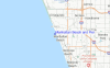
Manhattan Beach and Pier Surf Guide
Manhattan Beach and Pier in LA County is an exposed beach break that has consistent surf. Summer offers the favoured conditions for surfing. The best wind direction is from the east. Most of the surf here comes from groundswells and the ideal swell direction is from the southwest. Waves at the beach are both lefts and rights. Often Crowded. Be wary of rips - they make surfing here dangerous.
Manhattan Beach and Pier Spot Info
Type: Rating: Reliability: Todays Sea Temp*:  Beach
Beach 1
1consistent 21.1°C*ocean temperature recorded from satelliteSurfing Manhattan Beach and Pier:
The best conditions reported for surf at Manhattan Beach and Pier occur when a Southwest swell combines with an offshore wind direction from the East.
Énergie de Vague (puissance): 12h
Utilisez les onglets ci-dessus pour voir la température de la mer à Manhattan Beach and Pier, photos pour Manhattan Beach and Pier, prévisions de houle détaillées pour Manhattan Beach and Pier, prévisions de vent et météo, webcams pour Manhattan Beach and Pier, conditions de vents en temps réel à partir des données de la station météo de CAL - LA County et prévisions des marées pour Manhattan Beach and Pier. Les cartes de houle pour United States afficheront une image agrandie de United States et des ses mers environnantes. Ces cartes de houles peuvent êtres animées pour montrer les différents composantes de houle, la hauteur, la période et l'énergie des vagues avec les prévisions météo et prévisions de vent. Des observations en temps réel du temps et de l'état de la mer sont fournies grâce aux bouées marines de United States, des navires de passages, et des stations météo côtières. Toutes les pages de prévisions pour ce spot de surf ont un Vagu-o-Mètre Local et Global pour facilement trouver les meilleurs spot de surf à proximité de Manhattan Beach and Pier.
Manhattan Beach and Pier Surf:
Tuesday, 14 July 2026, 16:01 Local timeMardi 14 2PM 5PM 8PM 11PM Wave (m) Période (s) 12 12 18 18 Vent (km/h) Etat du vent cross-
onon on cross - /breaks/Manhattan-Beach-Pier/forecasts/latest
- /breaks/Manhattan-Beach-Pier/forecasts/latest/six_day
Manhattan Beach and Pier Surf Guide
Manhattan Beach and Pier in LA County is an exposed beach break that has consistent surf. Summer offers the favoured conditions for surfing. The best wind direction is from the east. Most of the surf here comes from groundswells and the ideal swell direction is from the southwest. Waves at the beach are both lefts and rights. Often Crowded. Be wary of rips - they make surfing here dangerous.
Manhattan Beach and Pier Spot Info
Type: Rating: Reliability: Todays Sea Temp*: Beach1consistent 21.1°C*ocean temperature recorded from satelliteSurfing Manhattan Beach and Pier:
The best conditions reported for surf at Manhattan Beach and Pier occur when a Southwest swell combines with an offshore wind direction from the East.
Énergie de Vague (puissance): 12h
Utilisez les onglets ci-dessus pour voir la température de la mer à Manhattan Beach and Pier, photos pour Manhattan Beach and Pier, prévisions de houle détaillées pour Manhattan Beach and Pier, prévisions de vent et météo, webcams pour Manhattan Beach and Pier, conditions de vents en temps réel à partir des données de la station météo de CAL - LA County et prévisions des marées pour Manhattan Beach and Pier. Les cartes de houle pour United States afficheront une image agrandie de United States et des ses mers environnantes. Ces cartes de houles peuvent êtres animées pour montrer les différents composantes de houle, la hauteur, la période et l'énergie des vagues avec les prévisions météo et prévisions de vent. Des observations en temps réel du temps et de l'état de la mer sont fournies grâce aux bouées marines de United States, des navires de passages, et des stations météo côtières. Toutes les pages de prévisions pour ce spot de surf ont un Vagu-o-Mètre Local et Global pour facilement trouver les meilleurs spot de surf à proximité de Manhattan Beach and Pier.
Manhattan Beach and Pier Surf:
Tuesday, 14 July 2026, 16:01 Local timeMardi 14 2PM 5PM 8PM 11PM Wave (m) Période (s) 12 12 18 18 Vent (km/h) Etat du vent cross-
onon on cross - /breaks/Manhattan-Beach-Pier/forecasts/latest
Manhattan Beach and Pier Surf Guide
Manhattan Beach and Pier in LA County is an exposed beach break that has consistent surf. Summer offers the favoured conditions for surfing. The best wind direction is from the east. Most of the surf here comes from groundswells and the ideal swell direction is from the southwest. Waves at the beach are both lefts and rights. Often Crowded. Be wary of rips - they make surfing here dangerous.
Manhattan Beach and Pier Spot Info
Type: Rating: Reliability: Todays Sea Temp*: Beach1consistent 21.1°C*ocean temperature recorded from satelliteSurfing Manhattan Beach and Pier:
The best conditions reported for surf at Manhattan Beach and Pier occur when a Southwest swell combines with an offshore wind direction from the East.
Énergie de Vague (puissance): 12h
Utilisez les onglets ci-dessus pour voir la température de la mer à Manhattan Beach and Pier, photos pour Manhattan Beach and Pier, prévisions de houle détaillées pour Manhattan Beach and Pier, prévisions de vent et météo, webcams pour Manhattan Beach and Pier, conditions de vents en temps réel à partir des données de la station météo de CAL - LA County et prévisions des marées pour Manhattan Beach and Pier. Les cartes de houle pour United States afficheront une image agrandie de United States et des ses mers environnantes. Ces cartes de houles peuvent êtres animées pour montrer les différents composantes de houle, la hauteur, la période et l'énergie des vagues avec les prévisions météo et prévisions de vent. Des observations en temps réel du temps et de l'état de la mer sont fournies grâce aux bouées marines de United States, des navires de passages, et des stations météo côtières. Toutes les pages de prévisions pour ce spot de surf ont un Vagu-o-Mètre Local et Global pour facilement trouver les meilleurs spot de surf à proximité de Manhattan Beach and Pier.
Manhattan Beach and Pier Surf:
Tuesday, 14 July 2026, 16:01 Local timeMardi 14 2PM 5PM 8PM 11PM Wave (m) Période (s) 12 12 18 18 Vent (km/h) Etat du vent cross-
onon on cross Tide Times:
Pour Manhattan Beach, %{dist} %{km} de %{location}.
PROCHAIN EST A (heure locale) il reste marée haute marée basse Manhattan Beach and Pier Tide Times and Tide Chart
Live Weather:
At SHIP3005, 2 km from Manhattan Beach and Pier.
- Air temperature
-°CCurrent weather near Manhattan Beach and Pier
Buoy Data:
At Santa Monica Bay, CA, 12 miles from Manhattan Beach and Pier.
10AM 11AM 12PM 1PM Age des données 4 hr 3 hr 2 hr 1 hr hauteur de la vague (m) 

Période Dominante (s) 13 13 13 13 Overall Manhattan Beach and Pier Surf Consistency and Wind Distribution in Juillet


Wind stats for Manhattan Beach and Pier: see the variation in direction and stength by month.
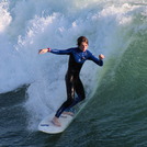
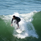
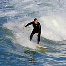
Photos de Surf
de la galerieContours: Routes et Rivières: Sélectionnez un spot de surf du menu 


Utilisez cette carte en relief pour naviguer vers les spots de surf de CAL - LA County, et les stations de marées aux alentours de Manhattan Beach and Pier
Spots de Surf les plus proches de Manhattan Beach and Pier:
(Cliquez sur le nom du spot pour plus de détails)- Closest spot1 mi
- Second closest spot1 mi
- Third closest spot1 mi
- Fourth closest spot1 mi
- Fifth closest spot2 mi
Bouées marines les plus proches de Manhattan Beach and Pier:
- Closest Bouées marines12 mi
- Second closest Bouées marines19 mi
- Third closest Bouées marines20 mi
- Fourth closest Bouées marines25 mi
- Fifth closest Bouées marines36 mi
Stations de marée les plus proches de Manhattan Beach and Pier:
- Closest station de maréeManhattan Beach1 mi
- Second closest station de maréeEl Segundo, Santa Monica Bay2 mi
- Third closest station de maréeKing Harbor, Santa Monica Bay3 mi
- Fourth closest station de maréeMarina del Rey6 mi
- Fifth closest station de maréePalos Verdes Estates7 mi
Airports
- The closest passenger airport to Manhattan Beach and Pier is Los Angeles International Airport (LAX) in USA, 6 km (4 miles) away (directly).
- The second nearest airport to Manhattan Beach and Pier is Jack Northrop Fld Hawthorne Muni Airport (HHR), also in USA, 9 km (6 miles) away.
- Third is Long Beach Airport (LGB) in USA, 26 km (16 miles) away.
- Burbank Glendale Pasadena Airport (BUR) in USA is 35 km (22 miles) away.
- John Wayne Arpt Orange Co (Santa Ana) Airport (SNA), also in USA is the fifth nearest airport to Manhattan Beach and Pier and is 56 km (35 miles) away.

- /breaks/Manhattan-Beach-Pier/forecasts/latest


 Nearest