

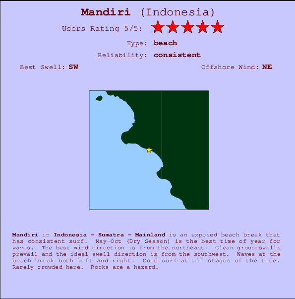
Mandiri Surf Guide
Mandiri in Sumatra is an exposed beach break that has consistent surf. May-Oct (Dry Season) is the best time of year for waves. Offshore winds blow from the northeast. Groundswells more frequent than windswells and the ideal swell direction is from the southwest. Waves at the beach break both left and right. Unlikely to be too crowded, even when the surf is up. Take care to avoid the rocks.
Mandiri Spot Info
| Type: | Rating: | Reliability: | Todays Sea Temp*: |
|---|---|---|---|
| consistent | 29.1°C*ocean temperature recorded from satellite |
Surfing Mandiri:
The best conditions reported for surf at Mandiri occur when a Southwest swell combines with an offshore wind direction from the Northeast.

Énergie de Vague (puissance): 12h


Mandiri Surf:
Friday, 17 July 2026, 10:54 Local time| Vendredi 17 | ||||
| 10AM | 1PM | 4PM | 7PM | |
| Wave (m) | ||||
| Période (s) | 16 | 15 | 15 | 15 |
| Vent (km/h) | ||||
| Etat du vent | cross- on |
cross- on |
cross- on |
cross |
- /breaks/Mandiri/forecasts/latest
Mandiri Surf Guide
Mandiri in Sumatra is an exposed beach break that has consistent surf. May-Oct (Dry Season) is the best time of year for waves. Offshore winds blow from the northeast. Groundswells more frequent than windswells and the ideal swell direction is from the southwest. Waves at the beach break both left and right. Unlikely to be too crowded, even when the surf is up. Take care to avoid the rocks.
Mandiri Spot Info
Type: Rating: Reliability: Todays Sea Temp*:  Beach
Beach 5
5consistent 29.1°C*ocean temperature recorded from satelliteSurfing Mandiri:
The best conditions reported for surf at Mandiri occur when a Southwest swell combines with an offshore wind direction from the Northeast.
Énergie de Vague (puissance): 12h
Utilisez les onglets ci-dessus pour voir la température de la mer à Mandiri, photos pour Mandiri, prévisions de houle détaillées pour Mandiri, prévisions de vent et météo, webcams pour Mandiri, conditions de vents en temps réel à partir des données de la station météo de Sumatra - Mainland et prévisions des marées pour Mandiri. Les cartes de houle pour Indonesia afficheront une image agrandie de Indonesia et des ses mers environnantes. Ces cartes de houles peuvent êtres animées pour montrer les différents composantes de houle, la hauteur, la période et l'énergie des vagues avec les prévisions météo et prévisions de vent. Des observations en temps réel du temps et de l'état de la mer sont fournies grâce aux bouées marines de Indonesia, des navires de passages, et des stations météo côtières. Toutes les pages de prévisions pour ce spot de surf ont un Vagu-o-Mètre Local et Global pour facilement trouver les meilleurs spot de surf à proximité de Mandiri.
Mandiri Surf:
Friday, 17 July 2026, 10:54 Local timeVendredi 17 10AM 1PM 4PM 7PM Wave (m) Période (s) 16 15 15 15 Vent (km/h) Etat du vent cross-
oncross-
oncross-
oncross - /breaks/Mandiri/forecasts/latest
- /breaks/Mandiri/forecasts/latest/six_day
Mandiri Surf Guide
Mandiri in Sumatra is an exposed beach break that has consistent surf. May-Oct (Dry Season) is the best time of year for waves. Offshore winds blow from the northeast. Groundswells more frequent than windswells and the ideal swell direction is from the southwest. Waves at the beach break both left and right. Unlikely to be too crowded, even when the surf is up. Take care to avoid the rocks.
Mandiri Spot Info
Type: Rating: Reliability: Todays Sea Temp*: Beach5consistent 29.1°C*ocean temperature recorded from satelliteSurfing Mandiri:
The best conditions reported for surf at Mandiri occur when a Southwest swell combines with an offshore wind direction from the Northeast.
Énergie de Vague (puissance): 12h
Utilisez les onglets ci-dessus pour voir la température de la mer à Mandiri, photos pour Mandiri, prévisions de houle détaillées pour Mandiri, prévisions de vent et météo, webcams pour Mandiri, conditions de vents en temps réel à partir des données de la station météo de Sumatra - Mainland et prévisions des marées pour Mandiri. Les cartes de houle pour Indonesia afficheront une image agrandie de Indonesia et des ses mers environnantes. Ces cartes de houles peuvent êtres animées pour montrer les différents composantes de houle, la hauteur, la période et l'énergie des vagues avec les prévisions météo et prévisions de vent. Des observations en temps réel du temps et de l'état de la mer sont fournies grâce aux bouées marines de Indonesia, des navires de passages, et des stations météo côtières. Toutes les pages de prévisions pour ce spot de surf ont un Vagu-o-Mètre Local et Global pour facilement trouver les meilleurs spot de surf à proximité de Mandiri.
Mandiri Surf:
Friday, 17 July 2026, 10:54 Local timeVendredi 17 10AM 1PM 4PM 7PM Wave (m) Période (s) 16 15 15 15 Vent (km/h) Etat du vent cross-
oncross-
oncross-
oncross - /breaks/Mandiri/forecasts/latest
Mandiri Surf Guide
Mandiri in Sumatra is an exposed beach break that has consistent surf. May-Oct (Dry Season) is the best time of year for waves. Offshore winds blow from the northeast. Groundswells more frequent than windswells and the ideal swell direction is from the southwest. Waves at the beach break both left and right. Unlikely to be too crowded, even when the surf is up. Take care to avoid the rocks.
Mandiri Spot Info
Type: Rating: Reliability: Todays Sea Temp*: Beach5consistent 29.1°C*ocean temperature recorded from satelliteSurfing Mandiri:
The best conditions reported for surf at Mandiri occur when a Southwest swell combines with an offshore wind direction from the Northeast.
Énergie de Vague (puissance): 12h
Utilisez les onglets ci-dessus pour voir la température de la mer à Mandiri, photos pour Mandiri, prévisions de houle détaillées pour Mandiri, prévisions de vent et météo, webcams pour Mandiri, conditions de vents en temps réel à partir des données de la station météo de Sumatra - Mainland et prévisions des marées pour Mandiri. Les cartes de houle pour Indonesia afficheront une image agrandie de Indonesia et des ses mers environnantes. Ces cartes de houles peuvent êtres animées pour montrer les différents composantes de houle, la hauteur, la période et l'énergie des vagues avec les prévisions météo et prévisions de vent. Des observations en temps réel du temps et de l'état de la mer sont fournies grâce aux bouées marines de Indonesia, des navires de passages, et des stations météo côtières. Toutes les pages de prévisions pour ce spot de surf ont un Vagu-o-Mètre Local et Global pour facilement trouver les meilleurs spot de surf à proximité de Mandiri.
Mandiri Surf:
Friday, 17 July 2026, 10:54 Local timeVendredi 17 10AM 1PM 4PM 7PM Wave (m) Période (s) 16 15 15 15 Vent (km/h) Etat du vent cross-
oncross-
oncross-
oncross Tide Times:
Pour Karang Nyimbor, %{dist} %{km} de %{location}.
PROCHAIN EST A (heure locale) il reste marée haute marée basse Mandiri Tide Times and Tide Chart
Live Weather:
At Palembang/Sultan Mahmud Badaruddin II Airport, 276 km from Mandiri.
light winds from the SE.(Wind varies from 110 to 190 degs)
(km/h)
Dry and partly cloudyAir temperature
30°COverall Mandiri Surf Consistency and Wind Distribution in Juillet
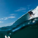
Photos de Surf
de la galerieContours: Routes et Rivières: Sélectionnez un spot de surf du menu 


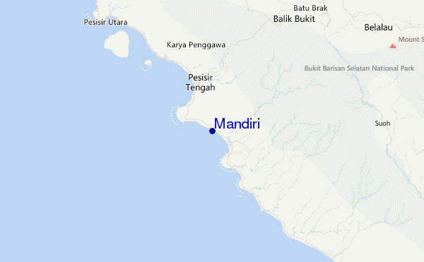
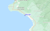
Utilisez cette carte en relief pour naviguer vers les spots de surf de Sumatra - Mainland, et les stations de marées aux alentours de Mandiri
Spots de Surf les plus proches de Mandiri:
(Cliquez sur le nom du spot pour plus de détails)- Closest spot4 mi
- Second closest spot6 mi
- Third closest spot6 mi
- Fourth closest spot8 mi
- Fifth closest spot10 mi
Bouées marines les plus proches de Mandiri:
- Closest Bouées marines2456 mi
- Second closest Bouées marines2525 mi
- Third closest Bouées marines2623 mi
- Fourth closest Bouées marines2695 mi
- Fifth closest Bouées marines2707 mi
Stations de marée les plus proches de Mandiri:
- Closest station de maréeBandar Lampung93 mi
- Second closest station de maréeLabuhan150 mi
- Third closest station de maréeBengkulu154 mi
- Fourth closest station de maréeJakarta201 mi
- Fifth closest station de maréeTanjung Priok208 mi
Airports
- The nearest passenger airport to Mandiri is Padang Kemiling (Bengkulu) Airport (BKS) in Indonesia, which is 238 km (148 miles) away (directly).
- The second closest airport to Mandiri is Sultan Mahmud Badaruddin Ii (Palembang) Airport (PLM), also in Indonesia, 274 km (170 miles) away.
- /breaks/Mandiri/forecasts/latest


 Nearest