
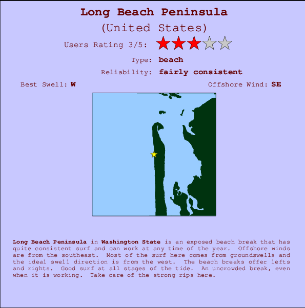
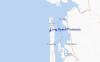
Long Beach Peninsula Surf Guide
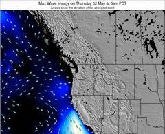
Long Beach Peninsula in Washington is an exposed beach break that has reasonably consistent surf and can work at any time of the year. The best wind direction is from the southeast. Windswells and groundswells in equal measure and the best swell direction is from the west. The beach breaks offer lefts and rights. Good surf at all stages of the tide. The location means that it never gets crowded. Dangerous rips are a hazard of surfing here.
Long Beach Peninsula Spot Info
| Type: | Rating: | Reliability: | Todays Sea Temp*: |
|---|---|---|---|
| fairly consistent | 15.0°C*ocean temperature recorded from satellite |
Surfing Long Beach Peninsula:
The best conditions reported for surf at Long Beach Peninsula occur when a West swell combines with an offshore wind direction from the Southeast.
Énergie de Vague (puissance): 12h


Long Beach Peninsula Surf:
Thursday, 23 July 2026, 14:53 Local time| Jeudi 23 | ||||
| 2PM | 5PM | 8PM | 11PM | |
| Wave (m) | ||||
| Période (s) | 9 | 9 | 9 | 9 |
| Vent (km/h) | ||||
| Etat du vent | cross | cross- on |
on | cross- on |
- /breaks/Long-Beach-Peninsula/forecasts/latest
Long Beach Peninsula Surf Guide
Long Beach Peninsula in Washington is an exposed beach break that has reasonably consistent surf and can work at any time of the year. The best wind direction is from the southeast. Windswells and groundswells in equal measure and the best swell direction is from the west. The beach breaks offer lefts and rights. Good surf at all stages of the tide. The location means that it never gets crowded. Dangerous rips are a hazard of surfing here.
Long Beach Peninsula Spot Info
Type: Rating: Reliability: Todays Sea Temp*:  Beach
Beach 3
3fairly consistent 15.0°C*ocean temperature recorded from satelliteSurfing Long Beach Peninsula:
The best conditions reported for surf at Long Beach Peninsula occur when a West swell combines with an offshore wind direction from the Southeast.
Énergie de Vague (puissance): 12h
Utilisez les onglets ci-dessus pour voir la température de la mer à Long Beach Peninsula, photos pour Long Beach Peninsula, prévisions de houle détaillées pour Long Beach Peninsula, prévisions de vent et météo, webcams pour Long Beach Peninsula, conditions de vents en temps réel à partir des données de la station météo de Washington et prévisions des marées pour Long Beach Peninsula. Les cartes de houle pour United States afficheront une image agrandie de United States et des ses mers environnantes. Ces cartes de houles peuvent êtres animées pour montrer les différents composantes de houle, la hauteur, la période et l'énergie des vagues avec les prévisions météo et prévisions de vent. Des observations en temps réel du temps et de l'état de la mer sont fournies grâce aux bouées marines de United States, des navires de passages, et des stations météo côtières. Toutes les pages de prévisions pour ce spot de surf ont un Vagu-o-Mètre Local et Global pour facilement trouver les meilleurs spot de surf à proximité de Long Beach Peninsula.
Long Beach Peninsula Surf:
Thursday, 23 July 2026, 14:53 Local timeJeudi 23 2PM 5PM 8PM 11PM Wave (m) Période (s) 9 9 9 9 Vent (km/h) Etat du vent cross cross-
onon cross-
on- /breaks/Long-Beach-Peninsula/forecasts/latest
- /breaks/Long-Beach-Peninsula/forecasts/latest/six_day
Long Beach Peninsula Surf Guide
Long Beach Peninsula in Washington is an exposed beach break that has reasonably consistent surf and can work at any time of the year. The best wind direction is from the southeast. Windswells and groundswells in equal measure and the best swell direction is from the west. The beach breaks offer lefts and rights. Good surf at all stages of the tide. The location means that it never gets crowded. Dangerous rips are a hazard of surfing here.
Long Beach Peninsula Spot Info
Type: Rating: Reliability: Todays Sea Temp*: Beach3fairly consistent 15.0°C*ocean temperature recorded from satelliteSurfing Long Beach Peninsula:
The best conditions reported for surf at Long Beach Peninsula occur when a West swell combines with an offshore wind direction from the Southeast.
Énergie de Vague (puissance): 12h
Utilisez les onglets ci-dessus pour voir la température de la mer à Long Beach Peninsula, photos pour Long Beach Peninsula, prévisions de houle détaillées pour Long Beach Peninsula, prévisions de vent et météo, webcams pour Long Beach Peninsula, conditions de vents en temps réel à partir des données de la station météo de Washington et prévisions des marées pour Long Beach Peninsula. Les cartes de houle pour United States afficheront une image agrandie de United States et des ses mers environnantes. Ces cartes de houles peuvent êtres animées pour montrer les différents composantes de houle, la hauteur, la période et l'énergie des vagues avec les prévisions météo et prévisions de vent. Des observations en temps réel du temps et de l'état de la mer sont fournies grâce aux bouées marines de United States, des navires de passages, et des stations météo côtières. Toutes les pages de prévisions pour ce spot de surf ont un Vagu-o-Mètre Local et Global pour facilement trouver les meilleurs spot de surf à proximité de Long Beach Peninsula.
Long Beach Peninsula Surf:
Thursday, 23 July 2026, 14:53 Local timeJeudi 23 2PM 5PM 8PM 11PM Wave (m) Période (s) 9 9 9 9 Vent (km/h) Etat du vent cross cross-
onon cross-
on- /breaks/Long-Beach-Peninsula/forecasts/latest
Long Beach Peninsula Surf Guide
Long Beach Peninsula in Washington is an exposed beach break that has reasonably consistent surf and can work at any time of the year. The best wind direction is from the southeast. Windswells and groundswells in equal measure and the best swell direction is from the west. The beach breaks offer lefts and rights. Good surf at all stages of the tide. The location means that it never gets crowded. Dangerous rips are a hazard of surfing here.
Long Beach Peninsula Spot Info
Type: Rating: Reliability: Todays Sea Temp*: Beach3fairly consistent 15.0°C*ocean temperature recorded from satelliteSurfing Long Beach Peninsula:
The best conditions reported for surf at Long Beach Peninsula occur when a West swell combines with an offshore wind direction from the Southeast.
Énergie de Vague (puissance): 12h
Utilisez les onglets ci-dessus pour voir la température de la mer à Long Beach Peninsula, photos pour Long Beach Peninsula, prévisions de houle détaillées pour Long Beach Peninsula, prévisions de vent et météo, webcams pour Long Beach Peninsula, conditions de vents en temps réel à partir des données de la station météo de Washington et prévisions des marées pour Long Beach Peninsula. Les cartes de houle pour United States afficheront une image agrandie de United States et des ses mers environnantes. Ces cartes de houles peuvent êtres animées pour montrer les différents composantes de houle, la hauteur, la période et l'énergie des vagues avec les prévisions météo et prévisions de vent. Des observations en temps réel du temps et de l'état de la mer sont fournies grâce aux bouées marines de United States, des navires de passages, et des stations météo côtières. Toutes les pages de prévisions pour ce spot de surf ont un Vagu-o-Mètre Local et Global pour facilement trouver les meilleurs spot de surf à proximité de Long Beach Peninsula.
Long Beach Peninsula Surf:
Thursday, 23 July 2026, 14:53 Local timeJeudi 23 2PM 5PM 8PM 11PM Wave (m) Période (s) 9 9 9 9 Vent (km/h) Etat du vent cross cross-
onon cross-
onTide Times:
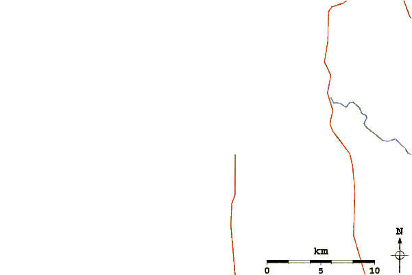
Pour Nahcotta, Willipa Bay, Washington, %{dist} %{km} de %{location}.
PROCHAIN EST A (heure locale) il reste marée haute marée basse Long Beach Peninsula Tide Times and Tide Chart
Live Weather:
At BUOY-TOKW1, 18 km from Long Beach Peninsula.
light winds from the WSW
(km/h)Air temperature
17.5°CCurrent weather near Long Beach Peninsula
Buoy Data:
At Grays Harbor, WA , 22 miles from Long Beach Peninsula.
9AM 10AM 11AM 12PM Age des données 4 hr 3 hr 2 hr 1 hr hauteur de la vague (m) 


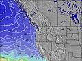
Période Dominante (s) 10 10 10 9 Overall Long Beach Peninsula Surf Consistency and Wind Distribution in Juillet


Wind stats for Long Beach Peninsula: see the variation in direction and stength by month.
Photos de Surf
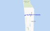
de la galerieContours: Routes et Rivières: Sélectionnez un spot de surf du menu 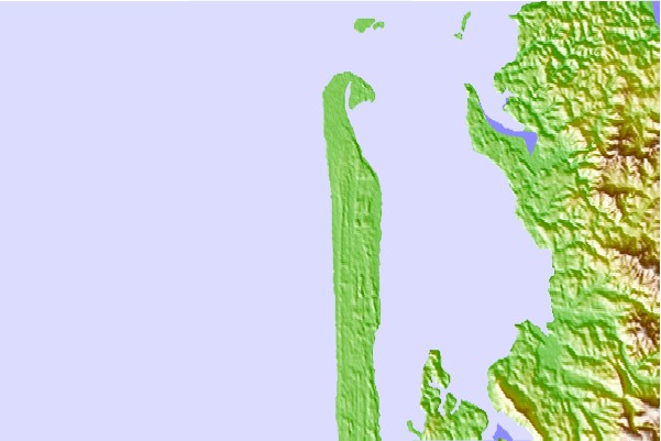
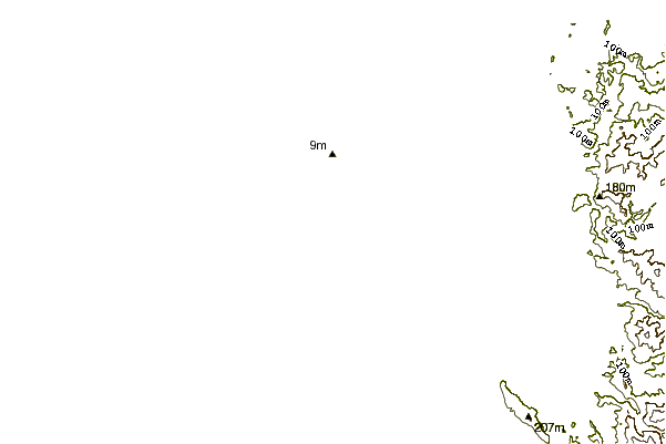
Utilisez cette carte en relief pour naviguer vers les spots de surf de Washington, et les stations de marées aux alentours de Long Beach Peninsula
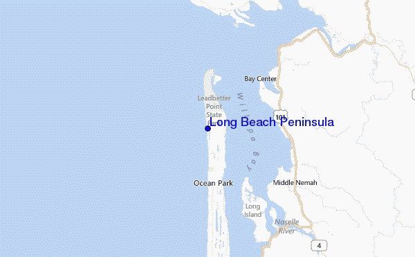
Spots de Surf les plus proches de Long Beach Peninsula:
(Cliquez sur le nom du spot pour plus de détails)- Closest spot5 mi
- Second closest spot20 mi
- Third closest spot21 mi
- Fourth closest spot21 mi
- Fifth closest spot24 mi
Bouées marines les plus proches de Long Beach Peninsula:
- Closest Bouées marines22 mi
- Second closest Bouées marines24 mi
- Third closest Bouées marines36 mi
- Fourth closest Bouées marines41 mi
- Fifth closest Bouées marines63 mi
Stations de marée les plus proches de Long Beach Peninsula:
- Closest station de maréeNahcotta, Willipa Bay5 mi
- Second closest station de maréeBay Center, Palix River, Willapa Bay7 mi
- Third closest station de maréePalix River, south fork, Willapa Bay7 mi
- Fourth closest station de maréeParadise Point, Long Island, Willapa Bay9 mi
- Fifth closest station de maréeToke Point, Willapa Bay11 mi
Airports
- The closest passenger airport to Long Beach Peninsula is Gray Aaf (Fort Lewis) Airport (GRF) in USA, 126 km (78 miles) away (directly).
- The second nearest airport to Long Beach Peninsula is Scappoose Industrial Airpark (San Luis) Airport (SPB), also in USA, 128 km (80 miles) away.
- Third is Mc Chord Afb (Tacoma) Airport (TCM) in USA, 136 km (84 miles) away.
- Portland International Airport (PDX) in USA is 157 km (98 miles) away.
- Seattle Tacoma International Airport (SEA), also in USA is the fifth nearest airport to Long Beach Peninsula and is 165 km (102 miles) away.
- /breaks/Long-Beach-Peninsula/forecasts/latest

 Nearest