
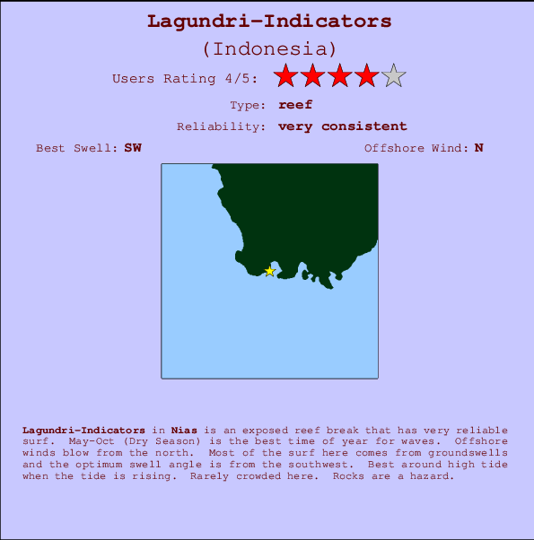
Lagundri-Indicators Surf Guide
Lagundri-Indicators in Nias, Hinako Islands is an exposed reef break that is usually a safe bet. May-Oct (Dry Season) is the optimum time of year for waves. The best wind direction is from the north. Tends to receive distant groundswells and the best swell direction is from the southwest. There is a right breaking reef. Best around high tide when the tide is rising. Unlikely to be too crowded, even when the surf is up. Take care of rocks in the line up.
Lagundri-Indicators Spot Info
| Type: | Rating: | Reliability: | Todays Sea Temp*: |
|---|---|---|---|
| very consistent | 30.1°C*ocean temperature recorded from satellite |
Surfing Lagundri-Indicators:
The best conditions reported for surf at Lagundri-Indicators occur when a Southwest swell combines with an offshore wind direction from the North.

Énergie de Vague (puissance): 12h


Lagundri-Indicators Surf:
Saturday, 18 July 2026, 04:59 Local time| Samedi 18 | ||||
| 4AM | 7AM | 10AM | 1PM | |
| Wave (m) | ||||
| Période (s) | 14 | 14 | 14 | 14 |
| Vent (km/h) | ||||
| Etat du vent | cross- off |
cross- off |
off | off |
- /breaks/Lagundri-Indicators/forecasts/latest
Lagundri-Indicators Surf Guide
Lagundri-Indicators in Nias, Hinako Islands is an exposed reef break that is usually a safe bet. May-Oct (Dry Season) is the optimum time of year for waves. The best wind direction is from the north. Tends to receive distant groundswells and the best swell direction is from the southwest. There is a right breaking reef. Best around high tide when the tide is rising. Unlikely to be too crowded, even when the surf is up. Take care of rocks in the line up.
Lagundri-Indicators Spot Info
Type: Rating: Reliability: Todays Sea Temp*:  Reef
Reef 4
4very consistent 30.1°C*ocean temperature recorded from satelliteSurfing Lagundri-Indicators:
The best conditions reported for surf at Lagundri-Indicators occur when a Southwest swell combines with an offshore wind direction from the North.
Énergie de Vague (puissance): 12h
Utilisez les onglets ci-dessus pour voir la température de la mer à Lagundri-Indicators, photos pour Lagundri-Indicators, prévisions de houle détaillées pour Lagundri-Indicators, prévisions de vent et météo, webcams pour Lagundri-Indicators, conditions de vents en temps réel à partir des données de la station météo de Nias et prévisions des marées pour Lagundri-Indicators. Les cartes de houle pour Indonesia afficheront une image agrandie de Indonesia et des ses mers environnantes. Ces cartes de houles peuvent êtres animées pour montrer les différents composantes de houle, la hauteur, la période et l'énergie des vagues avec les prévisions météo et prévisions de vent. Des observations en temps réel du temps et de l'état de la mer sont fournies grâce aux bouées marines de Indonesia, des navires de passages, et des stations météo côtières. Toutes les pages de prévisions pour ce spot de surf ont un Vagu-o-Mètre Local et Global pour facilement trouver les meilleurs spot de surf à proximité de Lagundri-Indicators.
Lagundri-Indicators Surf:
Saturday, 18 July 2026, 04:59 Local timeSamedi 18 4AM 7AM 10AM 1PM Wave (m) Période (s) 14 14 14 14 Vent (km/h) Etat du vent cross-
offcross-
offoff off - /breaks/Lagundri-Indicators/forecasts/latest
- /breaks/Lagundri-Indicators/forecasts/latest/six_day
Lagundri-Indicators Surf Guide
Lagundri-Indicators in Nias, Hinako Islands is an exposed reef break that is usually a safe bet. May-Oct (Dry Season) is the optimum time of year for waves. The best wind direction is from the north. Tends to receive distant groundswells and the best swell direction is from the southwest. There is a right breaking reef. Best around high tide when the tide is rising. Unlikely to be too crowded, even when the surf is up. Take care of rocks in the line up.
Lagundri-Indicators Spot Info
Type: Rating: Reliability: Todays Sea Temp*: Reef4very consistent 30.1°C*ocean temperature recorded from satelliteSurfing Lagundri-Indicators:
The best conditions reported for surf at Lagundri-Indicators occur when a Southwest swell combines with an offshore wind direction from the North.
Énergie de Vague (puissance): 12h
Utilisez les onglets ci-dessus pour voir la température de la mer à Lagundri-Indicators, photos pour Lagundri-Indicators, prévisions de houle détaillées pour Lagundri-Indicators, prévisions de vent et météo, webcams pour Lagundri-Indicators, conditions de vents en temps réel à partir des données de la station météo de Nias et prévisions des marées pour Lagundri-Indicators. Les cartes de houle pour Indonesia afficheront une image agrandie de Indonesia et des ses mers environnantes. Ces cartes de houles peuvent êtres animées pour montrer les différents composantes de houle, la hauteur, la période et l'énergie des vagues avec les prévisions météo et prévisions de vent. Des observations en temps réel du temps et de l'état de la mer sont fournies grâce aux bouées marines de Indonesia, des navires de passages, et des stations météo côtières. Toutes les pages de prévisions pour ce spot de surf ont un Vagu-o-Mètre Local et Global pour facilement trouver les meilleurs spot de surf à proximité de Lagundri-Indicators.
Lagundri-Indicators Surf:
Saturday, 18 July 2026, 04:59 Local timeSamedi 18 4AM 7AM 10AM 1PM Wave (m) Période (s) 14 14 14 14 Vent (km/h) Etat du vent cross-
offcross-
offoff off - /breaks/Lagundri-Indicators/forecasts/latest
Lagundri-Indicators Surf Guide
Lagundri-Indicators in Nias, Hinako Islands is an exposed reef break that is usually a safe bet. May-Oct (Dry Season) is the optimum time of year for waves. The best wind direction is from the north. Tends to receive distant groundswells and the best swell direction is from the southwest. There is a right breaking reef. Best around high tide when the tide is rising. Unlikely to be too crowded, even when the surf is up. Take care of rocks in the line up.
Lagundri-Indicators Spot Info
Type: Rating: Reliability: Todays Sea Temp*: Reef4very consistent 30.1°C*ocean temperature recorded from satelliteSurfing Lagundri-Indicators:
The best conditions reported for surf at Lagundri-Indicators occur when a Southwest swell combines with an offshore wind direction from the North.
Énergie de Vague (puissance): 12h
Utilisez les onglets ci-dessus pour voir la température de la mer à Lagundri-Indicators, photos pour Lagundri-Indicators, prévisions de houle détaillées pour Lagundri-Indicators, prévisions de vent et météo, webcams pour Lagundri-Indicators, conditions de vents en temps réel à partir des données de la station météo de Nias et prévisions des marées pour Lagundri-Indicators. Les cartes de houle pour Indonesia afficheront une image agrandie de Indonesia et des ses mers environnantes. Ces cartes de houles peuvent êtres animées pour montrer les différents composantes de houle, la hauteur, la période et l'énergie des vagues avec les prévisions météo et prévisions de vent. Des observations en temps réel du temps et de l'état de la mer sont fournies grâce aux bouées marines de Indonesia, des navires de passages, et des stations météo côtières. Toutes les pages de prévisions pour ce spot de surf ont un Vagu-o-Mètre Local et Global pour facilement trouver les meilleurs spot de surf à proximité de Lagundri-Indicators.
Lagundri-Indicators Surf:
Saturday, 18 July 2026, 04:59 Local timeSamedi 18 4AM 7AM 10AM 1PM Wave (m) Période (s) 14 14 14 14 Vent (km/h) Etat du vent cross-
offcross-
offoff off Tide Times:
À Lagundri-Indicators (0 km).
PROCHAIN EST A (heure locale) il reste marée haute marée basse Lagundri-Indicators Tide Times and Tide Chart
Live Weather:
At Minangkabau Airport, 323 km from Lagundri-Indicators.
calm
(km/h)Air temperature
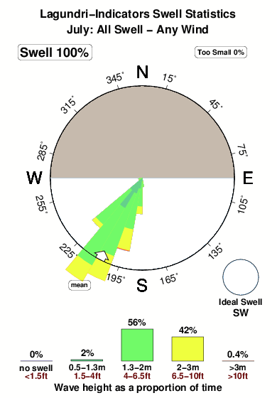
25°COverall Lagundri-Indicators Surf Consistency and Wind Distribution in Juillet
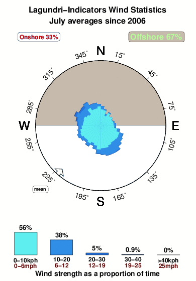


Wind stats for Lagundri-Indicators: see the variation in direction and stength by month.
Photos de Surf
de la galerieContours: Routes et Rivières: Sélectionnez un spot de surf du menu 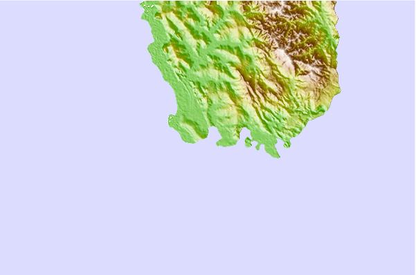
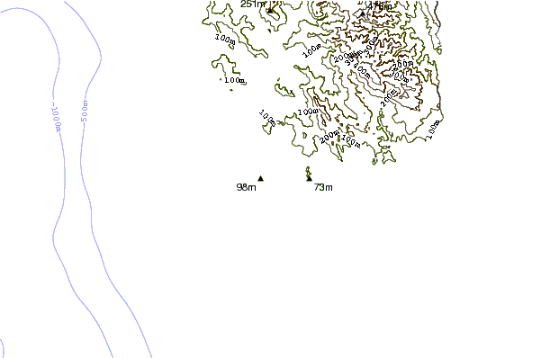
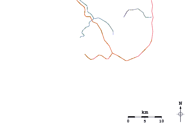
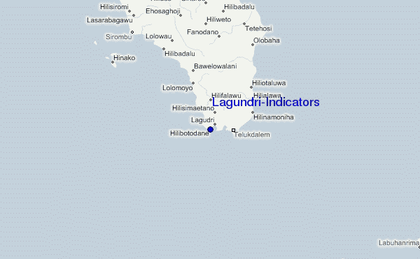
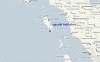
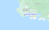
Utilisez cette carte en relief pour naviguer vers les spots de surf de Nias, et les stations de marées aux alentours de Lagundri-Indicators
Spots de Surf les plus proches de Lagundri-Indicators:
(Cliquez sur le nom du spot pour plus de détails)- Closest spot1 mi
- Second closest spot1 mi
- Third closest spot7 mi
- Fourth closest spot9 mi
- Fifth closest spot12 mi
Bouées marines les plus proches de Lagundri-Indicators:
- Closest Bouées marines2414 mi
- Second closest Bouées marines2491 mi
- Third closest Bouées marines2669 mi
- Fourth closest Bouées marines2684 mi
- Fifth closest Bouées marines2853 mi
Stations de marée les plus proches de Lagundri-Indicators:
- Closest station de maréeSibolga109 mi
- Second closest station de maréeSinabang161 mi
- Third closest station de maréePariaman185 mi
- Fourth closest station de maréeTeluk Nibung222 mi
- Fifth closest station de maréeBelawan236 mi
Airports
- The nearest passenger airport to Lagundri-Indicators is Binaka (Gunung Sitoli) Airport (GNS) in Indonesia, which is 66 km (41 miles) away (directly).
- The second closest airport to Lagundri-Indicators is Tabing (Padang) Airport (PDG), also in Indonesia, 334 km (207 miles) away.
- /breaks/Lagundri-Indicators/forecasts/latest
 Nearest