
Prévisions:

Prévision court termeGénéralement sec. Very mild (max 19°C le Mar après-midi, min 10°C le Mar soir). Le vent sera généralement léger. | ||||||||||||||||||||||||
Mar 14 | Mercredi 15 | Jeudi 16 | Ven 17 | |||||||||||||||||||||
1 PM | 4 PM | 7 PM | 10 PM | 1 AM | 4 AM | 7 AM | 10 AM | 1 PM | 4 PM | 7 PM | 10 PM | 1 AM | 4 AM | 7 AM | 10 AM | 1 PM | 4 PM | 7 PM | 10 PM | 1 AM | 4 AM | 7 AM | 10 AM | |
Carte Hauteur de Houle |  |  |  |  |  |  |  |  |  | 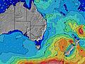 | ||||||||||||||
Houle Hauteur (m) Direction Période (s) | S 10 | S 10 | S 10 | S 10 | S 10 | S 6 | S 8 | SSW 8 | S 7 | S 7 | S 7 | SSW 7 | S 8 | SSW 8 | S 8 | S 8 | S 8 | S 6 | S 6 | SSE 6 | S 8 | S 8 | S 8 | S 8 |
Graphique Vague | ||||||||||||||||||||||||
8 | 8 | 18 | 31 | 31 | 137 | 471 | 345 | 81 | 155 | 188 | 277 | 309 | 229 | 187 | 164 | 20 | 49 | 92 | 33 | 130 | 97 | 42 | 44 | |
Vent (km/h) | ||||||||||||||||||||||||
Etat du vent Vent de Mer Vent de Mer-Latéral Latéral Vent de Terre-Latéral Vent de Terre Mer d'Huile | cross-off | off | off | off | off | cross-off | off | off | cross-on | cross-on | cross-off | cross-off | off | off | off | off | cross-off | cross | cross-off | cross-off | cross-off | off | off | glassy |
Marée haute | 8:04PM1.77m | 9:02AM1.15m | 8:56PM1.76m | 9:52AM1.17m | 9:46PM1.70m | |||||||||||||||||||
Marée basse | 2:59AM-0.05m | 2:27PM0.29m | 3:48AM-0.05m | 3:20PM0.29m | 4:34AM-0.01m | |||||||||||||||||||
— | — | — | — | — | — | 7:07 | — | — | — | — | — | — | — | 7:07 | — | — | — | — | — | — | — | 7:07 | — | |
— | 5:01 | — | — | — | — | — | — | — | 5:01 | — | — | — | — | — | — | — | 5:02 | — | — | — | — | — | 5:02 | |
mm | — | — | — | — | — | — | — | — | — | — | — | — | — | — | — | — | — | — | — | — | — | — | — | — |
Temp. °C | 20 | 19 | 15 | 13 | 11 | 10 | 10 | 11 | 14 | 13 | 13 | 12 | 12 | 12 | 13 | 14 | 16 | 16 | 15 | 13 | 12 | 11 | 11 | 12 |
Refroid. °C | 15 | 14 | 11 | 9 | 6 | 5 | 6 | 8 | 11 | 10 | 10 | 9 | 8 | 8 | 10 | 11 | 12 | 13 | 13 | 11 | 10 | 9 | 9 | 11 |
Houle 1 Hauteur (m) Direction Période (s) | S 10 | S 7 | S 10 | S 5 | S 10 | S 10 | S 6 | S 7 | S 7 | SSE 7 | SSE 7 | S 6 | SSE 6 | S 8 | S 8 | S 6 | S 8 | SE 15 | SSE 6 | SSE 6 | SSE 8 | SSE 8 | S 8 | S 8 |
8 | 4 | 18 | 22 | 31 | 49 | 116 | 103 | 81 | 65 | 77 | 97 | 62 | 88 | 82 | 30 | 20 | 9 | 37 | 33 | 65 | 62 | 42 | 44 | |
Houle 2 Hauteur (m) Direction Période (s) | S 15 | S 10 | — | S 10 | E 10 | — | S 11 | E 10 | E 10 | E 12 | E 12 | E 11 | S 8 | S 15 | S 15 | S 8 | SE 15 | E 11 | S 10 | SE 15 | SE 15 | S 11 | S 11 | S 11 |
5 | 8 | — | 31 | 2 | — | 21 | 2 | 2 | 3 | 3 | 2 | 35 | 4 | 4 | 21 | 9 | 2 | 8 | 9 | 9 | 9 | 10 | 9 | |
Houle 3 Hauteur (m) Direction Période (s) | — | S 15 | — | — | — | — | E 10 | S 15 | S 15 | S 15 | — | — | E 11 | E 11 | E 11 | SE 14 | E 11 | S 15 | SE 15 | E 11 | E 11 | SE 15 | S 15 | S 15 |
— | 4 | — | — | — | — | 2 | 5 | 4 | 4 | — | — | 2 | 2 | 2 | 8 | 2 | 4 | 9 | 2 | 2 | 9 | 4 | 4 | |
Vagues de vent Hauteur (m) Direction Période (s) | NW 4 | NW 3 | S 7 | SSW 5 | S 6 | S 6 | S 8 | SSW 8 | — | S 7 | S 7 | SSW 7 | S 8 | SSW 8 | S 8 | S 8 | S 6 | S 6 | S 6 | S 6 | S 8 | S 8 | — | — |
2 | 2 | 16 | 66 | 48 | 137 | 471 | 345 | — | 155 | 188 | 277 | 309 | 229 | 187 | 164 | 26 | 49 | 92 | 69 | 130 | 97 | — | — | |
Vent de Terre ou Glassy les Plus Proches | ||||||||||||||||||||||||
Distance (km) | 108 | 59 | 108 | 0 | 38 | 12 | 0 | 0 | 81 | 81 | 0 | 0 | 0 | 0 | 0 | 0 | 12 | 81 | 0 | 0 | 0 | 0 | 0 | 0 |
Meilleures Vagues Prévues à Far South New South Wales | ||||||||||||||||||||||||
Meilleures Vagues Prévues à Australia | ||||||||||||||||||||||||
Vagu-o-Mètre Mondial | ||||||||||||||||||||||||
- Map Icons:
 Break
Break Live Wave Height (m)
 Live Wind Speed (km/h)
 Surf Rating (10 Max)
 Ocean Swells (m)
- Wind Speed (km/h)
GRATUIT ! Un widget Surf-Forecast.com pour votre site web
Ce widget gratuit de surf report et prévision météo est disponible pour intégrer dans vos sites web et vous donne un résumé de nos prévisions de surf pour Kianga Point. Il vous suffit de copier le code HTML et de le coller dans votre site. Vous pouvez choisir votre langue préférée ainsi que les unités de mesures (métrique ou impériale) pour les prévisions pour adapter aux utilisateurs de votre site. Cliquez ici pour obtenir le code.
 Nearest