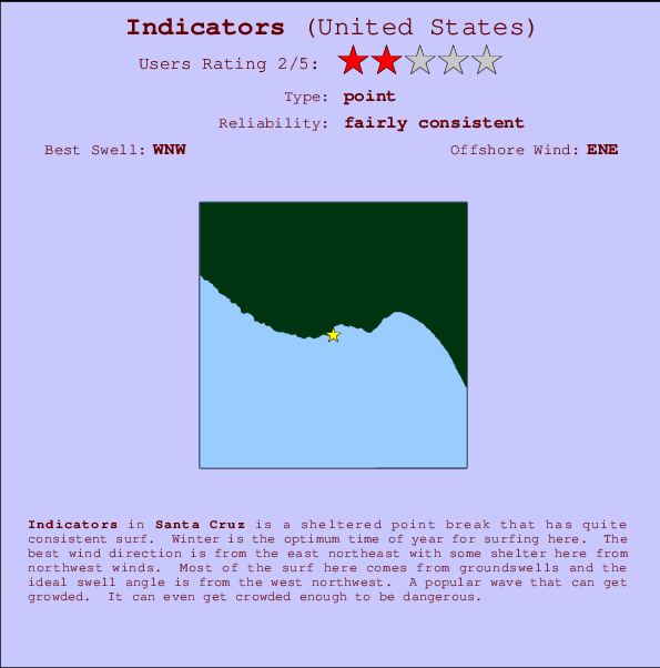
Indicators Surf Guide
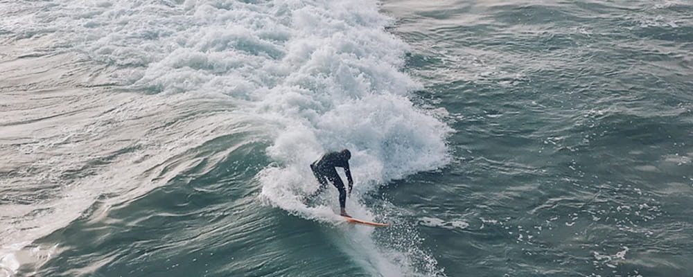
Indicators in Santa Cruz is a sheltered point break that has reasonably consistent surf. Winter is the optimum time of year for surfing here. The best wind direction is from the east northeast with some shelter here from northwest winds. Groundswells more frequent than windswells and the optimum swell angle is from the west northwest. Often Crowded. Overcrowding can even make surfing hazardous.
Indicators Spot Info
| Type: | Rating: | Reliability: | Todays Sea Temp*: |
|---|---|---|---|
| fairly consistent | 16.1°C*ocean temperature recorded from satellite |
Surfing Indicators:
The best conditions reported for surf at Indicators occur when a West-northwest swell combines with an offshore wind direction from the East-northeast.

Énergie de Vague (puissance): 12h


Indicators Surf:
Friday, 17 July 2026, 03:55 Local time| Vendredi 17 | ||||
| 2AM | 5AM | 8AM | 11AM | |
| Wave (m) | ||||
| Période (s) | 8 | 8 | 8 | 8 |
| Vent (km/h) | ||||
| Etat du vent | glass | glass | glass | on |
- /breaks/Indicators/forecasts/latest
Indicators Surf Guide
Indicators in Santa Cruz is a sheltered point break that has reasonably consistent surf. Winter is the optimum time of year for surfing here. The best wind direction is from the east northeast with some shelter here from northwest winds. Groundswells more frequent than windswells and the optimum swell angle is from the west northwest. Often Crowded. Overcrowding can even make surfing hazardous.
Indicators Spot Info
Type: Rating: Reliability: Todays Sea Temp*:  Point
Point 2
2fairly consistent 16.1°C*ocean temperature recorded from satelliteSurfing Indicators:
The best conditions reported for surf at Indicators occur when a West-northwest swell combines with an offshore wind direction from the East-northeast.
Énergie de Vague (puissance): 12h
Utilisez les onglets ci-dessus pour voir la température de la mer à Indicators, photos pour Indicators, prévisions de houle détaillées pour Indicators, prévisions de vent et météo, webcams pour Indicators, conditions de vents en temps réel à partir des données de la station météo de CAL - Santa Cruz et prévisions des marées pour Indicators. Les cartes de houle pour United States afficheront une image agrandie de United States et des ses mers environnantes. Ces cartes de houles peuvent êtres animées pour montrer les différents composantes de houle, la hauteur, la période et l'énergie des vagues avec les prévisions météo et prévisions de vent. Des observations en temps réel du temps et de l'état de la mer sont fournies grâce aux bouées marines de United States, des navires de passages, et des stations météo côtières. Toutes les pages de prévisions pour ce spot de surf ont un Vagu-o-Mètre Local et Global pour facilement trouver les meilleurs spot de surf à proximité de Indicators.
Indicators Surf:
Friday, 17 July 2026, 03:55 Local timeVendredi 17 2AM 5AM 8AM 11AM Wave (m) Période (s) 8 8 8 8 Vent (km/h) Etat du vent glass glass glass on - /breaks/Indicators/forecasts/latest
- /breaks/Indicators/forecasts/latest/six_day
Indicators Surf Guide
Indicators in Santa Cruz is a sheltered point break that has reasonably consistent surf. Winter is the optimum time of year for surfing here. The best wind direction is from the east northeast with some shelter here from northwest winds. Groundswells more frequent than windswells and the optimum swell angle is from the west northwest. Often Crowded. Overcrowding can even make surfing hazardous.
Indicators Spot Info
Type: Rating: Reliability: Todays Sea Temp*: Point2fairly consistent 16.1°C*ocean temperature recorded from satelliteSurfing Indicators:
The best conditions reported for surf at Indicators occur when a West-northwest swell combines with an offshore wind direction from the East-northeast.
Énergie de Vague (puissance): 12h
Utilisez les onglets ci-dessus pour voir la température de la mer à Indicators, photos pour Indicators, prévisions de houle détaillées pour Indicators, prévisions de vent et météo, webcams pour Indicators, conditions de vents en temps réel à partir des données de la station météo de CAL - Santa Cruz et prévisions des marées pour Indicators. Les cartes de houle pour United States afficheront une image agrandie de United States et des ses mers environnantes. Ces cartes de houles peuvent êtres animées pour montrer les différents composantes de houle, la hauteur, la période et l'énergie des vagues avec les prévisions météo et prévisions de vent. Des observations en temps réel du temps et de l'état de la mer sont fournies grâce aux bouées marines de United States, des navires de passages, et des stations météo côtières. Toutes les pages de prévisions pour ce spot de surf ont un Vagu-o-Mètre Local et Global pour facilement trouver les meilleurs spot de surf à proximité de Indicators.
Indicators Surf:
Friday, 17 July 2026, 03:55 Local timeVendredi 17 2AM 5AM 8AM 11AM Wave (m) Période (s) 8 8 8 8 Vent (km/h) Etat du vent glass glass glass on - /breaks/Indicators/forecasts/latest
Indicators Surf Guide
Indicators in Santa Cruz is a sheltered point break that has reasonably consistent surf. Winter is the optimum time of year for surfing here. The best wind direction is from the east northeast with some shelter here from northwest winds. Groundswells more frequent than windswells and the optimum swell angle is from the west northwest. Often Crowded. Overcrowding can even make surfing hazardous.
Indicators Spot Info
Type: Rating: Reliability: Todays Sea Temp*: Point2fairly consistent 16.1°C*ocean temperature recorded from satelliteSurfing Indicators:
The best conditions reported for surf at Indicators occur when a West-northwest swell combines with an offshore wind direction from the East-northeast.
Énergie de Vague (puissance): 12h
Utilisez les onglets ci-dessus pour voir la température de la mer à Indicators, photos pour Indicators, prévisions de houle détaillées pour Indicators, prévisions de vent et météo, webcams pour Indicators, conditions de vents en temps réel à partir des données de la station météo de CAL - Santa Cruz et prévisions des marées pour Indicators. Les cartes de houle pour United States afficheront une image agrandie de United States et des ses mers environnantes. Ces cartes de houles peuvent êtres animées pour montrer les différents composantes de houle, la hauteur, la période et l'énergie des vagues avec les prévisions météo et prévisions de vent. Des observations en temps réel du temps et de l'état de la mer sont fournies grâce aux bouées marines de United States, des navires de passages, et des stations météo côtières. Toutes les pages de prévisions pour ce spot de surf ont un Vagu-o-Mètre Local et Global pour facilement trouver les meilleurs spot de surf à proximité de Indicators.
Indicators Surf:
Friday, 17 July 2026, 03:55 Local timeVendredi 17 2AM 5AM 8AM 11AM Wave (m) Période (s) 8 8 8 8 Vent (km/h) Etat du vent glass glass glass on Tide Times:
Pour Santa Cruz, California, %{dist} %{km} de %{location}.
PROCHAIN EST A (heure locale) il reste marée haute marée basse Indicators Tide Times and Tide Chart
Live Weather:
At Santa Cruz, 2 km from Indicators.
calm
(km/h)
dryAir temperature
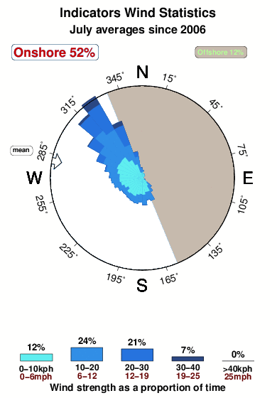
12°COverall Indicators Surf Consistency and Wind Distribution in Juillet
Photos de Surf
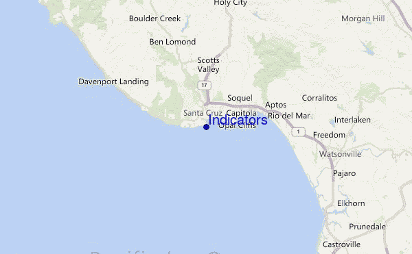
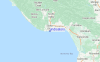
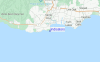
de la galerieContours: Routes et Rivières: Sélectionnez un spot de surf du menu 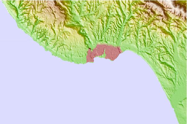
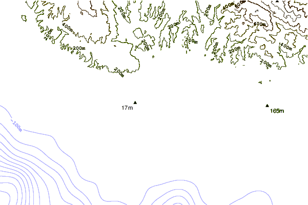
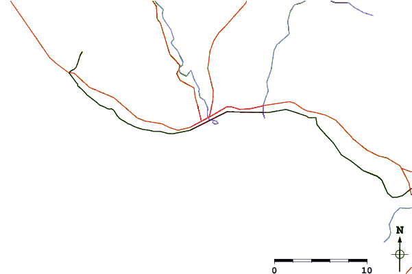
Utilisez cette carte en relief pour naviguer vers les spots de surf de CAL - Santa Cruz, et les stations de marées aux alentours de Indicators
Spots de Surf les plus proches de Indicators:
(Cliquez sur le nom du spot pour plus de détails)- Closest spot0 mi
- Second closest spot0 mi
- Third closest spot0 mi
- Fourth closest spot1 mi
- Fifth closest spot1 mi
Bouées marines les plus proches de Indicators:
- Closest Bouées marines23 mi
- Second closest Bouées marines24 mi
- Third closest Bouées marines24 mi
- Fourth closest Bouées marines42 mi
- Fifth closest Bouées marines55 mi
Stations de marée les plus proches de Indicators:
- Closest station de maréeSanta Cruz1 mi
- Second closest station de maréeLive Oak3 mi
- Third closest station de maréeRio Del Mar7 mi
- Fourth closest station de maréeAptos7 mi
- Fifth closest station de maréeElkhorn Slough railroad bridge16 mi
Airports
- The closest passenger airport to Indicators is Norman Y Mineta San Jose International Airport (SJC) in USA, 46 km (29 miles) away (directly).
- The second nearest airport to Indicators is Moffett Federal Afld (Mountain View) Airport (NUQ), also in USA, 52 km (32 miles) away.
- Third is San Francisco International Airport (SFO) in USA, 80 km (50 miles) away.
- Metropolitan Oakland International Airport (OAK) in USA is 87 km (54 miles) away.
- Modesto City Co Harry Sham Airport (MOD), also in USA is the fifth nearest airport to Indicators and is 121 km (75 miles) away.
- /breaks/Indicators/forecasts/latest


 Nearest