

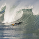
Imperial Pier (North and South) Surf Guide
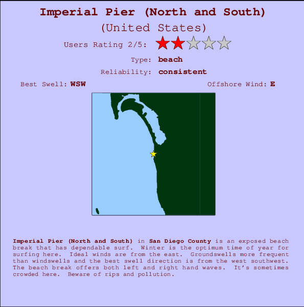
Imperial Pier (North and South) in San Diego County is an exposed beach break that has consistent surf. Winter is the best time of year for surfing here. Offshore winds blow from the east. Tends to receive distant groundswells and the best swell direction is from the west southwest. The beach breaks offer lefts and rights. Sometimes crowded. Beware of rips and pollution.
Imperial Pier (North and South) Spot Info
| Type: | Rating: | Reliability: | Todays Sea Temp*: |
|---|---|---|---|
| consistent | 22.2°C*ocean temperature recorded from satellite |
Surfing Imperial Pier (North and South):
The best conditions reported for surf at Imperial Pier (North and South) occur when a West-southwest swell combines with an offshore wind direction from the East.

Énergie de Vague (puissance): 12h


Imperial Pier (North and South) Surf:
Monday, 27 July 2026, 23:48 Local time| Lun | Mar | |||
| 8PM | 11PM | 2AM | 5AM | |
| Wave (m) | ||||
| Période (s) | 16 | 17 | 17 | 17 |
| Vent (km/h) | ||||
| Etat du vent | cross- on |
cross- on |
glass | on |
- /breaks/Imperial-Pier/forecasts/latest
Imperial Pier (North and South) Surf Guide
Imperial Pier (North and South) in San Diego County is an exposed beach break that has consistent surf. Winter is the best time of year for surfing here. Offshore winds blow from the east. Tends to receive distant groundswells and the best swell direction is from the west southwest. The beach breaks offer lefts and rights. Sometimes crowded. Beware of rips and pollution.
Imperial Pier (North and South) Spot Info
Type: Rating: Reliability: Todays Sea Temp*:  Beach
Beach 2
2consistent 22.2°C*ocean temperature recorded from satelliteSurfing Imperial Pier (North and South):
The best conditions reported for surf at Imperial Pier (North and South) occur when a West-southwest swell combines with an offshore wind direction from the East.
Énergie de Vague (puissance): 12h
Utilisez les onglets ci-dessus pour voir la température de la mer à Imperial Pier (North and South), photos pour Imperial Pier (North and South), prévisions de houle détaillées pour Imperial Pier (North and South), prévisions de vent et météo, webcams pour Imperial Pier (North and South), conditions de vents en temps réel à partir des données de la station météo de CAL - San Diego County et prévisions des marées pour Imperial Pier (North and South). Les cartes de houle pour United States afficheront une image agrandie de United States et des ses mers environnantes. Ces cartes de houles peuvent êtres animées pour montrer les différents composantes de houle, la hauteur, la période et l'énergie des vagues avec les prévisions météo et prévisions de vent. Des observations en temps réel du temps et de l'état de la mer sont fournies grâce aux bouées marines de United States, des navires de passages, et des stations météo côtières. Toutes les pages de prévisions pour ce spot de surf ont un Vagu-o-Mètre Local et Global pour facilement trouver les meilleurs spot de surf à proximité de Imperial Pier (North and South).
Imperial Pier (North and South) Surf:
Monday, 27 July 2026, 23:48 Local timeLun Mar 8PM 11PM 2AM 5AM Wave (m) Période (s) 16 17 17 17 Vent (km/h) Etat du vent cross-
oncross-
onglass on - /breaks/Imperial-Pier/forecasts/latest
- /breaks/Imperial-Pier/forecasts/latest/six_day
Imperial Pier (North and South) Surf Guide
Imperial Pier (North and South) in San Diego County is an exposed beach break that has consistent surf. Winter is the best time of year for surfing here. Offshore winds blow from the east. Tends to receive distant groundswells and the best swell direction is from the west southwest. The beach breaks offer lefts and rights. Sometimes crowded. Beware of rips and pollution.
Imperial Pier (North and South) Spot Info
Type: Rating: Reliability: Todays Sea Temp*: Beach2consistent 22.2°C*ocean temperature recorded from satelliteSurfing Imperial Pier (North and South):
The best conditions reported for surf at Imperial Pier (North and South) occur when a West-southwest swell combines with an offshore wind direction from the East.
Énergie de Vague (puissance): 12h
Utilisez les onglets ci-dessus pour voir la température de la mer à Imperial Pier (North and South), photos pour Imperial Pier (North and South), prévisions de houle détaillées pour Imperial Pier (North and South), prévisions de vent et météo, webcams pour Imperial Pier (North and South), conditions de vents en temps réel à partir des données de la station météo de CAL - San Diego County et prévisions des marées pour Imperial Pier (North and South). Les cartes de houle pour United States afficheront une image agrandie de United States et des ses mers environnantes. Ces cartes de houles peuvent êtres animées pour montrer les différents composantes de houle, la hauteur, la période et l'énergie des vagues avec les prévisions météo et prévisions de vent. Des observations en temps réel du temps et de l'état de la mer sont fournies grâce aux bouées marines de United States, des navires de passages, et des stations météo côtières. Toutes les pages de prévisions pour ce spot de surf ont un Vagu-o-Mètre Local et Global pour facilement trouver les meilleurs spot de surf à proximité de Imperial Pier (North and South).
Imperial Pier (North and South) Surf:
Monday, 27 July 2026, 23:48 Local timeLun Mar 8PM 11PM 2AM 5AM Wave (m) Période (s) 16 17 17 17 Vent (km/h) Etat du vent cross-
oncross-
onglass on - /breaks/Imperial-Pier/forecasts/latest
Imperial Pier (North and South) Surf Guide
Imperial Pier (North and South) in San Diego County is an exposed beach break that has consistent surf. Winter is the best time of year for surfing here. Offshore winds blow from the east. Tends to receive distant groundswells and the best swell direction is from the west southwest. The beach breaks offer lefts and rights. Sometimes crowded. Beware of rips and pollution.
Imperial Pier (North and South) Spot Info
Type: Rating: Reliability: Todays Sea Temp*: Beach2consistent 22.2°C*ocean temperature recorded from satelliteSurfing Imperial Pier (North and South):
The best conditions reported for surf at Imperial Pier (North and South) occur when a West-southwest swell combines with an offshore wind direction from the East.
Énergie de Vague (puissance): 12h
Utilisez les onglets ci-dessus pour voir la température de la mer à Imperial Pier (North and South), photos pour Imperial Pier (North and South), prévisions de houle détaillées pour Imperial Pier (North and South), prévisions de vent et météo, webcams pour Imperial Pier (North and South), conditions de vents en temps réel à partir des données de la station météo de CAL - San Diego County et prévisions des marées pour Imperial Pier (North and South). Les cartes de houle pour United States afficheront une image agrandie de United States et des ses mers environnantes. Ces cartes de houles peuvent êtres animées pour montrer les différents composantes de houle, la hauteur, la période et l'énergie des vagues avec les prévisions météo et prévisions de vent. Des observations en temps réel du temps et de l'état de la mer sont fournies grâce aux bouées marines de United States, des navires de passages, et des stations météo côtières. Toutes les pages de prévisions pour ce spot de surf ont un Vagu-o-Mètre Local et Global pour facilement trouver les meilleurs spot de surf à proximité de Imperial Pier (North and South).
Imperial Pier (North and South) Surf:
Monday, 27 July 2026, 23:48 Local timeLun Mar 8PM 11PM 2AM 5AM Wave (m) Période (s) 16 17 17 17 Vent (km/h) Etat du vent cross-
oncross-
onglass on Tide Times:
À Imperial Beach, California (0 km).
PROCHAIN EST A (heure locale) il reste marée haute marée basse Imperial Pier (North and South) Tide Times and Tide Chart
Live Weather:
At BUOY-TIXC1, 0 km from Imperial Pier (North and South).
calm
(km/h)Air temperature
20.7°COverall Imperial Pier (North and South) Surf Consistency and Wind Distribution in Juillet
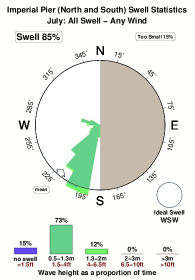


Surf stats for Imperial Pier (North and South): see the swell variation by month.
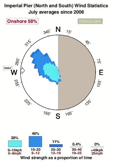
Wind stats for Imperial Pier (North and South): see the variation in direction and stength by month.
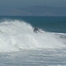
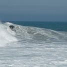
Photos de Surf
de la galerieContours: Routes et Rivières: Sélectionnez un spot de surf du menu 


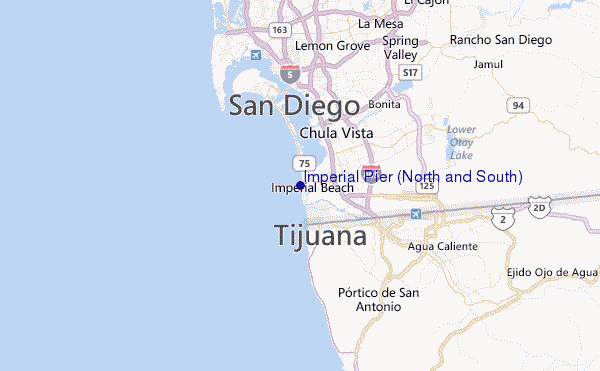
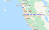
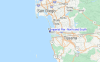
Utilisez cette carte en relief pour naviguer vers les spots de surf de CAL - San Diego County, et les stations de marées aux alentours de Imperial Pier (North and South)
Spots de Surf les plus proches de Imperial Pier (North and South):
(Cliquez sur le nom du spot pour plus de détails)- Closest spot1 mi
- Second closest spot2 mi
- Third closest spot8 mi
- Fourth closest spot8 mi
- Fifth closest spot9 mi
Bouées marines les plus proches de Imperial Pier (North and South):
- Closest Bouées marines2 mi
- Second closest Bouées marines17 mi
- Third closest Bouées marines21 mi
- Fourth closest Bouées marines22 mi
- Fifth closest Bouées marines24 mi
Stations de marée les plus proches de Imperial Pier (North and South):
- Closest station de maréeImperial Beach0 mi
- Second closest station de maréeChula Vista4 mi
- Third closest station de maréeNational City, San Diego Bay6 mi
- Fourth closest station de maréeTijuana6 mi
- Fifth closest station de maréePoint Loma8 mi
Airports
- The closest passenger airport to Imperial Pier (North and South) is North Island Nas (San Diego) Airport (NZY) in USA, 15 km (9 miles) away (directly).
- The second nearest airport to Imperial Pier (North and South) is General Abelardo L Rodriguez International (Tijuana) Airport (TIJ) in Mexico, 16 km (10 miles) away.
- Third is San Diego International Lindbergh Fld Airport (SAN) in USA, 18 km (11 miles) away.
- Miramar Mcas Airport (NKX) in USA is 32 km (20 miles) away.
- General Alberto L Salinas C International (Ensenada) Airport (ESE) in Mexico is the fifth nearest airport to Imperial Pier (North and South) and is 101 km (63 miles) away.
- /breaks/Imperial-Pier/forecasts/latest
 Nearest