
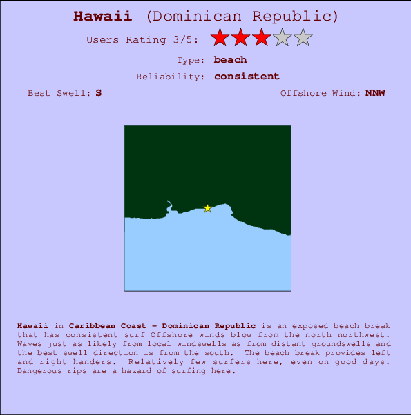
Hawaii Surf Guide
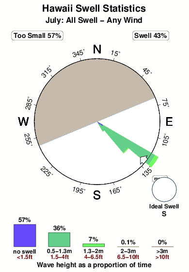
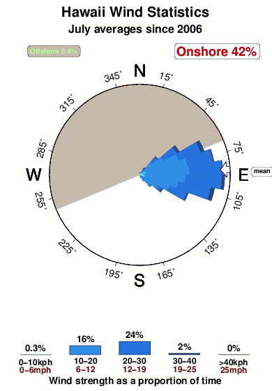
Hawaii on the South Coast is an exposed beach break that has dependable surf Offshore winds are from the north northwest. Most of the surf here comes from groundswells and the ideal swell direction is from the south. The beach breaks offer lefts and rights. Relatively few surfers here, even on good days. Watch out for dangerous rips.
Hawaii Spot Info
| Type: | Rating: | Reliability: | Todays Sea Temp*: |
|---|---|---|---|
| consistent | 28.5°C*ocean temperature recorded from satellite |
Surfing Hawaii:
The best conditions reported for surf at Hawaii occur when a South swell combines with an offshore wind direction from the North-northwest.

Énergie de Vague (puissance): 12h


Hawaii Surf:
Thursday, 16 July 2026, 17:58 Local time| Jeudi 16 | Ven | |||
| 5PM | 8PM | 11PM | 2AM | |
| Wave (m) | ||||
| Période (s) | 4 | 5 | 6 | 6 |
| Vent (km/h) | ||||
| Etat du vent | cross- on |
cross | cross | cross- off |
- /breaks/Hawaii/forecasts/latest

Hawaii Surf Guide
Hawaii on the South Coast is an exposed beach break that has dependable surf Offshore winds are from the north northwest. Most of the surf here comes from groundswells and the ideal swell direction is from the south. The beach breaks offer lefts and rights. Relatively few surfers here, even on good days. Watch out for dangerous rips.
Hawaii Spot Info
Type: Rating: Reliability: Todays Sea Temp*:  Beach
Beach 3
3consistent 28.5°C*ocean temperature recorded from satelliteSurfing Hawaii:
The best conditions reported for surf at Hawaii occur when a South swell combines with an offshore wind direction from the North-northwest.
Énergie de Vague (puissance): 12h
Utilisez les onglets ci-dessus pour voir la température de la mer à Hawaii, photos pour Hawaii, prévisions de houle détaillées pour Hawaii, prévisions de vent et météo, webcams pour Hawaii, conditions de vents en temps réel à partir des données de la station météo de Caribbean Coast et prévisions des marées pour Hawaii. Les cartes de houle pour Dominican Republic afficheront une image agrandie de Dominican Republic et des ses mers environnantes. Ces cartes de houles peuvent êtres animées pour montrer les différents composantes de houle, la hauteur, la période et l'énergie des vagues avec les prévisions météo et prévisions de vent. Des observations en temps réel du temps et de l'état de la mer sont fournies grâce aux bouées marines de Dominican Republic, des navires de passages, et des stations météo côtières. Toutes les pages de prévisions pour ce spot de surf ont un Vagu-o-Mètre Local et Global pour facilement trouver les meilleurs spot de surf à proximité de Hawaii.
Hawaii Surf:
Thursday, 16 July 2026, 17:58 Local timeJeudi 16 Ven 5PM 8PM 11PM 2AM Wave (m) Période (s) 4 5 6 6 Vent (km/h) Etat du vent cross-
oncross cross cross-
off- /breaks/Hawaii/forecasts/latest
- /breaks/Hawaii/forecasts/latest/six_day
Hawaii Surf Guide
Hawaii on the South Coast is an exposed beach break that has dependable surf Offshore winds are from the north northwest. Most of the surf here comes from groundswells and the ideal swell direction is from the south. The beach breaks offer lefts and rights. Relatively few surfers here, even on good days. Watch out for dangerous rips.
Hawaii Spot Info
Type: Rating: Reliability: Todays Sea Temp*: Beach3consistent 28.5°C*ocean temperature recorded from satelliteSurfing Hawaii:
The best conditions reported for surf at Hawaii occur when a South swell combines with an offshore wind direction from the North-northwest.
Énergie de Vague (puissance): 12h
Utilisez les onglets ci-dessus pour voir la température de la mer à Hawaii, photos pour Hawaii, prévisions de houle détaillées pour Hawaii, prévisions de vent et météo, webcams pour Hawaii, conditions de vents en temps réel à partir des données de la station météo de Caribbean Coast et prévisions des marées pour Hawaii. Les cartes de houle pour Dominican Republic afficheront une image agrandie de Dominican Republic et des ses mers environnantes. Ces cartes de houles peuvent êtres animées pour montrer les différents composantes de houle, la hauteur, la période et l'énergie des vagues avec les prévisions météo et prévisions de vent. Des observations en temps réel du temps et de l'état de la mer sont fournies grâce aux bouées marines de Dominican Republic, des navires de passages, et des stations météo côtières. Toutes les pages de prévisions pour ce spot de surf ont un Vagu-o-Mètre Local et Global pour facilement trouver les meilleurs spot de surf à proximité de Hawaii.
Hawaii Surf:
Thursday, 16 July 2026, 17:58 Local timeJeudi 16 Ven 5PM 8PM 11PM 2AM Wave (m) Période (s) 4 5 6 6 Vent (km/h) Etat du vent cross-
oncross cross cross-
off- /breaks/Hawaii/forecasts/latest
Hawaii Surf Guide
Hawaii on the South Coast is an exposed beach break that has dependable surf Offshore winds are from the north northwest. Most of the surf here comes from groundswells and the ideal swell direction is from the south. The beach breaks offer lefts and rights. Relatively few surfers here, even on good days. Watch out for dangerous rips.
Hawaii Spot Info
Type: Rating: Reliability: Todays Sea Temp*: Beach3consistent 28.5°C*ocean temperature recorded from satelliteSurfing Hawaii:
The best conditions reported for surf at Hawaii occur when a South swell combines with an offshore wind direction from the North-northwest.
Énergie de Vague (puissance): 12h
Utilisez les onglets ci-dessus pour voir la température de la mer à Hawaii, photos pour Hawaii, prévisions de houle détaillées pour Hawaii, prévisions de vent et météo, webcams pour Hawaii, conditions de vents en temps réel à partir des données de la station météo de Caribbean Coast et prévisions des marées pour Hawaii. Les cartes de houle pour Dominican Republic afficheront une image agrandie de Dominican Republic et des ses mers environnantes. Ces cartes de houles peuvent êtres animées pour montrer les différents composantes de houle, la hauteur, la période et l'énergie des vagues avec les prévisions météo et prévisions de vent. Des observations en temps réel du temps et de l'état de la mer sont fournies grâce aux bouées marines de Dominican Republic, des navires de passages, et des stations météo côtières. Toutes les pages de prévisions pour ce spot de surf ont un Vagu-o-Mètre Local et Global pour facilement trouver les meilleurs spot de surf à proximité de Hawaii.
Hawaii Surf:
Thursday, 16 July 2026, 17:58 Local timeJeudi 16 Ven 5PM 8PM 11PM 2AM Wave (m) Période (s) 4 5 6 6 Vent (km/h) Etat du vent cross-
oncross cross cross-
offTide Times:
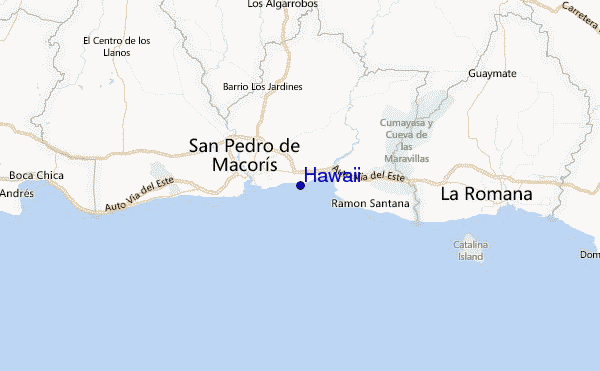
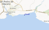
Pour San Pedro de Macoris, %{dist} %{km} de %{location}.
PROCHAIN EST A (heure locale) il reste marée haute marée basse Hawaii Tide Times and Tide Chart
Live Weather:
At La Romana International Airport, 31 km from Hawaii.
light winds from the E
(km/h)Air temperature
34°COverall Hawaii Surf Consistency and Wind Distribution in Juillet
Photos de Surf
de la galerieContours: Routes et Rivières: Sélectionnez un spot de surf du menu 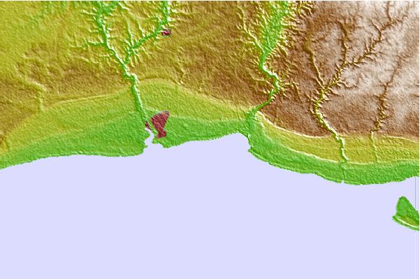
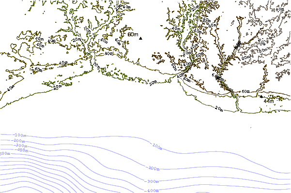
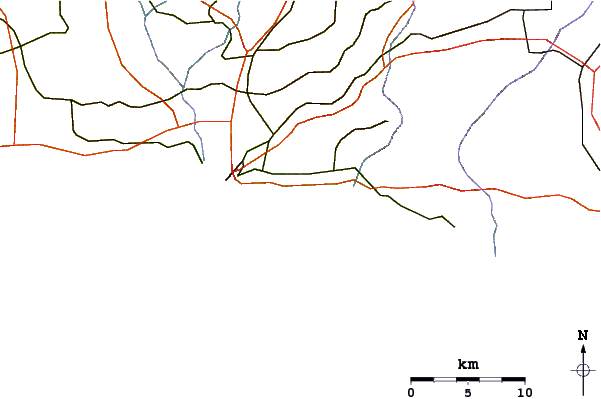
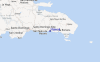
Utilisez cette carte en relief pour naviguer vers les spots de surf de Caribbean Coast, et les stations de marées aux alentours de Hawaii
Spots de Surf les plus proches de Hawaii:
(Cliquez sur le nom du spot pour plus de détails)- Closest spot5 mi
- Second closest spot5 mi
- Third closest spot6 mi
- Fourth closest spot7 mi
- Fifth closest spot8 mi
Bouées marines les plus proches de Hawaii:
- Closest Bouées marines129 mi
- Second closest Bouées marines183 mi
- Third closest Bouées marines206 mi
- Fourth closest Bouées marines249 mi
- Fifth closest Bouées marines295 mi
Stations de marée les plus proches de Hawaii:
- Closest station de maréeSan Pedro de Macoris4 mi
- Second closest station de maréeLa Romana18 mi
- Third closest station de maréeBoca Chica24 mi
- Fourth closest station de maréeMiches40 mi
- Fifth closest station de maréeSanto Domingo (Ciudad Trujillo)42 mi
Airports
- The closest passenger airport to Hawaii is La Romana International Airport (LRM) in Dominican Republic, 35 km (22 miles) away (directly).
- The second nearest airport to Hawaii is Las Americas International (Santo Domingo) Airport (SDQ), also in Dominican Republic, 45 km (28 miles) away.
- Third is Herrera International (Santo Domingo) Airport (HEX) in Dominican Republic, 76 km (47 miles) away.
- Punta Cana International Airport (PUJ) in Dominican Republic is 94 km (58 miles) away.
- Cibao International (Santiago) Airport (STI), also in Dominican Republic is the fifth nearest airport to Hawaii and is 180 km (112 miles) away.
- /breaks/Hawaii/forecasts/latest


 Nearest