
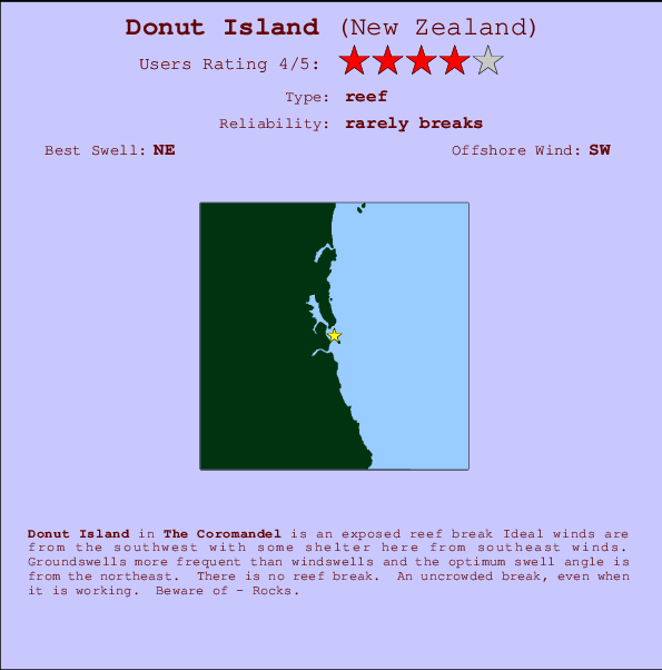
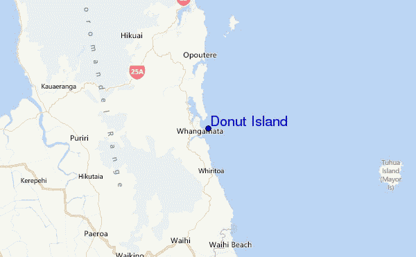
Donut Island Surf Guide
Donut Island in The Coromandel is an exposed reef break Offshore winds blow from the southwest with some shelter here from southeast winds. Most of the surf here comes from groundswells and the ideal swell direction is from the northeast. There is no reef break. The location means that it never gets crowded. Take care of - Rocks.
Donut Island Spot Info
| Type: | Rating: | Reliability: | Todays Sea Temp*: |
|---|---|---|---|
| rarely breaks | 14.9°C*ocean temperature recorded from satellite |
Surfing Donut Island:
The best conditions reported for surf at Donut Island occur when a Northeast swell combines with an offshore wind direction from the Southwest.

Énergie de Vague (puissance): 12h


Donut Island Surf:
Thursday, 16 July 2026, 23:25 Local time| Jeu | Vendredi 17 | |||
| 9PM | 0AM | 3AM | 6AM | |
| Wave (m) | ||||
| Période (s) | 19 | 18 | 18 | 18 |
| Vent (km/h) | ||||
| Etat du vent | cross- off |
off | cross- off |
cross- off |
- /breaks/Donut-Island/forecasts/latest
Donut Island Surf Guide
Donut Island in The Coromandel is an exposed reef break Offshore winds blow from the southwest with some shelter here from southeast winds. Most of the surf here comes from groundswells and the ideal swell direction is from the northeast. There is no reef break. The location means that it never gets crowded. Take care of - Rocks.
Donut Island Spot Info
Type: Rating: Reliability: Todays Sea Temp*:  Reef
Reef 4
4rarely breaks 14.9°C*ocean temperature recorded from satelliteSurfing Donut Island:
The best conditions reported for surf at Donut Island occur when a Northeast swell combines with an offshore wind direction from the Southwest.
Énergie de Vague (puissance): 12h
Utilisez les onglets ci-dessus pour voir la température de la mer à Donut Island, photos pour Donut Island, prévisions de houle détaillées pour Donut Island, prévisions de vent et météo, webcams pour Donut Island, conditions de vents en temps réel à partir des données de la station météo de Coromandel et prévisions des marées pour Donut Island. Les cartes de houle pour New Zealand afficheront une image agrandie de New Zealand et des ses mers environnantes. Ces cartes de houles peuvent êtres animées pour montrer les différents composantes de houle, la hauteur, la période et l'énergie des vagues avec les prévisions météo et prévisions de vent. Des observations en temps réel du temps et de l'état de la mer sont fournies grâce aux bouées marines de New Zealand, des navires de passages, et des stations météo côtières. Toutes les pages de prévisions pour ce spot de surf ont un Vagu-o-Mètre Local et Global pour facilement trouver les meilleurs spot de surf à proximité de Donut Island.
Donut Island Surf:
Thursday, 16 July 2026, 23:25 Local timeJeu Vendredi 17 9PM 0AM 3AM 6AM Wave (m) Période (s) 19 18 18 18 Vent (km/h) Etat du vent cross-
offoff cross-
offcross-
off- /breaks/Donut-Island/forecasts/latest
- /breaks/Donut-Island/forecasts/latest/six_day
Donut Island Surf Guide
Donut Island in The Coromandel is an exposed reef break Offshore winds blow from the southwest with some shelter here from southeast winds. Most of the surf here comes from groundswells and the ideal swell direction is from the northeast. There is no reef break. The location means that it never gets crowded. Take care of - Rocks.
Donut Island Spot Info
Type: Rating: Reliability: Todays Sea Temp*: Reef4rarely breaks 14.9°C*ocean temperature recorded from satelliteSurfing Donut Island:
The best conditions reported for surf at Donut Island occur when a Northeast swell combines with an offshore wind direction from the Southwest.
Énergie de Vague (puissance): 12h
Utilisez les onglets ci-dessus pour voir la température de la mer à Donut Island, photos pour Donut Island, prévisions de houle détaillées pour Donut Island, prévisions de vent et météo, webcams pour Donut Island, conditions de vents en temps réel à partir des données de la station météo de Coromandel et prévisions des marées pour Donut Island. Les cartes de houle pour New Zealand afficheront une image agrandie de New Zealand et des ses mers environnantes. Ces cartes de houles peuvent êtres animées pour montrer les différents composantes de houle, la hauteur, la période et l'énergie des vagues avec les prévisions météo et prévisions de vent. Des observations en temps réel du temps et de l'état de la mer sont fournies grâce aux bouées marines de New Zealand, des navires de passages, et des stations météo côtières. Toutes les pages de prévisions pour ce spot de surf ont un Vagu-o-Mètre Local et Global pour facilement trouver les meilleurs spot de surf à proximité de Donut Island.
Donut Island Surf:
Thursday, 16 July 2026, 23:25 Local timeJeu Vendredi 17 9PM 0AM 3AM 6AM Wave (m) Période (s) 19 18 18 18 Vent (km/h) Etat du vent cross-
offoff cross-
offcross-
off- /breaks/Donut-Island/forecasts/latest
Donut Island Surf Guide
Donut Island in The Coromandel is an exposed reef break Offshore winds blow from the southwest with some shelter here from southeast winds. Most of the surf here comes from groundswells and the ideal swell direction is from the northeast. There is no reef break. The location means that it never gets crowded. Take care of - Rocks.
Donut Island Spot Info
Type: Rating: Reliability: Todays Sea Temp*: Reef4rarely breaks 14.9°C*ocean temperature recorded from satelliteSurfing Donut Island:
The best conditions reported for surf at Donut Island occur when a Northeast swell combines with an offshore wind direction from the Southwest.
Énergie de Vague (puissance): 12h
Utilisez les onglets ci-dessus pour voir la température de la mer à Donut Island, photos pour Donut Island, prévisions de houle détaillées pour Donut Island, prévisions de vent et météo, webcams pour Donut Island, conditions de vents en temps réel à partir des données de la station météo de Coromandel et prévisions des marées pour Donut Island. Les cartes de houle pour New Zealand afficheront une image agrandie de New Zealand et des ses mers environnantes. Ces cartes de houles peuvent êtres animées pour montrer les différents composantes de houle, la hauteur, la période et l'énergie des vagues avec les prévisions météo et prévisions de vent. Des observations en temps réel du temps et de l'état de la mer sont fournies grâce aux bouées marines de New Zealand, des navires de passages, et des stations météo côtières. Toutes les pages de prévisions pour ce spot de surf ont un Vagu-o-Mètre Local et Global pour facilement trouver les meilleurs spot de surf à proximité de Donut Island.
Donut Island Surf:
Thursday, 16 July 2026, 23:25 Local timeJeu Vendredi 17 9PM 0AM 3AM 6AM Wave (m) Période (s) 19 18 18 18 Vent (km/h) Etat du vent cross-
offoff cross-
offcross-
offTide Times:
Pour Clark Island, %{dist} %{km} de %{location}.
PROCHAIN EST A (heure locale) il reste marée haute marée basse Donut Island Tide Times and Tide Chart
Live Weather:
At Whangamata 2, 10 km from Donut Island.
wind obs. (7 kph from 180 degs) was rejected
(km/h)
DryAir temperature
13°COverall Donut Island Surf Consistency and Wind Distribution in Juillet


Wind stats for Donut Island: see the variation in direction and stength by month.
Photos de Surf
de la galerieContours: Routes et Rivières: Sélectionnez un spot de surf du menu 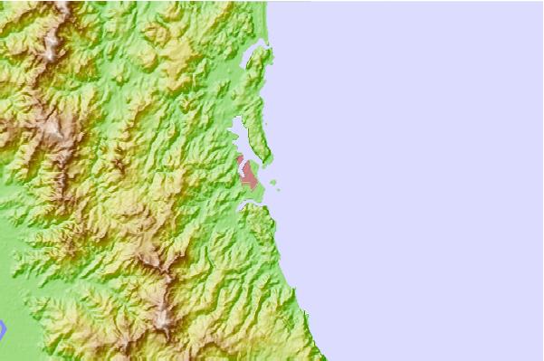
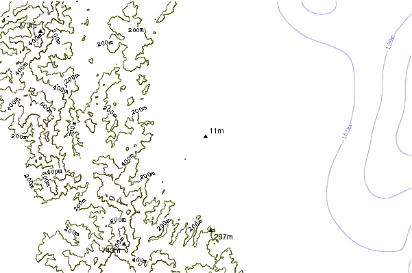
Utilisez cette carte en relief pour naviguer vers les spots de surf de Coromandel, et les stations de marées aux alentours de Donut Island
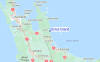
Spots de Surf les plus proches de Donut Island:
(Cliquez sur le nom du spot pour plus de détails)- Closest spot1 mi
- Second closest spot1 mi
- Third closest spot1 mi
- Fourth closest spot1 mi
- Fifth closest spot4 mi
Bouées marines les plus proches de Donut Island:
- Closest Bouées marines52 mi
- Second closest Bouées marines119 mi
- Third closest Bouées marines288 mi
- Fourth closest Bouées marines289 mi
- Fifth closest Bouées marines313 mi
Stations de marée les plus proches de Donut Island:
- Closest station de maréeSlipper Island12 mi
- Second closest station de maréeTairua15 mi
- Third closest station de maréeRocky Point (Thames)22 mi
- Fourth closest station de maréeWhitianga29 mi
- Fifth closest station de maréeTauranga34 mi
Airports
- The closest passenger airport to Donut Island is Tauranga Airport (TRG) in New Zealand, 57 km (35 miles) away (directly).
- The second nearest airport to Donut Island is Hamilton Airport (HLZ), also in New Zealand, 88 km (55 miles) away.
- Third is Auckland International Airport (AKL) in New Zealand, 100 km (62 miles) away.
- Rotorua Airport (ROT) in New Zealand is 106 km (66 miles) away.
- Whakatane Airport (WHK), also in New Zealand is the fifth nearest airport to Donut Island and is 119 km (74 miles) away.
- /breaks/Donut-Island/forecasts/latest

 Nearest