
Cherry Hill Surf Guide
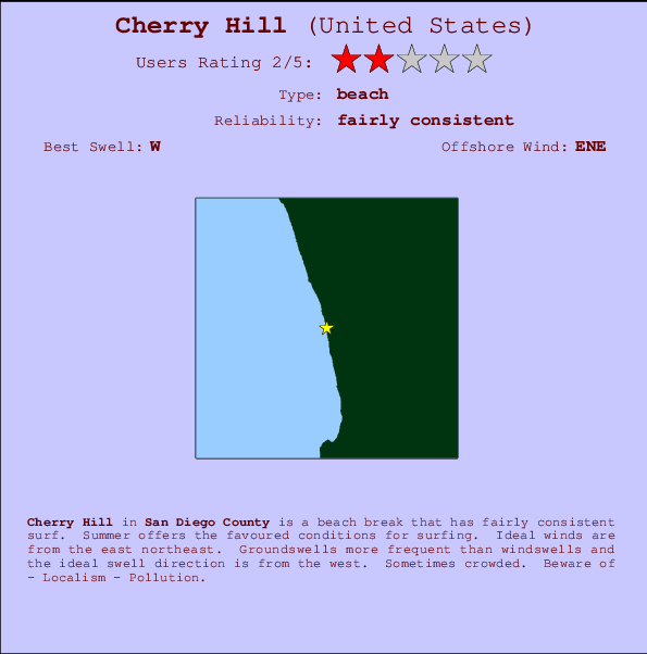
Cherry Hill in San Diego County is an exposed beach break that has quite reliable surf. Summer offers the best conditions for surfing. The best wind direction is from the east northeast. Groundswells more frequent than windswells and the best swell direction is from the west. Sometimes crowded. Hazards include - Localism - Pollution.
Cherry Hill Spot Info
| Type: | Rating: | Reliability: | Todays Sea Temp*: |
|---|---|---|---|
| fairly consistent | 22.6°C*ocean temperature recorded from satellite |
Surfing Cherry Hill:
The best conditions reported for surf at Cherry Hill occur when a West swell combines with an offshore wind direction from the East-northeast.

Énergie de Vague (puissance): 12h


Cherry Hill Surf:
Wednesday, 15 July 2026, 00:41 Local time| Mar | Mer | |||
| 8PM | 11PM | 2AM | 5AM | |
| Wave (m) | ||||
| Période (s) | 18 | 18 | 18 | 18 |
| Vent (km/h) | ||||
| Etat du vent | cross- on |
glass | glass | on |
- /breaks/Cherry-Hill-2/forecasts/latest
Cherry Hill Surf Guide
Cherry Hill in San Diego County is an exposed beach break that has quite reliable surf. Summer offers the best conditions for surfing. The best wind direction is from the east northeast. Groundswells more frequent than windswells and the best swell direction is from the west. Sometimes crowded. Hazards include - Localism - Pollution.
Cherry Hill Spot Info
Type: Rating: Reliability: Todays Sea Temp*:  Beach
Beach 2
2fairly consistent 22.6°C*ocean temperature recorded from satelliteSurfing Cherry Hill:
The best conditions reported for surf at Cherry Hill occur when a West swell combines with an offshore wind direction from the East-northeast.
Énergie de Vague (puissance): 12h
Utilisez les onglets ci-dessus pour voir la température de la mer à Cherry Hill, photos pour Cherry Hill, prévisions de houle détaillées pour Cherry Hill, prévisions de vent et météo, webcams pour Cherry Hill, conditions de vents en temps réel à partir des données de la station météo de CAL - San Diego County et prévisions des marées pour Cherry Hill. Les cartes de houle pour United States afficheront une image agrandie de United States et des ses mers environnantes. Ces cartes de houles peuvent êtres animées pour montrer les différents composantes de houle, la hauteur, la période et l'énergie des vagues avec les prévisions météo et prévisions de vent. Des observations en temps réel du temps et de l'état de la mer sont fournies grâce aux bouées marines de United States, des navires de passages, et des stations météo côtières. Toutes les pages de prévisions pour ce spot de surf ont un Vagu-o-Mètre Local et Global pour facilement trouver les meilleurs spot de surf à proximité de Cherry Hill.
Cherry Hill Surf:
Wednesday, 15 July 2026, 00:41 Local timeMar Mer 8PM 11PM 2AM 5AM Wave (m) Période (s) 18 18 18 18 Vent (km/h) Etat du vent cross-
onglass glass on - /breaks/Cherry-Hill-2/forecasts/latest
- /breaks/Cherry-Hill-2/forecasts/latest/six_day
Cherry Hill Surf Guide
Cherry Hill in San Diego County is an exposed beach break that has quite reliable surf. Summer offers the best conditions for surfing. The best wind direction is from the east northeast. Groundswells more frequent than windswells and the best swell direction is from the west. Sometimes crowded. Hazards include - Localism - Pollution.
Cherry Hill Spot Info
Type: Rating: Reliability: Todays Sea Temp*: Beach2fairly consistent 22.6°C*ocean temperature recorded from satelliteSurfing Cherry Hill:
The best conditions reported for surf at Cherry Hill occur when a West swell combines with an offshore wind direction from the East-northeast.
Énergie de Vague (puissance): 12h
Utilisez les onglets ci-dessus pour voir la température de la mer à Cherry Hill, photos pour Cherry Hill, prévisions de houle détaillées pour Cherry Hill, prévisions de vent et météo, webcams pour Cherry Hill, conditions de vents en temps réel à partir des données de la station météo de CAL - San Diego County et prévisions des marées pour Cherry Hill. Les cartes de houle pour United States afficheront une image agrandie de United States et des ses mers environnantes. Ces cartes de houles peuvent êtres animées pour montrer les différents composantes de houle, la hauteur, la période et l'énergie des vagues avec les prévisions météo et prévisions de vent. Des observations en temps réel du temps et de l'état de la mer sont fournies grâce aux bouées marines de United States, des navires de passages, et des stations météo côtières. Toutes les pages de prévisions pour ce spot de surf ont un Vagu-o-Mètre Local et Global pour facilement trouver les meilleurs spot de surf à proximité de Cherry Hill.
Cherry Hill Surf:
Wednesday, 15 July 2026, 00:41 Local timeMar Mer 8PM 11PM 2AM 5AM Wave (m) Période (s) 18 18 18 18 Vent (km/h) Etat du vent cross-
onglass glass on - /breaks/Cherry-Hill-2/forecasts/latest
Cherry Hill Surf Guide
Cherry Hill in San Diego County is an exposed beach break that has quite reliable surf. Summer offers the best conditions for surfing. The best wind direction is from the east northeast. Groundswells more frequent than windswells and the best swell direction is from the west. Sometimes crowded. Hazards include - Localism - Pollution.
Cherry Hill Spot Info
Type: Rating: Reliability: Todays Sea Temp*: Beach2fairly consistent 22.6°C*ocean temperature recorded from satelliteSurfing Cherry Hill:
The best conditions reported for surf at Cherry Hill occur when a West swell combines with an offshore wind direction from the East-northeast.
Énergie de Vague (puissance): 12h
Utilisez les onglets ci-dessus pour voir la température de la mer à Cherry Hill, photos pour Cherry Hill, prévisions de houle détaillées pour Cherry Hill, prévisions de vent et météo, webcams pour Cherry Hill, conditions de vents en temps réel à partir des données de la station météo de CAL - San Diego County et prévisions des marées pour Cherry Hill. Les cartes de houle pour United States afficheront une image agrandie de United States et des ses mers environnantes. Ces cartes de houles peuvent êtres animées pour montrer les différents composantes de houle, la hauteur, la période et l'énergie des vagues avec les prévisions météo et prévisions de vent. Des observations en temps réel du temps et de l'état de la mer sont fournies grâce aux bouées marines de United States, des navires de passages, et des stations météo côtières. Toutes les pages de prévisions pour ce spot de surf ont un Vagu-o-Mètre Local et Global pour facilement trouver les meilleurs spot de surf à proximité de Cherry Hill.
Cherry Hill Surf:
Wednesday, 15 July 2026, 00:41 Local timeMar Mer 8PM 11PM 2AM 5AM Wave (m) Période (s) 18 18 18 18 Vent (km/h) Etat du vent cross-
onglass glass on Tide Times:
Pour Solana Beach, %{dist} %{km} de %{location}.
PROCHAIN EST A (heure locale) il reste marée haute marée basse Cherry Hill Tide Times and Tide Chart
Live Weather:
At BUOY-46266, 3 km from Cherry Hill.
- Air temperature
-°CCurrent weather near Cherry Hill
Buoy Data:
At Torrey Pines Outer, CA, 7 miles from Cherry Hill.
7PM 8PM 9PM 10PM Age des données 4 hr 3 hr 2 hr 1 hr hauteur de la vague (m) 

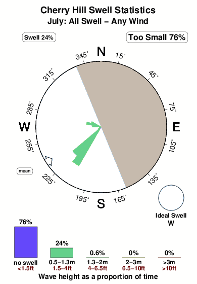
Période Dominante (s) 14 14 13 14 Overall Cherry Hill Surf Consistency and Wind Distribution in Juillet
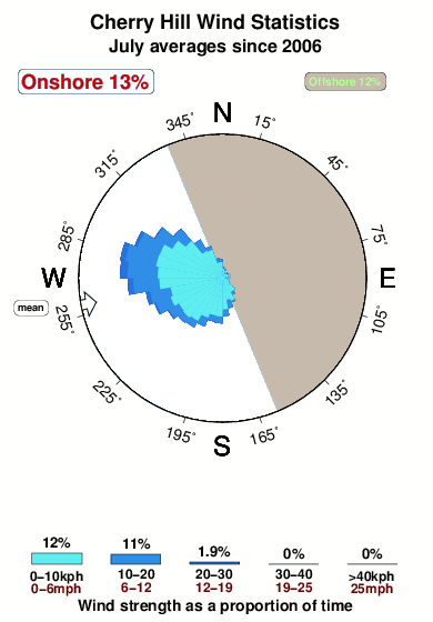

Wind stats for Cherry Hill: see the variation in direction and stength by month.
Photos de Surf
de la galerieContours: Routes et Rivières: Sélectionnez un spot de surf du menu 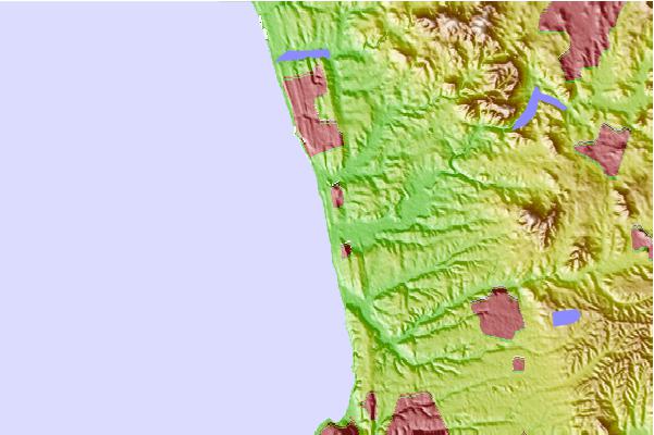
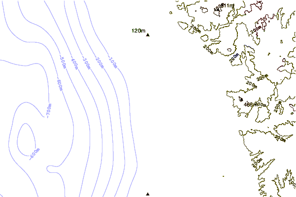
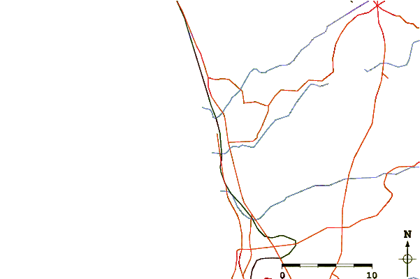
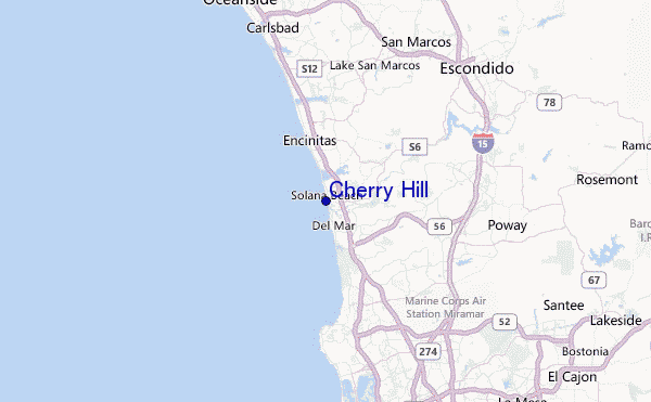
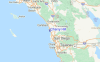
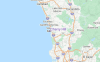
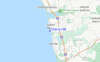
Utilisez cette carte en relief pour naviguer vers les spots de surf de CAL - San Diego County, et les stations de marées aux alentours de Cherry Hill
Spots de Surf les plus proches de Cherry Hill:
(Cliquez sur le nom du spot pour plus de détails)- Closest spot1 mi
- Second closest spot1 mi
- Third closest spot1 mi
- Fourth closest spot1 mi
- Fifth closest spot2 mi
Bouées marines les plus proches de Cherry Hill:
- Closest Bouées marines7 mi
- Second closest Bouées marines7 mi
- Third closest Bouées marines8 mi
- Fourth closest Bouées marines18 mi
- Fifth closest Bouées marines19 mi
Stations de marée les plus proches de Cherry Hill:
- Closest station de maréeSolana Beach1 mi
- Second closest station de maréeLa Jolla, Scripps Pier8 mi
- Third closest station de maréeCarlsbad13 mi
- Fourth closest station de maréeCrown Point, Mission Bay14 mi
- Fifth closest station de maréeQuivira Basin, Mission Bay15 mi
Airports
- The closest passenger airport to Cherry Hill is Miramar Mcas Airport (NKX) in USA, 18 km (11 miles) away (directly).
- The second nearest airport to Cherry Hill is San Diego International Lindbergh Fld Airport (SAN), also in USA, 29 km (18 miles) away.
- Third is North Island Nas (San Diego) Airport (NZY) in USA, 32 km (20 miles) away.
- General Abelardo L Rodriguez International (Tijuana) Airport (TIJ) in Mexico is 57 km (35 miles) away.
- John Wayne Arpt Orange Co (Santa Ana) Airport (SNA) in USA is the fifth nearest airport to Cherry Hill and is 95 km (59 miles) away.
- /breaks/Cherry-Hill-2/forecasts/latest
 Nearest