

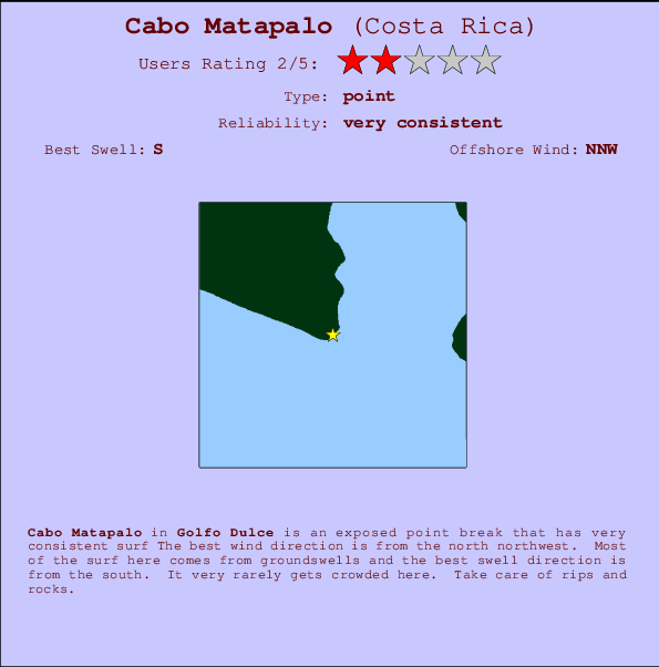
Cabo Matapalo Surf Guide
Cabo Matapalo in Golfo Dulce is an exposed point break that has very consistent surf Offshore winds are from the north northwest. Tends to receive distant groundswells and the best swell direction is from the south. Even when there are waves, it's not likley to be crowded. Beware of rips and rocks.
Cabo Matapalo Spot Info
| Type: | Rating: | Reliability: | Todays Sea Temp*: |
|---|---|---|---|
| very consistent | 30.5°C*ocean temperature recorded from satellite |
Surfing Cabo Matapalo:
The best conditions reported for surf at Cabo Matapalo occur when a South swell combines with an offshore wind direction from the North-northwest.

Énergie de Vague (puissance): 12h


Cabo Matapalo Surf:
Wednesday, 15 July 2026, 15:00 Local time| Mercredi 15 | Jeu | |||
| 3PM | 6PM | 9PM | 0AM | |
| Wave (m) | ||||
| Période (s) | 15 | 16 | 16 | 16 |
| Vent (km/h) | ||||
| Etat du vent | cross | cross- off |
cross- off |
off |
- /breaks/Cabo-Matapalo/forecasts/latest
Cabo Matapalo Surf Guide
Cabo Matapalo in Golfo Dulce is an exposed point break that has very consistent surf Offshore winds are from the north northwest. Tends to receive distant groundswells and the best swell direction is from the south. Even when there are waves, it's not likley to be crowded. Beware of rips and rocks.
Cabo Matapalo Spot Info
Type: Rating: Reliability: Todays Sea Temp*:  Point
Point 2
2very consistent 30.5°C*ocean temperature recorded from satelliteSurfing Cabo Matapalo:
The best conditions reported for surf at Cabo Matapalo occur when a South swell combines with an offshore wind direction from the North-northwest.
Énergie de Vague (puissance): 12h
Utilisez les onglets ci-dessus pour voir la température de la mer à Cabo Matapalo, photos pour Cabo Matapalo, prévisions de houle détaillées pour Cabo Matapalo, prévisions de vent et météo, webcams pour Cabo Matapalo, conditions de vents en temps réel à partir des données de la station météo de Golfo Dulce et prévisions des marées pour Cabo Matapalo. Les cartes de houle pour Costa Rica afficheront une image agrandie de Costa Rica et des ses mers environnantes. Ces cartes de houles peuvent êtres animées pour montrer les différents composantes de houle, la hauteur, la période et l'énergie des vagues avec les prévisions météo et prévisions de vent. Des observations en temps réel du temps et de l'état de la mer sont fournies grâce aux bouées marines de Costa Rica, des navires de passages, et des stations météo côtières. Toutes les pages de prévisions pour ce spot de surf ont un Vagu-o-Mètre Local et Global pour facilement trouver les meilleurs spot de surf à proximité de Cabo Matapalo.
Cabo Matapalo Surf:
Wednesday, 15 July 2026, 15:00 Local timeMercredi 15 Jeu 3PM 6PM 9PM 0AM Wave (m) Période (s) 15 16 16 16 Vent (km/h) Etat du vent cross cross-
offcross-
offoff - /breaks/Cabo-Matapalo/forecasts/latest
- /breaks/Cabo-Matapalo/forecasts/latest/six_day
Cabo Matapalo Surf Guide
Cabo Matapalo in Golfo Dulce is an exposed point break that has very consistent surf Offshore winds are from the north northwest. Tends to receive distant groundswells and the best swell direction is from the south. Even when there are waves, it's not likley to be crowded. Beware of rips and rocks.
Cabo Matapalo Spot Info
Type: Rating: Reliability: Todays Sea Temp*: Point2very consistent 30.5°C*ocean temperature recorded from satelliteSurfing Cabo Matapalo:
The best conditions reported for surf at Cabo Matapalo occur when a South swell combines with an offshore wind direction from the North-northwest.
Énergie de Vague (puissance): 12h
Utilisez les onglets ci-dessus pour voir la température de la mer à Cabo Matapalo, photos pour Cabo Matapalo, prévisions de houle détaillées pour Cabo Matapalo, prévisions de vent et météo, webcams pour Cabo Matapalo, conditions de vents en temps réel à partir des données de la station météo de Golfo Dulce et prévisions des marées pour Cabo Matapalo. Les cartes de houle pour Costa Rica afficheront une image agrandie de Costa Rica et des ses mers environnantes. Ces cartes de houles peuvent êtres animées pour montrer les différents composantes de houle, la hauteur, la période et l'énergie des vagues avec les prévisions météo et prévisions de vent. Des observations en temps réel du temps et de l'état de la mer sont fournies grâce aux bouées marines de Costa Rica, des navires de passages, et des stations météo côtières. Toutes les pages de prévisions pour ce spot de surf ont un Vagu-o-Mètre Local et Global pour facilement trouver les meilleurs spot de surf à proximité de Cabo Matapalo.
Cabo Matapalo Surf:
Wednesday, 15 July 2026, 15:00 Local timeMercredi 15 Jeu 3PM 6PM 9PM 0AM Wave (m) Période (s) 15 16 16 16 Vent (km/h) Etat du vent cross cross-
offcross-
offoff - /breaks/Cabo-Matapalo/forecasts/latest
Cabo Matapalo Surf Guide
Cabo Matapalo in Golfo Dulce is an exposed point break that has very consistent surf Offshore winds are from the north northwest. Tends to receive distant groundswells and the best swell direction is from the south. Even when there are waves, it's not likley to be crowded. Beware of rips and rocks.
Cabo Matapalo Spot Info
Type: Rating: Reliability: Todays Sea Temp*: Point2very consistent 30.5°C*ocean temperature recorded from satelliteSurfing Cabo Matapalo:
The best conditions reported for surf at Cabo Matapalo occur when a South swell combines with an offshore wind direction from the North-northwest.
Énergie de Vague (puissance): 12h
Utilisez les onglets ci-dessus pour voir la température de la mer à Cabo Matapalo, photos pour Cabo Matapalo, prévisions de houle détaillées pour Cabo Matapalo, prévisions de vent et météo, webcams pour Cabo Matapalo, conditions de vents en temps réel à partir des données de la station météo de Golfo Dulce et prévisions des marées pour Cabo Matapalo. Les cartes de houle pour Costa Rica afficheront une image agrandie de Costa Rica et des ses mers environnantes. Ces cartes de houles peuvent êtres animées pour montrer les différents composantes de houle, la hauteur, la période et l'énergie des vagues avec les prévisions météo et prévisions de vent. Des observations en temps réel du temps et de l'état de la mer sont fournies grâce aux bouées marines de Costa Rica, des navires de passages, et des stations météo côtières. Toutes les pages de prévisions pour ce spot de surf ont un Vagu-o-Mètre Local et Global pour facilement trouver les meilleurs spot de surf à proximité de Cabo Matapalo.
Cabo Matapalo Surf:
Wednesday, 15 July 2026, 15:00 Local timeMercredi 15 Jeu 3PM 6PM 9PM 0AM Wave (m) Période (s) 15 16 16 16 Vent (km/h) Etat du vent cross cross-
offcross-
offoff Tide Times:
Pour Backwash, %{dist} %{km} de %{location}.
PROCHAIN EST A (heure locale) il reste marée haute marée basse Cabo Matapalo Tide Times and Tide Chart
Live Weather:
At Puerto Armuelles wx, 48 km from Cabo Matapalo.
light winds from the S
(km/h)
dryAir temperature
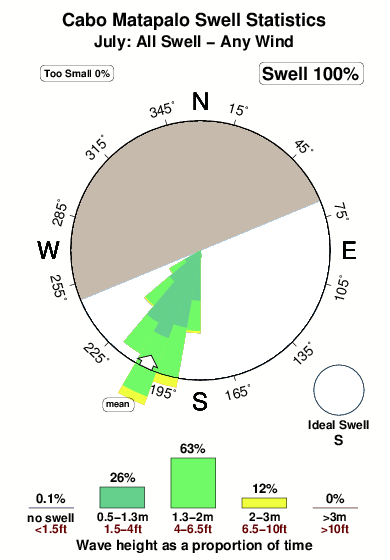
27°COverall Cabo Matapalo Surf Consistency and Wind Distribution in Juillet
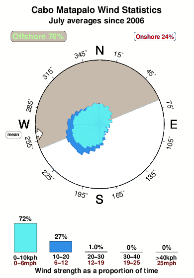


Wind stats for Cabo Matapalo: see the variation in direction and stength by month.
Photos de Surf
de la galerieContours: Routes et Rivières: Sélectionnez un spot de surf du menu 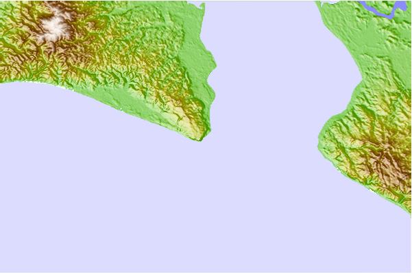
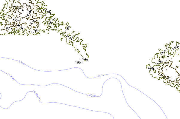
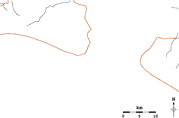
Utilisez cette carte en relief pour naviguer vers les spots de surf de Golfo Dulce, et les stations de marées aux alentours de Cabo Matapalo
Spots de Surf les plus proches de Cabo Matapalo:
(Cliquez sur le nom du spot pour plus de détails)- Closest spot1 mi
- Second closest spot1 mi
- Third closest spot2 mi
- Fourth closest spot5 mi
- Fifth closest spot9 mi
Bouées marines les plus proches de Cabo Matapalo:
- Closest Bouées marines597 mi
- Second closest Bouées marines803 mi
- Third closest Bouées marines1184 mi
- Fourth closest Bouées marines1198 mi
- Fifth closest Bouées marines1226 mi
Stations de marée les plus proches de Cabo Matapalo:
- Closest station de maréeGolfito20 mi
- Second closest station de maréePuerto Armuelles30 mi
- Third closest station de maréePedregal58 mi
- Fourth closest station de maréeAlmirante88 mi
- Fifth closest station de maréeBocas del Toro, Almirante Bay98 mi
Airports
- The closest passenger airport to Cabo Matapalo is Golfito Airport (GLF) in Costa Rica, 32 km (20 miles) away (directly).
- The second nearest airport to Cabo Matapalo is Coto 47 Airport (OTR), also in Costa Rica, 42 km (26 miles) away.
- Third is Palmar Sur Airport (PMZ) in Costa Rica, 67 km (42 miles) away.
- Enrique Malek International (David) Airport (DAV) in Panama is 93 km (58 miles) away.
- Cap Manuel Nino International (Changuinola) Airport (CHX), also in Panama is the fifth nearest airport to Cabo Matapalo and is 147 km (91 miles) away.
- /breaks/Cabo-Matapalo/forecasts/latest


 Nearest