

- Forecast
- Maps
- Live
- Weather State
- Spot Information

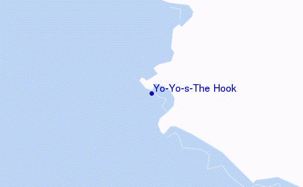
Yo-Yo's-The Hook surf Forecast / Sumbawa / Indonesia
- Map Icons:
 Break
Break Live Wave Height (m)
 Live Wind Speed (km/h)
 Surf Rating (10 Max)
 Ocean Swells (m)
- Wind Speed (km/h)
How big are the waves at Yo-Yo's-The Hook today?
The current surf forecast for Yo-Yo's-The Hook at 1PM is: 0.9m 12s primary swell from a South-southwest direction and 0.4m 18s secondary swell from a South-southwest direction (forecast issued at 07:00am April 27). An open ocean swell of 0.7m 6s is not directed at the surf break. The wind direction is predicted to be cross-offshore and the swell rating is 3.
| Time (WITA) & Date | Wave Height | Wave Period |
|---|---|---|
| Morning (27 Apr) | 3ft (0.9m) | 12s |
| Afternoon (27 Apr) | 2.5ft (0.8m) | 12s |
| Evening (27 Apr) | 2.5ft (0.7m) | 13s |
Table - waves today at Yo-Yo's-The Hook. (Swell directed towards the surf break)
Saturday 27 | Sunday 28 | Monday 29 | Tuesday 30 | Wednesday 01 | Thursday 02 | Friday 03 | Saturday 04 | |||||||||||||||||||||||||||||||||||||||||||||||||||||
| 5 AM | 8 AM | 11 AM | 2 PM | 5 PM | 8 PM | 11 PM | 2 AM | 5 AM | 8 AM | 11 AM | 2 PM | 5 PM | 8 PM | 11 PM | 2 AM | 5 AM | 8 AM | 11 AM | 2 PM | 5 PM | 8 PM | 11 PM | 2 AM | 5 AM | 8 AM | 11 AM | 2 PM | 5 PM | 8 PM | 11 PM | 2 AM | 5 AM | 8 AM | 11 AM | 2 PM | 5 PM | 8 PM | 11 PM | 2 AM | 5 AM | 8 AM | 11 AM | 2 PM | 5 PM | 8 PM | 11 PM | 2 AM | 5 AM | 8 AM | 11 AM | 2 PM | 5 PM | 8 PM | 11 PM | 2 AM | 5 AM | 8 AM | 11 AM | 2 PM | |
Rating (10 max) | ||||||||||||||||||||||||||||||||||||||||||||||||||||||||||||
Swell Height Map |    |    |    |    |  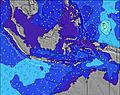 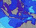 | 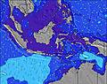 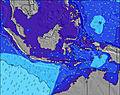  |    |    | ||||||||||||||||||||||||||||||||||||||||||||||||||||
| Wave Height (m) & direction (?) | ||||||||||||||||||||||||||||||||||||||||||||||||||||||||||||
| Period(s) (?) | 12 | 12 | 12 | 12 | 13 | 13 | 17 | 16 | 16 | 16 | 16 | 15 | 15 | 15 | 20 | 20 | 19 | 19 | 19 | 18 | 18 | 18 | 18 | 17 | 16 | 16 | 16 | 16 | 16 | 16 | 15 | 15 | 14 | 14 | 14 | 14 | 14 | 14 | 14 | 14 | 14 | 14 | 14 | 13 | 13 | 13 | 13 | 13 | 13 | 13 | 13 | 12 | 12 | 12 | 12 | 12 | 18 | 18 | 18 | 24 |
Wave (?)Graph | ||||||||||||||||||||||||||||||||||||||||||||||||||||||||||||
| Energy (?) | 230 | 230 | 230 | 187 | 206 | 176 | 243 | 232 | 229 | 226 | 425 | 387 | 382 | 377 | 557 | 872 | 863 | 855 | 794 | 926 | 1518 | 1518 | 1501 | 1433 | 1084 | 1044 | 1031 | 1018 | 1018 | 894 | 791 | 623 | 482 | 476 | 476 | 553 | 553 | 545 | 407 | 384 | 390 | 390 | 379 | 440 | 440 | 434 | 362 | 326 | 321 | 312 | 249 | 237 | 233 | 230 | 164 | 164 | 207 | 207 | 150 | 273 |
Wind (km/h) | ||||||||||||||||||||||||||||||||||||||||||||||||||||||||||||
| Wind State (?) onshore cross-onshore cross-shore cross-offshore offshore glassy | cross- off | off | glass | cross- off | cross- off | off | cross- off | cross- off | off | cross- off | cross- off | cross- off | cross- off | cross- off | cross- off | cross- off | cross- off | cross- off | cross- off | cross- off | cross- off | cross- off | cross- off | cross- off | cross- off | cross- off | cross- off | cross- off | cross- off | cross- off | cross- off | cross- off | cross- off | cross- off | cross- off | cross- off | cross- off | cross- off | cross- off | cross- off | cross- off | cross- off | cross- off | cross- off | cross- off | cross- off | cross- off | cross- off | cross- off | cross- off | cross- off | cross- off | cross- off | cross- off | cross- off | cross- off | cross- off | cross- off | cross- off | cross |
High Tide / height (m) | 11:35AM 2.81 | 12:16AM 2.19 | 12:02PM 2.74 | 12:47AM 2.05 | 12:31PM 2.64 | 1:23AM 1.89 | 1:06PM 2.48 | 2:12AM 1.74 | 1:50PM 2.28 | 3:36AM 1.65 | 3:03PM 2.05 | 5:50AM 1.73 | 5:19PM 1.92 | 7:10AM 1.99 | ||||||||||||||||||||||||||||||||||||||||||||||
Low Tide / height (m) | 5:26AM 0.61 | 6:10PM 0.14 | 5:51AM 0.69 | 6:42PM 0.24 | 6:17AM 0.80 | 7:19PM 0.40 | 6:46AM 0.94 | 8:04PM 0.58 | 7:24AM 1.12 | 9:07PM 0.77 | 8:34AM 1.31 | 10:40PM 0.89 | 11:07AM 1.36 | 12:19AM 0.88 | 1:10PM 1.11 | |||||||||||||||||||||||||||||||||||||||||||||
Saturday 27 | Sunday 28 | Monday 29 | Tuesday 30 | Wednesday 01 | Thursday 02 | Friday 03 | Saturday 04 | |||||||||||||||||||||||||||||||||||||||||||||||||||||
| Sunrise | - | 6:16 | - | - | - | - | - | - | - | 6:16 | - | - | - | - | - | - | - | 6:16 | - | - | - | - | - | - | - | 6:16 | - | - | - | - | - | - | - | 6:16 | - | - | - | - | - | - | - | 6:16 | - | - | - | - | - | - | - | 6:16 | - | - | - | - | - | - | - | 6:16 | - | - |
| Sunset | - | - | - | - | 6:05 | - | - | - | - | - | - | - | 6:04 | - | - | - | - | - | - | - | 6:04 | - | - | - | - | - | - | - | 6:04 | - | - | - | - | - | - | - | 6:02 | - | - | - | - | - | - | - | 6:02 | - | - | - | - | - | - | - | 6:02 | - | - | - | - | - | - | - |
Rain (mm) | - | - | - | - | 1 | - | - | - | - | - | - | - | - | - | - | - | - | - | - | - | - | - | - | - | - | - | - | - | - | - | - | - | - | - | - | - | - | - | - | - | - | - | - | - | - | - | - | - | - | - | - | - | - | - | - | - | - | - | - | - |
| Temp. °C | 26 | 27 | 29 | 29 | 29 | 28 | 27 | 27 | 26 | 27 | 30 | 29 | 29 | 27 | 27 | 27 | 26 | 27 | 29 | 29 | 28 | 27 | 27 | 27 | 27 | 27 | 29 | 29 | 29 | 27 | 26 | 26 | 26 | 27 | 29 | 29 | 28 | 27 | 26 | 26 | 26 | 27 | 29 | 29 | 28 | 27 | 26 | 26 | 26 | 27 | 29 | 29 | 28 | 27 | 26 | 26 | 26 | 27 | 29 | 29 |
| Feels °C (?) | 30 | 31 | 34 | 31 | 33 | 33 | 31 | 31 | 30 | 31 | 33 | 31 | 31 | 29 | 29 | 30 | 28 | 30 | 31 | 30 | 29 | 29 | 29 | 29 | 29 | 29 | 30 | 29 | 30 | 29 | 28 | 28 | 29 | 30 | 31 | 30 | 30 | 29 | 28 | 28 | 29 | 30 | 30 | 29 | 28 | 29 | 28 | 28 | 28 | 29 | 30 | 28 | 29 | 29 | 28 | 29 | 29 | 30 | 30 | 29 |
FREE! Surf-Forecast.com widget for your website
The surf report / weather widget below is available to embed on third party websites free of charge and provides a summary of our Yo-Yo's-The Hook surf forecast. Simply grab the html code snippet that we provide and paste it into your own site. You can choose your preferred language and metric/imperial units for the surf forecast feed to suit users of your site. Click here to get the code.


 Nearest