

- Forecast
- Maps
- Live
- Weather State
- Spot Information

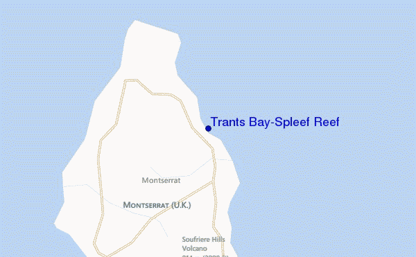
Trants Bay/Spleef Reef surf Forecast / Caribbean / Montserrat
- Map Icons:
 Break
Break Live Wave Height (m)
 Live Wind Speed (km/h)
 Surf Rating (10 Max)
 Ocean Swells (m)
- Wind Speed (km/h)
How big are the waves at Trants Bay/Spleef Reef today?
The current surf forecast for Trants Bay/Spleef Reef at 7PM is: 1.3m 7s primary swell from a East direction and 0.5m 11s secondary swell from a North-northwest direction, 0.2m 10s secondary swell from a North-northeast direction (forecast issued at 01:00pm April 26). The wind direction is predicted to be cross-onshore.
| Time (AST) & Date | Wave Height | Wave Period |
|---|---|---|
| Morning (26 Apr) | 3.5ft (1.0m) | 7s |
| Afternoon (26 Apr) | 3.5ft (1.1m) | 7s |
| Evening (26 Apr) | 4.5ft (1.3m) | 7s |
Table - waves today at Trants Bay/Spleef Reef. (Swell directed towards the surf break)
Friday 26 | Saturday 27 | Sunday 28 | Monday 29 | Tuesday 30 | Wednesday 01 | Thursday 02 | Friday 03 | |||||||||||||||||||||||||||||||||||||||||||||||||||||
| 11 AM | 2 PM | 5 PM | 8 PM | 11 PM | 2 AM | 5 AM | 8 AM | 11 AM | 2 PM | 5 PM | 8 PM | 11 PM | 2 AM | 5 AM | 8 AM | 11 AM | 2 PM | 5 PM | 8 PM | 11 PM | 2 AM | 5 AM | 8 AM | 11 AM | 2 PM | 5 PM | 8 PM | 11 PM | 2 AM | 5 AM | 8 AM | 11 AM | 2 PM | 5 PM | 8 PM | 11 PM | 2 AM | 5 AM | 8 AM | 11 AM | 2 PM | 5 PM | 8 PM | 11 PM | 2 AM | 5 AM | 8 AM | 11 AM | 2 PM | 5 PM | 8 PM | 11 PM | 2 AM | 5 AM | 8 AM | 11 AM | 2 PM | 5 PM | 8 PM | |
Rating (10 max) | ||||||||||||||||||||||||||||||||||||||||||||||||||||||||||||
Swell Height Map |    |    |    |    |  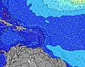 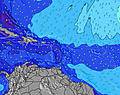 | 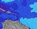 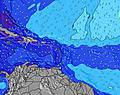 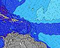 | 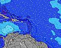 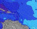 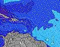 | 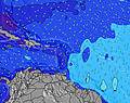 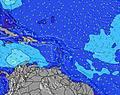 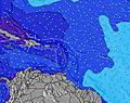 | ||||||||||||||||||||||||||||||||||||||||||||||||||||
| Wave Height (m) & direction (?) | ||||||||||||||||||||||||||||||||||||||||||||||||||||||||||||
| Period(s) (?) | 7 | 7 | 7 | 7 | 7 | 7 | 7 | 7 | 7 | 7 | 11 | 10 | 10 | 10 | 10 | 10 | 10 | 10 | 10 | 9 | 9 | 9 | 9 | 9 | 9 | 9 | 9 | 9 | 7 | 7 | 10 | 9 | 9 | 8 | 9 | 11 | 10 | 10 | 10 | 10 | 10 | 11 | 11 | 11 | 11 | 10 | 10 | 10 | 10 | 10 | 10 | 10 | 10 | 10 | 9 | 7 | 7 | 6 | 7 | 7 |
Wave (?)Graph | ||||||||||||||||||||||||||||||||||||||||||||||||||||||||||||
| Energy (?) | 97 | 117 | 171 | 181 | 181 | 155 | 131 | 106 | 106 | 91 | 218 | 157 | 98 | 98 | 113 | 113 | 148 | 107 | 105 | 96 | 94 | 73 | 94 | 71 | 54 | 140 | 151 | 127 | 184 | 149 | 511 | 497 | 429 | 388 | 387 | 452 | 370 | 339 | 342 | 279 | 385 | 338 | 332 | 275 | 223 | 218 | 214 | 161 | 161 | 125 | 125 | 122 | 117 | 88 | 113 | 77 | 89 | 85 | 99 | 105 |
Wind (km/h) | ||||||||||||||||||||||||||||||||||||||||||||||||||||||||||||
| Wind State (?) onshore cross-onshore cross-shore cross-offshore offshore glassy | cross- on | cross- on | cross- on | cross- on | cross- on | cross- on | cross- on | cross- on | cross- on | cross- on | cross- on | on | cross- on | cross- on | cross- on | cross- on | cross- on | on | on | on | on | cross- on | cross- on | cross- on | cross- on | cross- on | on | on | on | on | on | cross- on | cross- on | cross- on | cross- on | cross- on | cross- on | cross- on | cross- on | cross- on | cross- on | cross- on | cross- on | cross- on | cross- on | cross- on | cross- on | cross- on | cross | cross | cross- off | glass | on | on | on | cross- on | cross- on | cross- on | cross- on | cross- on |
High Tide / height (m) | 3:40AM 0.31 | 4:11AM 0.31 | 4:50AM 0.32 | 5:30AM 0.32 | 6:17AM 0.31 | 3:21AM 0.30 | 7:20AM 0.29 | 2:56AM 0.28 | 9:08AM 0.26 | |||||||||||||||||||||||||||||||||||||||||||||||||||
Low Tide / height (m) | 12:24PM 0.02 | 1:10PM 0.01 | 2:00PM 0.02 | 2:53PM 0.03 | 3:48PM 0.05 | 4:42PM 0.08 | 5:59AM 0.29 | 5:34PM 0.11 | 6:59AM 0.25 | 6:22PM 0.15 | ||||||||||||||||||||||||||||||||||||||||||||||||||
Friday 26 | Saturday 27 | Sunday 28 | Monday 29 | Tuesday 30 | Wednesday 01 | Thursday 02 | Friday 03 | |||||||||||||||||||||||||||||||||||||||||||||||||||||
| Sunrise | - | - | - | - | - | - | - | 5:45 | - | - | - | - | - | - | - | 5:43 | - | - | - | - | - | - | - | 5:43 | - | - | - | - | - | - | - | 5:43 | - | - | - | - | - | - | - | 5:43 | - | - | - | - | - | - | - | 5:41 | - | - | - | - | - | - | - | 5:41 | - | - | - | - |
| Sunset | - | - | 6:27 | - | - | - | - | - | - | - | 6:27 | - | - | - | - | - | - | - | 6:27 | - | - | - | - | - | - | - | 6:27 | - | - | - | - | - | - | - | 6:28 | - | - | - | - | - | - | - | 6:28 | - | - | - | - | - | - | - | 6:28 | - | - | - | - | - | - | - | 6:28 | - |
Rain (mm) | - | 1 | - | - | - | - | - | - | - | - | - | - | - | - | 1 | 1 | 1 | 1 | 1 | - | - | - | - | 1 | - | - | - | - | - | - | 1 | - | - | - | - | - | - | - | 1 | - | - | - | - | - | - | - | 1 | 1 | 2 | 1 | 2 | - | - | 1 | - | - | - | - | - | - |
| Temp. °C | 27 | 26 | 27 | 27 | 27 | 26 | 26 | 26 | 27 | 27 | 27 | 27 | 26 | 26 | 26 | 26 | 26 | 26 | 27 | 26 | 26 | 26 | 26 | 26 | 26 | 26 | 26 | 26 | 26 | 25 | 25 | 26 | 26 | 27 | 27 | 26 | 27 | 26 | 26 | 27 | 27 | 27 | 27 | 27 | 27 | 27 | 26 | 26 | 27 | 27 | 27 | 28 | 27 | 25 | 25 | 26 | 27 | 27 | 27 | 27 |
| Feels °C (?) | 27 | 24 | 25 | 25 | 25 | 24 | 25 | 25 | 26 | 26 | 26 | 26 | 26 | 27 | 27 | 27 | 28 | 28 | 29 | 26 | 26 | 26 | 26 | 26 | 26 | 26 | 26 | 25 | 25 | 23 | 23 | 25 | 25 | 26 | 26 | 25 | 25 | 24 | 25 | 25 | 26 | 26 | 26 | 26 | 26 | 26 | 25 | 25 | 28 | 29 | 29 | 31 | 29 | 23 | 23 | 28 | 28 | 27 | 27 | 27 |
FREE! Surf-Forecast.com widget for your website
The surf report / weather widget below is available to embed on third party websites free of charge and provides a summary of our Trants Bay/Spleef Reef surf forecast. Simply grab the html code snippet that we provide and paste it into your own site. You can choose your preferred language and metric/imperial units for the surf forecast feed to suit users of your site. Click here to get the code.


 Nearest