- Forecast
- Maps
- Live
- Weather State
- Spot Information

Prévisions
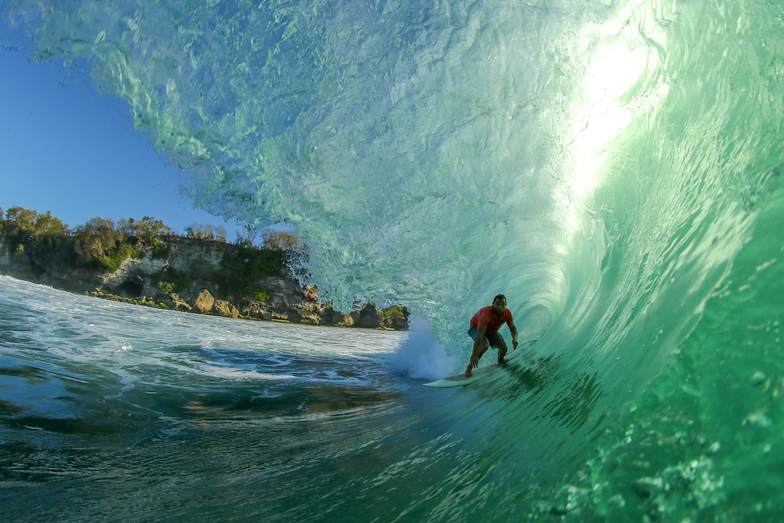
Surf à Padang PadangPrévision / Bali – The Bukit / Indonesia
Prévisions mises à jour dans hr min s Forecast update imminent
La hauteur de houle à Padang Padang est en océan ouvert. Les vagues déferlantes seront souvent plus petites sur des spots moins exposés.
La température de la mer à Padang Padang aujourd'hui est
27.3° C
(Ce qui est normal pour cette période de l'année)Mises à jour dans hr min s Forecast update imminent
Lundi 07 | Mardi 08 | Mercredi 09 | Jeudi 10 | Vendredi 11 | Samedi 12 | Dimanche 13 | Lundi 14 | |||||||||||||||||||||||||||||||||||||||||||||||||||||
| 11 PM | 2 AM | 5 AM | 8 AM | 11 AM | 2 PM | 5 PM | 8 PM | 11 PM | 2 AM | 5 AM | 8 AM | 11 AM | 2 PM | 5 PM | 8 PM | 11 PM | 2 AM | 5 AM | 8 AM | 11 AM | 2 PM | 5 PM | 8 PM | 11 PM | 2 AM | 5 AM | 8 AM | 11 AM | 2 PM | 5 PM | 8 PM | 11 PM | 2 AM | 5 AM | 8 AM | 11 AM | 2 PM | 5 PM | 8 PM | 11 PM | 2 AM | 5 AM | 8 AM | 11 AM | 2 PM | 5 PM | 8 PM | 11 PM | 2 AM | 5 AM | 8 AM | 11 AM | 2 PM | 5 PM | 8 PM | 11 PM | 2 AM | 5 AM | 8 AM | |
Notation (10 max) | ||||||||||||||||||||||||||||||||||||||||||||||||||||||||||||
Carte Hauteur de Houle |    |    |    |    |    |   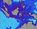 |  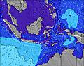 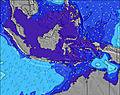 |  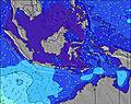 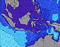 |    | |||||||||||||||||||||||||||||||||||||||||||||||||||
| Hauteur de Vagues (m) & direction (?) | ||||||||||||||||||||||||||||||||||||||||||||||||||||||||||||
| Période(s) (?) | 17 | 17 | 17 | 16 | 16 | 16 | 16 | 15 | 15 | 15 | 15 | 14 | 14 | 14 | 14 | 14 | 14 | 19 | 18 | 18 | 17 | 16 | 16 | 16 | 16 | 16 | 15 | 15 | 15 | 15 | 15 | 15 | 14 | 14 | 14 | 14 | 14 | 14 | 14 | 14 | 14 | 14 | 14 | 14 | 16 | 14 | 14 | 15 | 14 | 14 | 18 | 18 | 18 | 18 | 17 | 16 | 16 | 16 | 16 | 16 |
Graphique (?)Vague | ||||||||||||||||||||||||||||||||||||||||||||||||||||||||||||
| Énergie (?) | 879 | 913 | 924 | 1101 | 836 | 833 | 806 | 790 | 863 | 896 | 826 | 734 | 704 | 701 | 732 | 771 | 962 | 1352 | 2018 | 2330 | 2829 | 3005 | 3263 | 3222 | 3191 | 2887 | 2534 | 2424 | 2392 | 2292 | 2090 | 2117 | 1822 | 1772 | 1739 | 1441 | 1432 | 1637 | 1335 | 1286 | 1391 | 1508 | 1569 | 1446 | 1873 | 1482 | 1618 | 1733 | 1717 | 1639 | 1623 | 1960 | 2097 | 2179 | 2452 | 2067 | 1801 | 1755 | 1859 | 1611 |
Vent (km/h) | ||||||||||||||||||||||||||||||||||||||||||||||||||||||||||||
| Etat du vent (?) onshore Vent de Mer-Latéral Latéral Vent de Terre-Latéral Vent de Terre Mer d'Huile | off | cross- off | cross- off | off | off | off | off | off | off | off | off | off | off | off | off | off | off | off | off | off | off | off | off | off | off | off | off | off | off | off | off | off | off | off | off | off | off | off | off | off | off | off | cross- off | cross- off | cross- off | off | off | cross- off | cross- off | off | cross- off | off | off | off | off | off | off | off | off | off |
Marée haute / hauteur (m) | 6:50AM 2.03 | 8:39PM 1.49 | 7:51AM 2.10 | 9:31PM 1.60 | 8:43AM 2.21 | 10:10PM 1.71 | 9:27AM 2.33 | 10:44PM 1.82 | 10:07AM 2.44 | 11:16PM 1.93 | 10:45AM 2.52 | 11:46PM 2.04 | 11:21AM 2.56 | 12:17AM 2.14 | ||||||||||||||||||||||||||||||||||||||||||||||
Marée basse / hauteur (m) | 11:55PM 1.16 | 2:17PM 0.73 | 1:16AM 1.17 | 3:07PM 0.58 | 2:21AM 1.11 | 3:48PM 0.44 | 3:12AM 1.03 | 4:24PM 0.31 | 3:56AM 0.94 | 4:58PM 0.22 | 4:35AM 0.85 | 5:29PM 0.15 | 5:13AM 0.77 | 6:00PM 0.13 | 5:52AM 0.71 | |||||||||||||||||||||||||||||||||||||||||||||
Lundi 07 | Mardi 08 | Mercredi 09 | Jeudi 10 | Vendredi 11 | Samedi 12 | Dimanche 13 | Lundi 14 | |||||||||||||||||||||||||||||||||||||||||||||||||||||
| Lever du soleil | - | - | - | 6:35 | - | - | - | - | - | - | - | 6:35 | - | - | - | - | - | - | - | 6:35 | - | - | - | - | - | - | - | 6:35 | - | - | - | - | - | - | - | 6:35 | - | - | - | - | - | - | - | 6:35 | - | - | - | - | - | - | - | 6:35 | - | - | - | - | - | - | - | 6:35 |
| Coucher du soleil | - | - | - | - | - | - | 6:13 | - | - | - | - | - | - | - | 6:13 | - | - | - | - | - | - | - | 6:13 | - | - | - | - | - | - | - | 6:13 | - | - | - | - | - | - | - | 6:14 | - | - | - | - | - | - | - | 6:14 | - | - | - | - | - | - | - | 6:14 | - | - | - | - | - |
Pluie (mm) | 4 | 2 | 1 | - | - | - | - | - | - | - | - | - | - | - | - | - | - | - | - | - | - | - | - | - | - | - | - | - | - | - | - | - | - | - | - | - | - | - | - | - | - | - | - | - | - | - | 2 | 1 | - | - | - | 1 | - | - | - | - | 1 | 1 | 2 | 1 |
| Temp. °C | 26 | 26 | 26 | 26 | 26 | 26 | 26 | 26 | 26 | 26 | 26 | 26 | 26 | 26 | 26 | 26 | 26 | 26 | 25 | 25 | 25 | 26 | 26 | 26 | 25 | 26 | 26 | 25 | 25 | 25 | 25 | 25 | 25 | 25 | 25 | 25 | 25 | 26 | 26 | 26 | 26 | 26 | 26 | 26 | 26 | 26 | 26 | 26 | 26 | 26 | 26 | 26 | 26 | 26 | 26 | 26 | 26 | 26 | 26 | 26 |
| Feels °C (?) | 26 | 26 | 26 | 26 | 26 | 25 | 25 | 25 | 25 | 25 | 25 | 24 | 24 | 25 | 25 | 25 | 25 | 25 | 24 | 24 | 24 | 25 | 25 | 24 | 23 | 24 | 25 | 24 | 24 | 24 | 24 | 23 | 24 | 24 | 24 | 24 | 25 | 26 | 26 | 26 | 27 | 27 | 26 | 27 | 26 | 27 | 27 | 27 | 26 | 26 | 26 | 25 | 25 | 25 | 26 | 26 | 25 | 25 | 25 | 24 |
- Map Icons:
 Break
Break Live Wave Height (m)
 Live Wind Speed (km/h)
 Surf Rating (10 Max)
 Ocean Swells (m)
- Wind Speed (km/h)
GRATUIT ! Un widget Surf-Forecast.com pour votre site web
Ce widget gratuit de surf report et prévision météo est disponible pour intégrer dans vos sites web et vous donne un résumé de nos prévisions de surf pour Padang Padang. Il vous suffit de copier le code HTML et de le coller dans votre site. Vous pouvez choisir votre langue préférée ainsi que les unités de mesures (métrique ou impériale) pour les prévisions pour adapter aux utilisateurs de votre site. Cliquez ici pour obtenir le code.


 Nearest