

- Forecast
- Maps
- Live
- Weather State
- Spot Information

Surf Forecasts

Reef
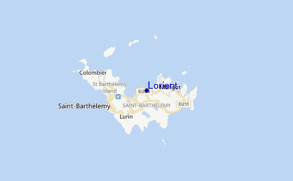
Lorient surf Forecast / Saint Barthélemy / Saint Barthélemy
48hr Weather and Surf, issued 7 am Tuesday 23 Apr 2024 AST
Forecast update in hr min s Update imminent
Lorient surf forecast is for near shore open water. Breaking waves will often be smaller at less exposed spots.
Today's Lorient sea temperature is 28.0°C (Statistics for 23 Apr 1981-2005 - mean: 26.9 °C max: 28.0 °C min: 26.2 °C)
- Map Icons:
 Break
Break Live Wave Height (m)
 Live Wind Speed (km/h)
 Surf Rating (10 Max)
 Ocean Swells (m)
- Wind Speed (km/h)
Lorient surf forecast is for near shore open water. Breaking waves will often be smaller at less exposed spots.
Today's Lorient sea temperature is 28.0°C (Statistics for 23 Apr 1981-2005 - mean: 26.9 °C max: 28.0 °C min: 26.2 °C)
How big are the waves at Lorient today?
The current surf forecast for Lorient at 9AM is: 1.3m 6s primary swell from a East direction and 0.6m 10s secondary swell from a North direction, 0.4m 9s secondary swell from a Northeast direction (forecast issued at 07:00am April 23). The wind direction is predicted to be cross-offshore.
| Time (AST) & Date | Wave Height | Wave Period |
|---|---|---|
| Morning (23 Apr) | 4.5ft (1.3m) | 6s |
| Afternoon (23 Apr) | 3.5ft (1.1m) | 6s |
| Evening (23 Apr) | 3.5ft (1.0m) | 7s |
Table - waves today at Lorient. (Swell directed towards the surf break)
Updates in hr min s Update imminent
Tuesday 23 | Wednesday 24 | Thursday 25 | Friday 26 | Saturday 27 | Sunday 28 | Monday 29 | Tuesday 30 | |||||||||||||||||||||||||||||||||||||||||||||||||||||
| 5 AM | 8 AM | 11 AM | 2 PM | 5 PM | 8 PM | 11 PM | 2 AM | 5 AM | 8 AM | 11 AM | 2 PM | 5 PM | 8 PM | 11 PM | 2 AM | 5 AM | 8 AM | 11 AM | 2 PM | 5 PM | 8 PM | 11 PM | 2 AM | 5 AM | 8 AM | 11 AM | 2 PM | 5 PM | 8 PM | 11 PM | 2 AM | 5 AM | 8 AM | 11 AM | 2 PM | 5 PM | 8 PM | 11 PM | 2 AM | 5 AM | 8 AM | 11 AM | 2 PM | 5 PM | 8 PM | 11 PM | 2 AM | 5 AM | 8 AM | 11 AM | 2 PM | 5 PM | 8 PM | 11 PM | 2 AM | 5 AM | 8 AM | 11 AM | 2 PM | |
Rating (10 max) | ||||||||||||||||||||||||||||||||||||||||||||||||||||||||||||
Swell Height Map |    |    |    |  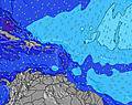 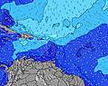 |  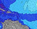 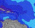 |  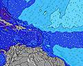 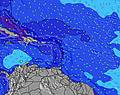 |  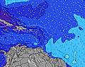 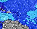 | 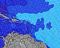 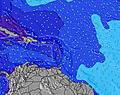 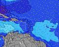 | ||||||||||||||||||||||||||||||||||||||||||||||||||||
| Wave Height (m) & direction (?) | ||||||||||||||||||||||||||||||||||||||||||||||||||||||||||||
| Period(s) (?) | 6 | 6 | 10 | 6 | 6 | 7 | 7 | 7 | 7 | 7 | 7 | 7 | 7 | 7 | 7 | 7 | 7 | 7 | 7 | 7 | 7 | 7 | 7 | 7 | 12 | 11 | 11 | 7 | 8 | 8 | 7 | 7 | 7 | 7 | 7 | 11 | 10 | 10 | 10 | 10 | 10 | 10 | 10 | 9 | 9 | 9 | 9 | 9 | 9 | 9 | 7 | 7 | 7 | 7 | 10 | 10 | 10 | 10 | 10 | 10 |
Wave (?)Graph | ||||||||||||||||||||||||||||||||||||||||||||||||||||||||||||
| Energy (?) | 148 | 127 | 70 | 97 | 96 | 85 | 91 | 102 | 195 | 217 | 270 | 247 | 247 | 217 | 184 | 184 | 184 | 159 | 184 | 205 | 179 | 199 | 199 | 205 | 284 | 256 | 242 | 236 | 221 | 191 | 191 | 186 | 181 | 155 | 131 | 366 | 265 | 208 | 225 | 188 | 184 | 184 | 177 | 173 | 173 | 198 | 198 | 194 | 172 | 172 | 159 | 244 | 229 | 227 | 184 | 379 | 426 | 482 | 492 | 494 |
Wind (km/h) | ||||||||||||||||||||||||||||||||||||||||||||||||||||||||||||
| Wind State (?) onshore cross-onshore cross-shore cross-offshore offshore glassy | cross- off | cross- off | cross- off | cross- off | cross- off | cross- off | cross- off | cross- off | cross- off | cross- off | cross- off | cross- off | cross- off | cross- off | cross- off | cross- off | cross- off | cross- off | cross- off | cross- off | cross- off | cross- off | cross- off | cross- off | cross- off | cross- off | cross- off | cross- off | cross- off | cross- off | cross- off | cross- off | cross- off | cross- off | cross- off | cross- off | cross- off | cross- off | cross | cross | cross | cross | cross- off | cross | cross | cross | cross | cross | cross | cross- off | cross- off | cross- off | cross- off | cross- off | cross- off | cross- off | cross- off | cross- off | cross- off | cross- off |
High Tide / height (m) | 4:30AM 0.37 | 7:25PM 0.48 | 4:18AM 0.38 | 8:19PM 0.49 | 3:45AM 0.40 | 9:19PM 0.50 | 2:47AM 0.43 | 10:28PM 0.50 | 11:49PM 0.51 | 1:09AM 0.51 | 2:01AM 0.51 | |||||||||||||||||||||||||||||||||||||||||||||||||
Low Tide / height (m) | 12:13PM 0.04 | 1:30AM 0.36 | 12:44PM 0.01 | 2:13AM 0.40 | 1:20PM -0.01 | 3:22AM 0.43 | 2:01PM -0.03 | 2:49PM -0.04 | 3:44PM -0.04 | 4:47PM -0.03 | ||||||||||||||||||||||||||||||||||||||||||||||||||
Tuesday 23 | Wednesday 24 | Thursday 25 | Friday 26 | Saturday 27 | Sunday 28 | Monday 29 | Tuesday 30 | |||||||||||||||||||||||||||||||||||||||||||||||||||||
| Sunrise | - | 5:48 | - | - | - | - | - | - | - | 5:48 | - | - | - | - | - | - | - | 5:47 | - | - | - | - | - | - | - | 5:47 | - | - | - | - | - | - | - | 5:46 | - | - | - | - | - | - | - | 5:46 | - | - | - | - | - | - | - | 5:45 | - | - | - | - | - | - | - | 5:45 | - | - |
| Sunset | - | - | - | - | 6:30 | - | - | - | - | - | - | - | 6:30 | - | - | - | - | - | - | - | 6:30 | - | - | - | - | - | - | - | 6:30 | - | - | - | - | - | - | - | 6:30 | - | - | - | - | - | - | - | 6:30 | - | - | - | - | - | - | - | 6:30 | - | - | - | - | - | - | - |
Rain (mm) | - | - | - | - | - | - | - | - | 1 | 2 | 1 | 1 | 1 | - | - | - | - | - | - | - | - | - | - | - | - | - | - | - | - | - | - | - | - | - | - | - | - | - | - | - | - | - | - | - | 1 | - | 1 | 1 | 1 | 1 | - | - | - | 1 | - | - | - | - | - | - |
| Temp. °C | 26 | 26 | 26 | 27 | 27 | 26 | 26 | 26 | 25 | 25 | 25 | 26 | 26 | 26 | 26 | 25 | 25 | 25 | 25 | 26 | 26 | 26 | 26 | 26 | 26 | 26 | 26 | 26 | 26 | 26 | 26 | 25 | 26 | 26 | 26 | 26 | 26 | 26 | 26 | 26 | 26 | 26 | 26 | 26 | 25 | 25 | 25 | 25 | 25 | 25 | 25 | 25 | 25 | 25 | 25 | 25 | 25 | 25 | 25 | 26 |
| Feels °C (?) | 26 | 25 | 25 | 27 | 27 | 26 | 26 | 26 | 25 | 25 | 24 | 25 | 25 | 24 | 24 | 23 | 23 | 22 | 23 | 25 | 25 | 25 | 25 | 25 | 24 | 25 | 25 | 25 | 25 | 25 | 24 | 24 | 25 | 26 | 25 | 26 | 26 | 26 | 25 | 25 | 25 | 25 | 25 | 25 | 23 | 23 | 23 | 22 | 23 | 23 | 23 | 23 | 23 | 22 | 22 | 22 | 22 | 22 | 23 | 25 |
FREE! Surf-Forecast.com widget for your website
The surf report / weather widget below is available to embed on third party websites free of charge and provides a summary of our Lorient surf forecast. Simply grab the html code snippet that we provide and paste it into your own site. You can choose your preferred language and metric/imperial units for the surf forecast feed to suit users of your site. Click here to get the code.


 Nearest