

- Forecast
- Maps
- Live
- Weather State
- Spot Information

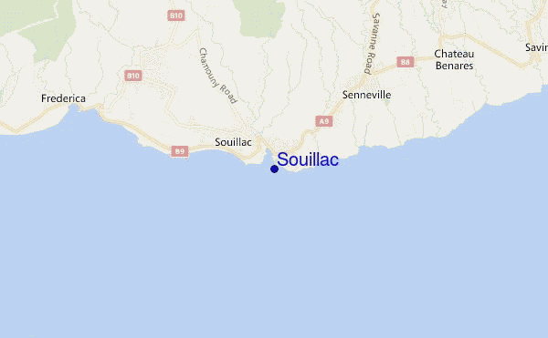
Souillac surf Forecast / Mauritius / Mauritius
- Map Icons:
 Break
Break Live Wave Height (m)
 Live Wind Speed (km/h)
 Surf Rating (10 Max)
 Ocean Swells (m)
- Wind Speed (km/h)
How big are the waves at Souillac today?
The current surf forecast for Souillac at 8AM is: 1.0m 21s primary swell from a South-southwest direction and 1.5m 12s secondary swell from a South-southwest direction, 1.3m 9s secondary swell from a East direction (forecast issued at 03:00am April 25). The wind direction is predicted to be cross-offshore and the swell rating is 4.
| Time (+04) & Date | Wave Height | Wave Period |
|---|---|---|
| Morning (25 Apr) | 6ft (1.9m) | 20s |
| Afternoon (25 Apr) | 8ft (2.5m) | 19s |
| Evening (25 Apr) | 10ft (3.0m) | 18s |
Table - waves today at Souillac. (Swell directed towards the surf break)
Thursday 25 | Friday 26 | Saturday 27 | Sunday 28 | Monday 29 | Tuesday 30 | Wednesday 01 | Thursday 02 | |||||||||||||||||||||||||||||||||||||||||||||||||||||
| 1 AM | 4 AM | 7 AM | 10 AM | 1 PM | 4 PM | 7 PM | 10 PM | 1 AM | 4 AM | 7 AM | 10 AM | 1 PM | 4 PM | 7 PM | 10 PM | 1 AM | 4 AM | 7 AM | 10 AM | 1 PM | 4 PM | 7 PM | 10 PM | 1 AM | 4 AM | 7 AM | 10 AM | 1 PM | 4 PM | 7 PM | 10 PM | 1 AM | 4 AM | 7 AM | 10 AM | 1 PM | 4 PM | 7 PM | 10 PM | 1 AM | 4 AM | 7 AM | 10 AM | 1 PM | 4 PM | 7 PM | 10 PM | 1 AM | 4 AM | 7 AM | 10 AM | 1 PM | 4 PM | 7 PM | 10 PM | 1 AM | 4 AM | 7 AM | 10 AM | |
Rating (10 max) | ||||||||||||||||||||||||||||||||||||||||||||||||||||||||||||
Swell Height Map |  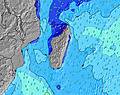 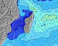 | 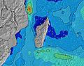 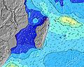 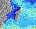 | 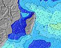 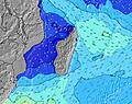 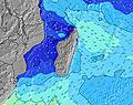 | 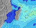 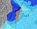 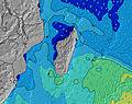 | 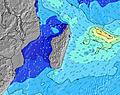   |  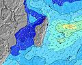 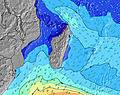 | 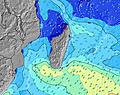 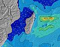 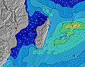 | 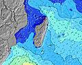 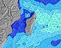 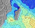 | ||||||||||||||||||||||||||||||||||||||||||||||||||||
| Wave Height (m) & direction (?) | ||||||||||||||||||||||||||||||||||||||||||||||||||||||||||||
| Period(s) (?) | 13 | 12 | 21 | 20 | 19 | 19 | 18 | 18 | 17 | 17 | 17 | 16 | 16 | 16 | 16 | 16 | 15 | 15 | 14 | 14 | 14 | 14 | 14 | 13 | 13 | 13 | 13 | 13 | 13 | 12 | 12 | 12 | 12 | 12 | 10 | 10 | 10 | 10 | 19 | 18 | 18 | 18 | 17 | 16 | 16 | 16 | 16 | 16 | 15 | 15 | 14 | 14 | 14 | 14 | 21 | 21 | 20 | 19 | 18 | 18 |
Wave (?)Graph | ||||||||||||||||||||||||||||||||||||||||||||||||||||||||||||
| Energy (?) | 725 | 702 | 943 | 2795 | 3505 | 4893 | 5460 | 5163 | 5372 | 4931 | 4817 | 3777 | 3393 | 3118 | 2766 | 2523 | 2047 | 1776 | 1517 | 1517 | 1355 | 1189 | 933 | 892 | 781 | 744 | 643 | 551 | 543 | 433 | 393 | 328 | 322 | 265 | 239 | 239 | 234 | 500 | 513 | 547 | 711 | 895 | 1061 | 1070 | 1271 | 1239 | 2766 | 2172 | 1846 | 1648 | 1604 | 1582 | 1447 | 1447 | 2245 | 4478 | 7784 | 8355 | 7920 | 7489 |
Wind (km/h) | ||||||||||||||||||||||||||||||||||||||||||||||||||||||||||||
| Wind State (?) onshore cross-onshore cross-shore cross-offshore offshore glassy | cross- off | cross- off | cross- off | cross- off | cross- off | cross- off | cross- off | cross- off | cross- off | cross- off | cross- off | cross- off | cross- off | cross- off | cross- off | cross- off | cross- off | cross- off | cross- off | cross- off | cross- off | cross | cross- off | cross- off | cross- off | cross- off | cross- off | cross | cross | cross | cross | cross | cross | cross | cross | cross | cross | cross | cross | cross | cross | cross- off | cross- off | cross | cross | cross | cross- off | cross- off | cross- off | cross- off | cross- off | cross- off | cross- off | cross | cross | cross | cross- off | cross- off | cross | cross |
High Tide / height (m) | 12:50AM 0.82 | 1:15PM 0.72 | 1:14AM 0.81 | 1:43PM 0.69 | 1:40AM 0.78 | 2:14PM 0.64 | 2:09AM 0.74 | 2:50PM 0.59 | 2:43AM 0.69 | 3:39PM 0.53 | 3:28AM 0.63 | 5:10PM 0.48 | 4:49AM 0.57 | 8:05PM 0.51 | 7:22AM 0.56 | |||||||||||||||||||||||||||||||||||||||||||||
Low Tide / height (m) | 7:12AM 0.04 | 7:08PM 0.13 | 7:38AM 0.05 | 7:32PM 0.15 | 8:08AM 0.07 | 7:57PM 0.19 | 8:42AM 0.12 | 8:27PM 0.24 | 9:26AM 0.17 | 9:04PM 0.31 | 10:35AM 0.23 | 10:12PM 0.39 | 12:41PM 0.26 | 1:30AM 0.41 | ||||||||||||||||||||||||||||||||||||||||||||||
Thursday 25 | Friday 26 | Saturday 27 | Sunday 28 | Monday 29 | Tuesday 30 | Wednesday 01 | Thursday 02 | |||||||||||||||||||||||||||||||||||||||||||||||||||||
| Sunrise | - | - | 6:24 | - | - | - | - | - | - | - | 6:24 | - | - | - | - | - | - | - | 6:24 | - | - | - | - | - | - | - | 6:24 | - | - | - | - | - | - | - | 6:24 | - | - | - | - | - | - | - | 6:26 | - | - | - | - | - | - | - | 6:26 | - | - | - | - | - | - | - | 6:26 | - |
| Sunset | - | - | - | - | - | 5:50 | - | - | - | - | - | - | - | 5:50 | - | - | - | - | - | - | - | 5:49 | - | - | - | - | - | - | - | 5:47 | - | - | - | - | - | - | - | 5:47 | - | - | - | - | - | - | - | 5:46 | - | - | - | - | - | - | - | 5:46 | - | - | - | - | - | - |
Rain (mm) | - | - | - | - | - | - | - | - | - | - | - | - | - | - | - | - | - | - | - | - | - | - | - | - | - | - | - | - | - | - | - | - | - | - | - | - | - | - | - | - | - | - | - | - | - | - | - | - | - | - | 1 | - | - | - | - | - | - | - | - | - |
| Temp. °C | 25 | 25 | 25 | 27 | 28 | 27 | 26 | 25 | 25 | 25 | 25 | 26 | 27 | 27 | 26 | 25 | 25 | 25 | 25 | 27 | 27 | 27 | 25 | 25 | 25 | 25 | 25 | 26 | 27 | 26 | 25 | 25 | 25 | 25 | 25 | 25 | 26 | 26 | 25 | 25 | 25 | 25 | 25 | 26 | 26 | 26 | 25 | 25 | 24 | 24 | 24 | 25 | 25 | 25 | 25 | 25 | 25 | 24 | 24 | 25 |
| Feels °C (?) | 28 | 28 | 27 | 29 | 29 | 28 | 28 | 26 | 26 | 27 | 27 | 26 | 27 | 28 | 28 | 27 | 27 | 27 | 27 | 28 | 28 | 29 | 27 | 27 | 28 | 28 | 28 | 28 | 29 | 27 | 27 | 27 | 26 | 26 | 25 | 24 | 26 | 26 | 25 | 25 | 25 | 25 | 26 | 26 | 25 | 26 | 26 | 26 | 25 | 24 | 24 | 25 | 25 | 25 | 25 | 25 | 24 | 22 | 22 | 23 |
FREE! Surf-Forecast.com widget for your website
The surf report / weather widget below is available to embed on third party websites free of charge and provides a summary of our Souillac surf forecast. Simply grab the html code snippet that we provide and paste it into your own site. You can choose your preferred language and metric/imperial units for the surf forecast feed to suit users of your site. Click here to get the code.


 Nearest