

- Forecast
- Maps
- Live
- Weather State
- Spot Information

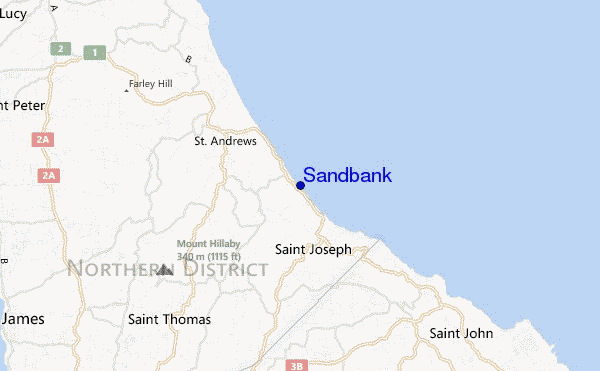
Sandbank surf Forecast / Barbados / Barbados
- Map Icons:
 Break
Break Live Wave Height (m)
 Live Wind Speed (km/h)
 Surf Rating (10 Max)
 Ocean Swells (m)
- Wind Speed (km/h)
How big are the waves at Sandbank today?
The current surf forecast for Sandbank at 5PM is: 1.8m 9s primary swell from a East direction and 1.7m 10s secondary swell from a East-northeast direction, 0.9m 12s secondary swell from a North-northeast direction (forecast issued at 07:00am April 16). The wind direction is predicted to be cross-shore.
| Time (AST) & Date | Wave Height | Wave Period |
|---|---|---|
| Morning (16 Apr) | 5.5ft (1.7m) | 9s |
| Afternoon (16 Apr) | 5.5ft (1.7m) | 10s |
| Evening (16 Apr) | 6ft (1.9m) | 9s |
Table - waves today at Sandbank. (Swell directed towards the surf break)
Tuesday 16 | Wednesday 17 | Thursday 18 | Friday 19 | Saturday 20 | Sunday 21 | Monday 22 | Tuesday 23 | |||||||||||||||||||||||||||||||||||||||||||||||||||||
| 5 AM | 8 AM | 11 AM | 2 PM | 5 PM | 8 PM | 11 PM | 2 AM | 5 AM | 8 AM | 11 AM | 2 PM | 5 PM | 8 PM | 11 PM | 2 AM | 5 AM | 8 AM | 11 AM | 2 PM | 5 PM | 8 PM | 11 PM | 2 AM | 5 AM | 8 AM | 11 AM | 2 PM | 5 PM | 8 PM | 11 PM | 2 AM | 5 AM | 8 AM | 11 AM | 2 PM | 5 PM | 8 PM | 11 PM | 2 AM | 5 AM | 8 AM | 11 AM | 2 PM | 5 PM | 8 PM | 11 PM | 2 AM | 5 AM | 8 AM | 11 AM | 2 PM | 5 PM | 8 PM | 11 PM | 2 AM | 5 AM | 8 AM | 11 AM | 2 PM | |
Rating (10 max) | ||||||||||||||||||||||||||||||||||||||||||||||||||||||||||||
Swell Height Map |    |    |    |    |  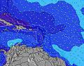 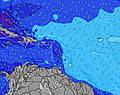 |  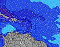 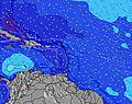 |   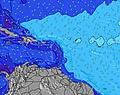 | 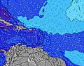 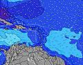 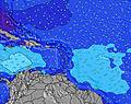 | ||||||||||||||||||||||||||||||||||||||||||||||||||||
| Wave Height (m) & direction (?) | ||||||||||||||||||||||||||||||||||||||||||||||||||||||||||||
| Period(s) (?) | 8 | 9 | 10 | 10 | 10 | 9 | 9 | 9 | 9 | 8 | 8 | 8 | 12 | 12 | 11 | 11 | 12 | 12 | 12 | 12 | 12 | 12 | 12 | 12 | 12 | 12 | 11 | 11 | 8 | 8 | 7 | 7 | 7 | 7 | 7 | 7 | 7 | 7 | 8 | 8 | 8 | 8 | 7 | 8 | 7 | 7 | 7 | 7 | 7 | 7 | 7 | 7 | 7 | 7 | 7 | 7 | 7 | 7 | 7 | 7 |
Wave (?)Graph | ||||||||||||||||||||||||||||||||||||||||||||||||||||||||||||
| Energy (?) | 398 | 408 | 602 | 551 | 563 | 562 | 528 | 600 | 549 | 454 | 527 | 428 | 367 | 794 | 673 | 418 | 502 | 520 | 511 | 463 | 403 | 403 | 361 | 355 | 349 | 293 | 273 | 237 | 198 | 221 | 245 | 239 | 245 | 245 | 209 | 191 | 122 | 199 | 96 | 96 | 90 | 87 | 159 | 87 | 152 | 147 | 172 | 173 | 173 | 178 | 178 | 178 | 183 | 183 | 189 | 188 | 194 | 195 | 173 | 172 |
Wind (km/h) | ||||||||||||||||||||||||||||||||||||||||||||||||||||||||||||
| Wind State (?) onshore cross-onshore cross-shore cross-offshore offshore glassy | cross- on | cross- on | cross- on | cross | cross | cross | cross | cross | cross | cross- on | cross | cross | cross- on | cross- on | cross- on | cross- on | cross- on | cross- on | cross- on | cross- on | cross- on | cross- on | cross- on | cross- on | cross- on | cross- on | cross- on | cross- on | cross- on | cross- on | cross- on | cross- on | cross- on | cross- on | cross- on | cross- on | cross- on | cross- on | cross- on | cross- on | cross- on | cross- on | cross- on | cross- on | cross- on | cross- on | cross- on | cross- on | cross- on | cross- on | cross- on | cross- on | cross- on | cross- on | cross- on | cross- on | cross- on | cross- on | cross- on | cross- on |
High Tide / height (m) | 9:35AM 0.59 | 12:29AM 0.55 | 11:19AM 0.59 | 1:05AM 0.59 | 12:31PM 0.62 | 1:32AM 0.63 | 1:22PM 0.65 | 1:54AM 0.67 | 2:03PM 0.68 | 2:16AM 0.71 | 2:41PM 0.70 | 2:38AM 0.73 | 3:16PM 0.70 | 3:01AM 0.75 | ||||||||||||||||||||||||||||||||||||||||||||||
Low Tide / height (m) | 3:42AM 0.45 | 5:14PM 0.24 | 5:32AM 0.43 | 6:16PM 0.25 | 6:37AM 0.39 | 7:01PM 0.26 | 7:20AM 0.34 | 7:36PM 0.26 | 7:55AM 0.28 | 8:06PM 0.27 | 8:27AM 0.23 | 8:34PM 0.27 | 8:59AM 0.17 | 9:01PM 0.28 | 9:30AM 0.13 | |||||||||||||||||||||||||||||||||||||||||||||
Tuesday 16 | Wednesday 17 | Thursday 18 | Friday 19 | Saturday 20 | Sunday 21 | Monday 22 | Tuesday 23 | |||||||||||||||||||||||||||||||||||||||||||||||||||||
| Sunrise | - | 5:43 | - | - | - | - | - | - | - | 5:43 | - | - | - | - | - | - | - | 5:43 | - | - | - | - | - | - | - | 5:41 | - | - | - | - | - | - | - | 5:41 | - | - | - | - | - | - | - | 5:41 | - | - | - | - | - | - | - | 5:41 | - | - | - | - | - | - | - | 5:39 | - | - |
| Sunset | - | - | - | - | 6:10 | - | - | - | - | - | - | - | 6:10 | - | - | - | - | - | - | - | 6:10 | - | - | - | - | - | - | - | 6:10 | - | - | - | - | - | - | - | 6:10 | - | - | - | - | - | - | - | 6:10 | - | - | - | - | - | - | - | 6:12 | - | - | - | - | - | - | - |
Rain (mm) | - | - | - | - | - | - | - | - | - | - | - | - | - | - | - | - | - | - | - | - | - | - | - | - | - | - | 1 | 1 | - | - | 1 | 1 | 1 | - | 1 | 2 | - | - | - | - | - | - | - | - | - | - | - | - | - | - | - | - | - | - | - | - | - | - | - | - |
| Temp. °C | 26 | 27 | 28 | 28 | 28 | 27 | 27 | 27 | 27 | 27 | 28 | 29 | 28 | 27 | 27 | 27 | 27 | 27 | 28 | 29 | 28 | 28 | 27 | 27 | 27 | 28 | 28 | 28 | 28 | 27 | 27 | 27 | 27 | 28 | 28 | 28 | 28 | 28 | 27 | 27 | 27 | 27 | 28 | 28 | 28 | 27 | 28 | 27 | 27 | 27 | 28 | 28 | 28 | 27 | 27 | 27 | 27 | 27 | 28 | 28 |
| Feels °C (?) | 26 | 27 | 28 | 28 | 28 | 28 | 28 | 27 | 28 | 27 | 27 | 29 | 28 | 28 | 27 | 28 | 28 | 27 | 28 | 30 | 29 | 30 | 28 | 28 | 29 | 30 | 29 | 29 | 29 | 29 | 29 | 30 | 28 | 29 | 29 | 28 | 29 | 30 | 28 | 28 | 27 | 26 | 28 | 27 | 28 | 27 | 28 | 26 | 27 | 26 | 26 | 26 | 27 | 27 | 26 | 26 | 26 | 26 | 27 | 27 |
FREE! Surf-Forecast.com widget for your website
The surf report / weather widget below is available to embed on third party websites free of charge and provides a summary of our Sandbank surf forecast. Simply grab the html code snippet that we provide and paste it into your own site. You can choose your preferred language and metric/imperial units for the surf forecast feed to suit users of your site. Click here to get the code.


 Nearest