

- Forecast
- Maps
- Live
- Weather State
- Spot Information

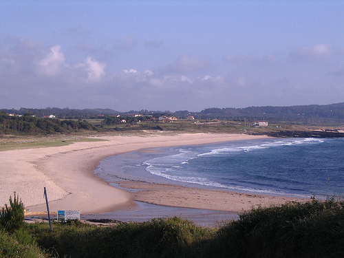
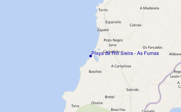
Playa de Rio Sieira / As Furnas surf Forecast / Galicia / Spain
- Map Icons:
 Break
Break Live Wave Height (m)
 Live Wind Speed (km/h)
 Surf Rating (10 Max)
 Ocean Swells (m)
- Wind Speed (km/h)
How big are the waves at Playa de Rio Sieira / As Furnas today?
The current surf forecast for Playa de Rio Sieira / As Furnas at 11PM is: 0.6m 9s primary swell from a West direction and 0.1m 14s secondary swell from a Southwest direction, 0.6m 4s secondary swell from a North direction (forecast issued at 07:00pm April 24). The wind direction is predicted to be cross-onshore.
| Time (CEST) & Date | Wave Height | Wave Period |
|---|---|---|
| Morning (24 Apr) | - | - |
| Afternoon (24 Apr) | 2ft (0.6m) | 10s |
| Evening (24 Apr) | 2ft (0.6m) | 9s |
Table - waves today at Playa de Rio Sieira / As Furnas. (Swell directed towards the surf break)
Wednesday 24 | Thursday 25 | Friday 26 | Saturday 27 | Sunday 28 | Monday 29 | Tuesday 30 | Wednesday 01 | Thu 02 | ||||||||||||||||||||||||||||||||||||||||||||||||||||
| 5 PM | 8 PM | 11 PM | 2 AM | 5 AM | 8 AM | 11 AM | 2 PM | 5 PM | 8 PM | 11 PM | 2 AM | 5 AM | 8 AM | 11 AM | 2 PM | 5 PM | 8 PM | 11 PM | 2 AM | 5 AM | 8 AM | 11 AM | 2 PM | 5 PM | 8 PM | 11 PM | 2 AM | 5 AM | 8 AM | 11 AM | 2 PM | 5 PM | 8 PM | 11 PM | 2 AM | 5 AM | 8 AM | 11 AM | 2 PM | 5 PM | 8 PM | 11 PM | 2 AM | 5 AM | 8 AM | 11 AM | 2 PM | 5 PM | 8 PM | 11 PM | 2 AM | 5 AM | 8 AM | 11 AM | 2 PM | 5 PM | 8 PM | 11 PM | 2 AM | |
Rating (10 max) | ||||||||||||||||||||||||||||||||||||||||||||||||||||||||||||
Swell Height Map |    |   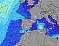 |  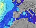 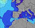 |  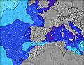 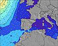 |  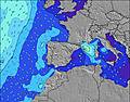 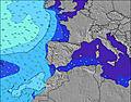 |  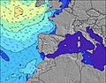 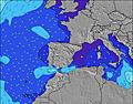 |  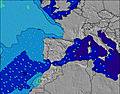 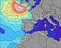 |  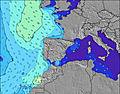 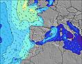 | 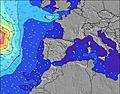 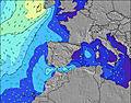 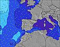 | |||||||||||||||||||||||||||||||||||||||||||||||||||
| Wave Height (m) & direction (?) | ||||||||||||||||||||||||||||||||||||||||||||||||||||||||||||
| Period(s) (?) | 10 | 9 | 9 | 9 | 9 | 9 | 9 | 8 | 5 | 6 | 6 | 6 | 7 | 8 | 10 | 10 | 10 | 10 | 10 | 10 | 13 | 13 | 13 | 13 | 12 | 12 | 11 | 11 | 11 | 10 | 10 | 10 | 10 | 9 | 9 | 9 | 9 | 9 | 9 | 8 | 8 | 8 | 12 | 11 | 11 | 7 | 7 | 7 | 9 | 9 | 9 | 10 | 10 | 11 | 11 | 11 | 12 | 13 | 13 | 13 |
Wave (?)Graph | ||||||||||||||||||||||||||||||||||||||||||||||||||||||||||||
| Energy (?) | 67 | 61 | 60 | 41 | 40 | 39 | 38 | 23 | 25 | 34 | 39 | 26 | 69 | 120 | 363 | 500 | 480 | 371 | 320 | 246 | 1018 | 1935 | 2005 | 1581 | 1412 | 1207 | 1074 | 952 | 980 | 901 | 833 | 653 | 489 | 350 | 269 | 203 | 176 | 149 | 126 | 92 | 114 | 103 | 101 | 91 | 86 | 93 | 171 | 279 | 426 | 528 | 539 | 717 | 549 | 966 | 1284 | 1515 | 2224 | 2986 | 3666 | 3843 |
Wind (km/h) | ||||||||||||||||||||||||||||||||||||||||||||||||||||||||||||
| Wind State (?) onshore cross-onshore cross-shore cross-offshore offshore glassy | cross- on | cross- on | cross- on | cross- on | cross- on | cross | cross- on | cross- on | on | on | on | glass | cross- off | cross- off | cross- off | cross- off | cross- off | cross | cross | cross | cross- off | cross- on | on | on | cross- on | cross- on | on | on | glass | cross- off | off | glass | cross- on | cross- on | cross- on | cross | cross- on | cross | cross- on | on | on | cross- on | cross- off | cross- off | cross- off | cross | on | cross- on | on | cross- on | cross- on | cross- on | cross- on | cross- on | cross- on | cross- on | cross- on | cross- on | cross- on | cross- on |
High Tide / height (m) | 5:18PM 2.98 | 5:33AM 2.92 | 5:48PM 2.97 | 6:05AM 2.85 | 6:20PM 2.92 | 6:39AM 2.74 | 6:55PM 2.82 | 7:17AM 2.61 | 7:35PM 2.70 | 8:02AM 2.45 | 8:26PM 2.57 | 9:02AM 2.30 | 9:32PM 2.47 | 10:21AM 2.21 | 10:53PM 2.46 | |||||||||||||||||||||||||||||||||||||||||||||
Low Tide / height (m) | 11:24PM 0.28 | 11:37AM 0.30 | 11:56PM 0.31 | 12:07PM 0.38 | 12:30AM 0.39 | 12:41PM 0.48 | 1:07AM 0.50 | 1:19PM 0.61 | 1:51AM 0.64 | 2:04PM 0.76 | 2:47AM 0.77 | 3:04PM 0.90 | 4:01AM 0.85 | 4:22PM 0.97 | ||||||||||||||||||||||||||||||||||||||||||||||
Wednesday 24 | Thursday 25 | Friday 26 | Saturday 27 | Sunday 28 | Monday 29 | Tuesday 30 | Wednesday 01 | Thu 02 | ||||||||||||||||||||||||||||||||||||||||||||||||||||
| Sunrise | - | - | - | - | - | 7:37 | - | - | - | - | - | - | - | 7:37 | - | - | - | - | - | - | - | 7:35 | - | - | - | - | - | - | - | 7:33 | - | - | - | - | - | - | - | 7:33 | - | - | - | - | - | - | - | 7:31 | - | - | - | - | - | - | - | 7:30 | - | - | - | - | - | - |
| Sunset | - | 9:28 | - | - | - | - | - | - | - | 9:30 | - | - | - | - | - | - | - | 9:30 | - | - | - | - | - | - | - | 9:31 | - | - | - | - | - | - | - | 9:32 | - | - | - | - | - | - | - | 9:34 | - | - | - | - | - | - | - | 9:35 | - | - | - | - | - | - | - | 9:36 | - | - |
Rain (mm) | - | - | - | - | - | - | - | - | - | - | - | - | - | - | 1 | 6 | 3 | 3 | 2 | - | 3 | 8 | 1 | 3 | 1 | 2 | 3 | 1 | 2 | 1 | - | - | 1 | 1 | - | - | - | - | - | - | - | - | - | 1 | 3 | 4 | 2 | 1 | 1 | - | 1 | 1 | 2 | 2 | 2 | 1 | 1 | 3 | 2 | 2 |
| Temp. °C | 17 | 14 | 11 | 11 | 11 | 11 | 12 | 12 | 13 | 13 | 12 | 12 | 12 | 12 | 12 | 12 | 13 | 10 | 10 | 10 | 10 | 8 | 11 | 12 | 12 | 12 | 11 | 11 | 10 | 9 | 10 | 11 | 13 | 13 | 11 | 10 | 9 | 9 | 11 | 12 | 13 | 13 | 12 | 12 | 12 | 12 | 13 | 13 | 12 | 12 | 11 | 11 | 11 | 11 | 12 | 13 | 12 | 12 | 12 | 12 |
| Feels °C (?) | 11 | 9 | 7 | 8 | 8 | 9 | 10 | 9 | 9 | 10 | 9 | 11 | 11 | 9 | 8 | 9 | 8 | 5 | 5 | 5 | 8 | 4 | 6 | 5 | 6 | 8 | 7 | 9 | 8 | 7 | 8 | 9 | 10 | 9 | 7 | 7 | 6 | 6 | 9 | 8 | 8 | 10 | 9 | 8 | 7 | 11 | 9 | 9 | 7 | 6 | 6 | 6 | 5 | 4 | 4 | 5 | 3 | 4 | 4 | 4 |
FREE! Surf-Forecast.com widget for your website
The surf report / weather widget below is available to embed on third party websites free of charge and provides a summary of our Playa de Rio Sieira / As Furnas surf forecast. Simply grab the html code snippet that we provide and paste it into your own site. You can choose your preferred language and metric/imperial units for the surf forecast feed to suit users of your site. Click here to get the code.


 Nearest