

- Forecast
- Maps
- Live
- Weather State
- Spot Information
Herbertville Surf Forecast
/ Wairarapa (21 surf breaks) /
Surf Forecasts
Beach And Reef
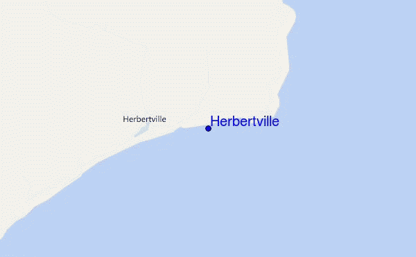
Herbertville surf Forecast / Wairarapa / New Zealand
48hr Weather and Surf, issued 5 am Saturday 20 Apr 2024 NZST
Forecast update in hr min s Update imminent
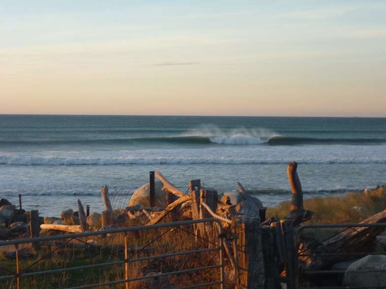
Herbertville surf forecast is for near shore open water. Breaking waves will often be smaller at less exposed spots.
Today's Herbertville sea temperature is 16.5°C (Statistics for 20 Apr 1981-2005 - mean: 16.3 °C max: 17.3 °C min: 15.2 °C)
- Map Icons:
 Break
Break Live Wave Height (m)
 Live Wind Speed (km/h)
 Surf Rating (10 Max)
 Ocean Swells (m)
- Wind Speed (km/h)
Herbertville surf forecast is for near shore open water. Breaking waves will often be smaller at less exposed spots.
Today's Herbertville sea temperature is 16.5°C (Statistics for 20 Apr 1981-2005 - mean: 16.3 °C max: 17.3 °C min: 15.2 °C)
How big are the waves at Herbertville today?
The current surf forecast for Herbertville at 10AM is: 0.7m 13s primary swell from a South-southwest direction and 0.4m 10s secondary swell from a Northeast direction (forecast issued at 05:00am April 20). The wind direction is predicted to be glassy and the swell rating is 2.
| Time (NZST) & Date | Wave Height | Wave Period |
|---|---|---|
| Morning (20 Apr) | 2.5ft (0.7m) | 14s |
| Afternoon (20 Apr) | 2ft (0.6m) | 13s |
| Evening (20 Apr) | 2ft (0.6m) | 12s |
Table - waves today at Herbertville. (Swell directed towards the surf break)
 Recent Eyeball Surf Reports for Wairarapa
Expand
<
>
View all
Updates in hr min s Update imminent
Saturday 20 | Sunday 21 | Monday 22 | Tuesday 23 | Wednesday 24 | Thursday 25 | Friday 26 | Saturday 27 | |||||||||||||||||||||||||||||||||||||||||||||||||||||
| 3 AM | 6 AM | 9 AM | 12 PM | 3 PM | 6 PM | 9 PM | 0 AM | 3 AM | 6 AM | 9 AM | 12 PM | 3 PM | 6 PM | 9 PM | 0 AM | 3 AM | 6 AM | 9 AM | 12 PM | 3 PM | 6 PM | 9 PM | 0 AM | 3 AM | 6 AM | 9 AM | 12 PM | 3 PM | 6 PM | 9 PM | 0 AM | 3 AM | 6 AM | 9 AM | 12 PM | 3 PM | 6 PM | 9 PM | 0 AM | 3 AM | 6 AM | 9 AM | 12 PM | 3 PM | 6 PM | 9 PM | 0 AM | 3 AM | 6 AM | 9 AM | 12 PM | 3 PM | 6 PM | 9 PM | 0 AM | 3 AM | 6 AM | 9 AM | 12 PM | |
Rating (10 max) | ||||||||||||||||||||||||||||||||||||||||||||||||||||||||||||
Swell Height Map |    |    |    |    |  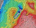 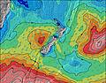 |  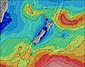 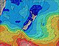 |  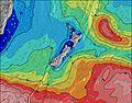 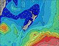 | 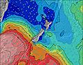 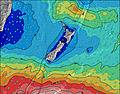 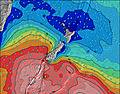 | ||||||||||||||||||||||||||||||||||||||||||||||||||||
| Wave Height (m) & direction (?) | ||||||||||||||||||||||||||||||||||||||||||||||||||||||||||||
| Period(s) (?) | 14 | 14 | 14 | 13 | 13 | 12 | 12 | 11 | 10 | 11 | 11 | 10 | 14 | 14 | 13 | 13 | 13 | 13 | 14 | 14 | 14 | 14 | 14 | 14 | 14 | 15 | 14 | 14 | 14 | 14 | 13 | 13 | 12 | 12 | 11 | 11 | 9 | 10 | 10 | 13 | 13 | 14 | 14 | 15 | 15 | 14 | 14 | 7 | 7 | 7 | 7 | 7 | 7 | 8 | 8 | 10 | 10 | 10 | 10 | 10 |
Wave (?)Graph | ||||||||||||||||||||||||||||||||||||||||||||||||||||||||||||
| Energy (?) | 273 | 281 | 192 | 133 | 125 | 117 | 117 | 95 | 106 | 65 | 70 | 115 | 158 | 390 | 372 | 444 | 444 | 378 | 401 | 419 | 346 | 336 | 331 | 261 | 269 | 2405 | 3208 | 3029 | 2341 | 1813 | 1264 | 838 | 598 | 390 | 157 | 152 | 109 | 127 | 131 | 139 | 141 | 152 | 143 | 174 | 172 | 165 | 156 | 275 | 261 | 275 | 127 | 151 | 164 | 150 | 149 | 231 | 256 | 251 | 231 | 235 |
Wind (km/h) | ||||||||||||||||||||||||||||||||||||||||||||||||||||||||||||
| Wind State (?) onshore cross-onshore cross-shore cross-offshore offshore glassy | cross- off | cross | glass | cross- off | cross- off | cross- off | cross- off | cross | cross | cross- on | cross- on | cross- on | cross- on | cross- on | cross | cross | cross- off | cross | cross | cross- on | cross- on | cross- on | cross- on | cross | glass | glass | off | off | cross- off | cross- off | cross- off | cross- off | cross- off | cross- off | cross- off | cross- off | cross- off | cross- off | cross- off | off | off | off | off | off | off | off | off | cross- off | off | cross- off | cross- off | cross- off | cross- off | cross- off | cross- off | cross- off | cross | cross | cross- on | cross- on |
High Tide / height (m) | 2:33AM 1.32 | 2:59PM 1.24 | 3:19AM 1.31 | 3:46PM 1.25 | 4:05AM 1.31 | 4:31PM 1.28 | 4:51AM 1.31 | 5:16PM 1.31 | 5:36AM 1.32 | 6:00PM 1.34 | 6:21AM 1.32 | 6:44PM 1.37 | 7:05AM 1.32 | 7:27PM 1.40 | 7:49AM 1.32 | |||||||||||||||||||||||||||||||||||||||||||||
Low Tide / height (m) | 8:51AM 0.30 | 9:05PM 0.32 | 9:37AM 0.30 | 9:53PM 0.32 | 10:22AM 0.29 | 10:41PM 0.30 | 11:06AM 0.28 | 11:29PM 0.29 | 11:50AM 0.27 | 12:16AM 0.27 | 12:34PM 0.27 | 1:02AM 0.26 | 1:17PM 0.27 | 1:48AM 0.26 | ||||||||||||||||||||||||||||||||||||||||||||||
Saturday 20 | Sunday 21 | Monday 22 | Tuesday 23 | Wednesday 24 | Thursday 25 | Friday 26 | Saturday 27 | |||||||||||||||||||||||||||||||||||||||||||||||||||||
| Sunrise | - | - | 6:48 | - | - | - | - | - | - | - | 6:48 | - | - | - | - | - | - | - | 6:50 | - | - | - | - | - | - | - | 6:50 | - | - | - | - | - | - | - | 6:52 | - | - | - | - | - | - | - | 6:52 | - | - | - | - | - | - | - | 6:54 | - | - | - | - | - | - | - | 6:54 | - |
| Sunset | - | - | - | - | 5:35 | - | - | - | - | - | - | - | 5:34 | - | - | - | - | - | - | - | 5:31 | - | - | - | - | - | - | - | 5:30 | - | - | - | - | - | - | - | 5:30 | - | - | - | - | - | - | - | 5:28 | - | - | - | - | - | - | - | 5:27 | - | - | - | - | - | - | - |
Rain (mm) | - | - | - | - | - | - | 1 | - | 1 | 1 | 2 | 2 | 1 | - | - | - | - | - | - | - | - | - | - | - | - | - | - | - | - | - | - | - | - | - | - | - | - | - | - | - | - | - | - | - | - | - | - | - | - | - | - | 2 | 1 | - | - | - | - | - | - | - |
| Temp. °C | 12 | 12 | 13 | 15 | 14 | 13 | 14 | 14 | 15 | 15 | 14 | 15 | 16 | 14 | 13 | 12 | 12 | 11 | 13 | 16 | 15 | 13 | 12 | 11 | 11 | 11 | 12 | 17 | 18 | 15 | 13 | 13 | 13 | 13 | 14 | 17 | 18 | 15 | 13 | 12 | 11 | 11 | 14 | 18 | 18 | 17 | 16 | 13 | 13 | 13 | 15 | 15 | 14 | 14 | 14 | 14 | 13 | 11 | 13 | 13 |
| Feels °C (?) | 10 | 11 | 12 | 13 | 12 | 11 | 12 | 11 | 15 | 14 | 13 | 14 | 14 | 12 | 11 | 10 | 10 | 9 | 11 | 12 | 11 | 11 | 10 | 9 | 10 | 10 | 10 | 15 | 15 | 10 | 8 | 7 | 7 | 5 | 7 | 10 | 13 | 11 | 11 | 10 | 8 | 8 | 12 | 15 | 15 | 14 | 13 | 10 | 10 | 10 | 13 | 12 | 12 | 13 | 12 | 9 | 10 | 8 | 7 | 6 |
FREE! Surf-Forecast.com widget for your website
The surf report / weather widget below is available to embed on third party websites free of charge and provides a summary of our Herbertville surf forecast. Simply grab the html code snippet that we provide and paste it into your own site. You can choose your preferred language and metric/imperial units for the surf forecast feed to suit users of your site. Click here to get the code.


 Nearest